Clear Sky Science · en
Sediment-modulated supershear rupture of the 2025 Mw 7.7 Myanmar earthquake
When the Ground Breaks Faster Than Sound
The 2025 Myanmar earthquake was not just another big quake; it was a rare example of the ground ripping so fast that parts of the fault outran seismic shear waves, creating what scientists call a “supershear” rupture. Because the fault sliced through heavily populated regions and ran for nearly 450 kilometers, understanding why this event grew so large, and how local geology shaped the shaking, matters for anyone living near major faults around the world.
A Giant Tear Through Central Myanmar
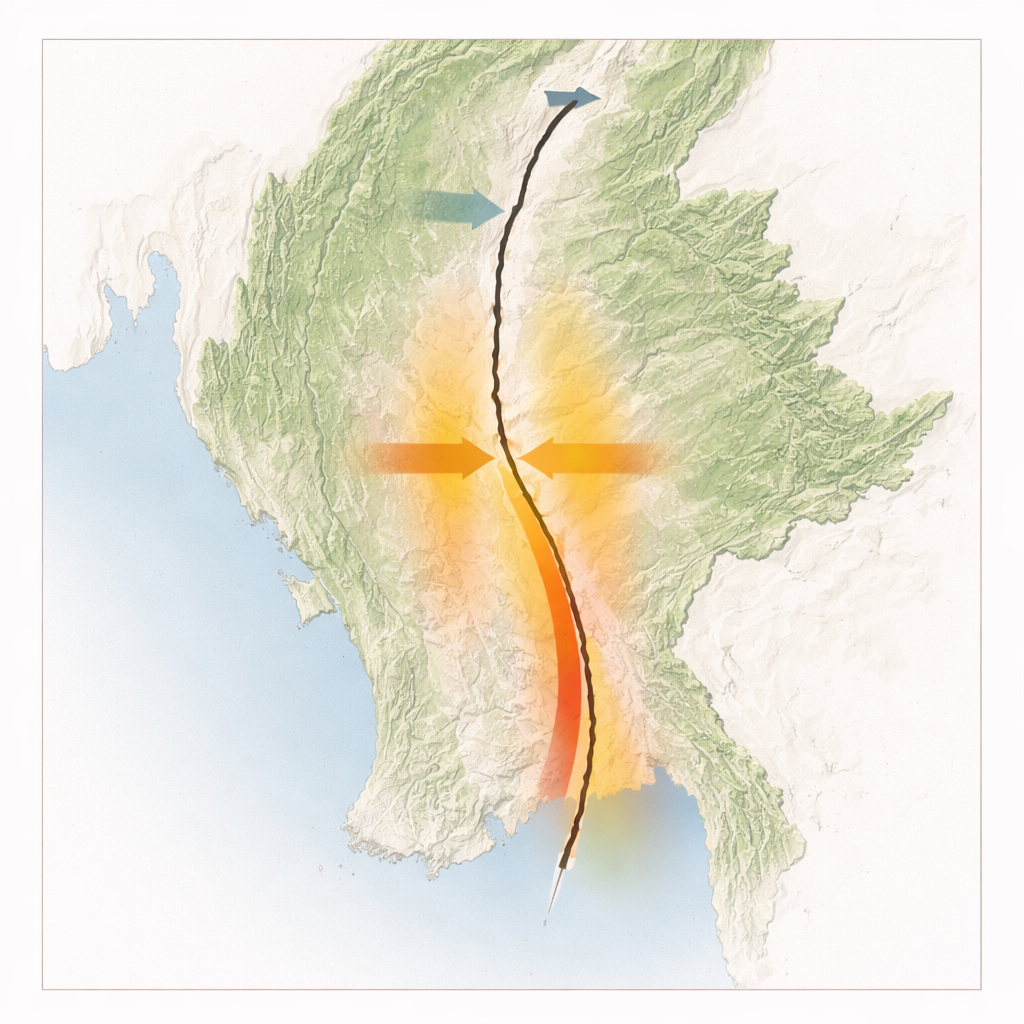
On March 28, 2025, a magnitude 7.7 earthquake struck along Myanmar’s Sagaing fault, a major boundary between tectonic plates that runs north–south through the country. This event was the largest in the region in more than 150 years and tore the surface by up to about six meters, cutting a rupture trace nearly 450 kilometers long. The break ran directly through major cities such as Mandalay and the capital region near Nay Pyi Taw, causing severe damage locally and shaking felt as far away as Bangkok, roughly 1,000 kilometers from the source. Compared with typical earthquakes of the same magnitude, this one produced an unusually long surface rupture, raising urgent questions about how large future events on similar faults might become.
Reading the Scar From Space
To reconstruct what happened, the researchers combined satellite observations and ground sensors. Radar and optical images from the European Sentinel satellites captured how the land shifted in three dimensions, revealing that most of the motion was horizontal, sliding north–south by up to about three meters, while vertical movement was much smaller. By fitting these ground changes with computer models, the team mapped how much the fault slipped at depth. They found that most of the slip was concentrated in the upper 10 kilometers of the crust and that the largest offsets, nearly seven meters, occurred only a few kilometers below the surface. This detailed “slip map” set the stage for exploring how the rupture actually grew and raced along the fault.
Supershear: When Rupture Outruns Its Own Waves
The team then used physics-based simulations to replay the earthquake, guided by the satellite data and a rare near-fault strong-motion station located just 2.6 kilometers from the fault. Their models show the rupture lasted roughly 100 seconds and spread about 70 kilometers north and 380 kilometers south from its starting point. As it traveled, its speed changed. In both directions, the crack began at ordinary, slower speeds, then shifted into supershear, where the rupture front moved at roughly 5.5 kilometers per second—faster than the local shear-wave speed. To the south, this high-speed phase persisted for more than 150 kilometers before slowing again, building a highly energetic front that helped sustain the exceptionally long surface break. The simulations suggest that features such as a nearby free surface, contrasts in rock stiffness across the fault, and the overall stress level all helped the rupture accelerate and then eventually slow or stop at zones disturbed by earlier earthquakes.
How Soft Sediments Steered the Shaking
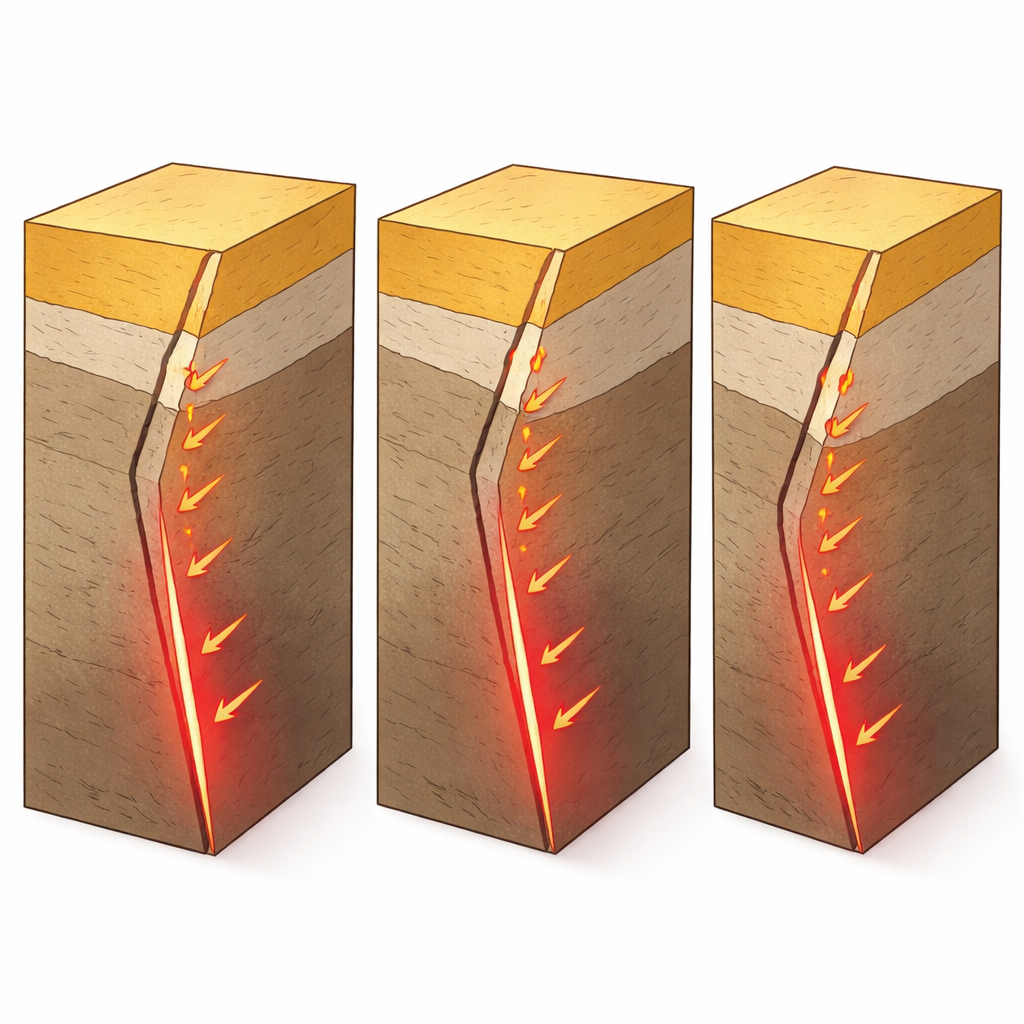
A key puzzle was what happened near the NPW station, where the recorded ground motion could not be explained by a uniformly slow or uniformly fast rupture. The best-fitting models indicate an unusual pattern: near the surface, the rupture stayed slower, while at greater depths it reached supershear speeds. Thick layers of relatively soft sediments around the fault appear to be the culprit. These layers change how seismic waves reflect and convert at the surface and alter the stress on the fault, making it harder for the shallow part of the rupture to go supershear even while deeper sections race ahead. Additional tests with different sediment thicknesses and crustal properties showed the same split pattern: shallow subshear, deep supershear. Because the fastest motion stayed mostly at depth, the strongest shaking near NPW was muted and decayed quickly away from the fault, suggesting that sediments can sometimes reduce, rather than amplify, the worst ground motion from supershear quakes.
Why This Matters for Future Earthquakes
By blending satellite data, video footage, and advanced simulations, the authors show that the 2025 Myanmar earthquake was a rare, ultralong, partially supershear rupture strongly influenced by near-surface sediments. The rupture’s long, high-speed run to the south likely helped it break beyond a previously identified “seismic gap,” tapping neighboring fault segments that might otherwise have been considered safer for decades. At the same time, the presence of soft sediments near key sites shaped where the rupture could go supershear and helped blunt some of the most damaging shaking. For people living along active faults worldwide, the study underscores two lessons: segments once thought independent can fail together during a powerful, fast-moving event, and local geology—especially sediment layers—can either intensify or soften the shaking that ultimately reaches the surface.
Citation: Xu, D., Luo, H., Yu, H. et al. Sediment-modulated supershear rupture of the 2025 Mw 7.7 Myanmar earthquake. Commun Earth Environ 7, 206 (2026). https://doi.org/10.1038/s43247-026-03232-5
Keywords: Myanmar earthquake, supershear rupture, Sagaing fault, sediment effects, seismic hazard