Clear Sky Science · en
Modeling urban planning contributions to flood resilience under shared socioeconomic pathways
Why city growth and flooding matter to everyday life
As cities grow and rainstorms intensify with climate change, more people, homes, and businesses are being built in places that can flood. This study looks at the Pearl River Delta in southern China—a region similar to other fast-growing coastal hubs worldwide—and asks a simple but pressing question: if authorities fully carry out their current plans for parks, canals, drainage pipes, and other projects, how much safer will people really be from sudden, heavy downpours?
Looking at real plans, not just ideas on paper
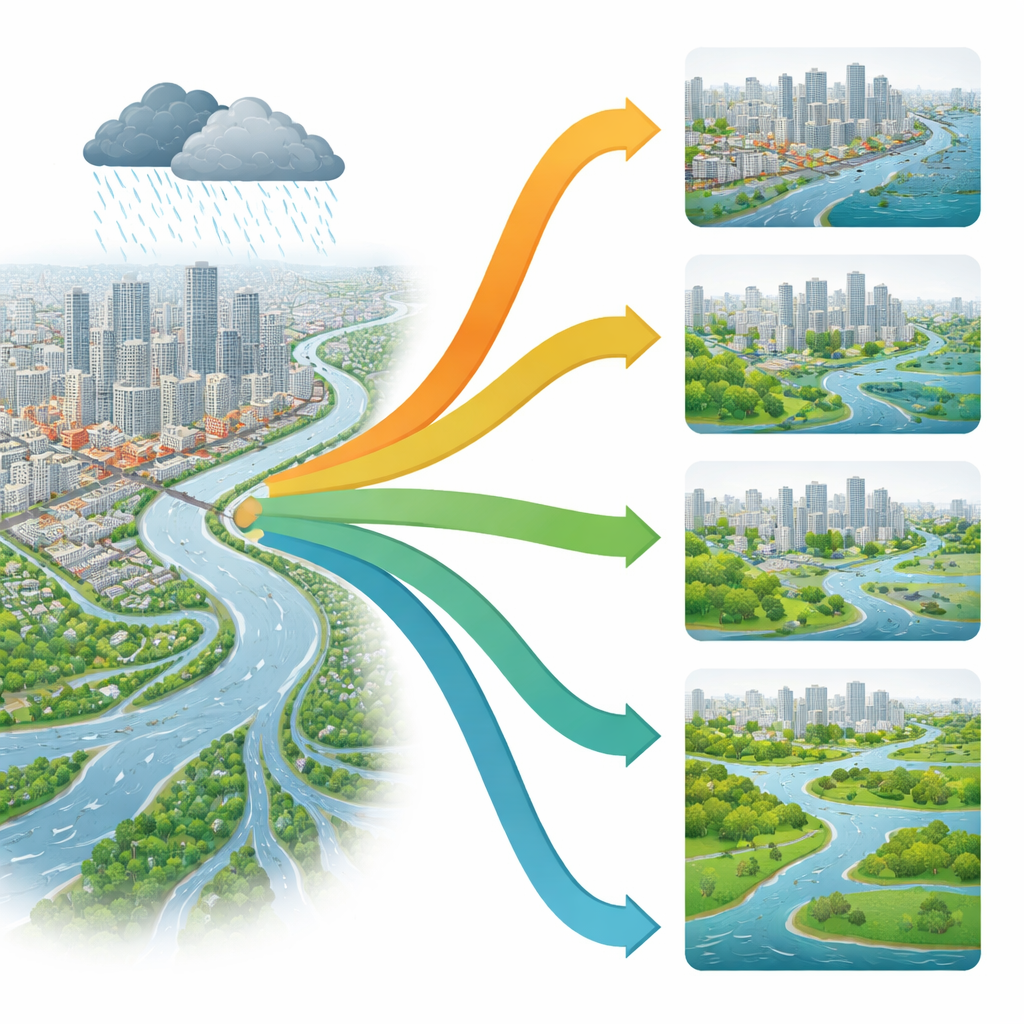
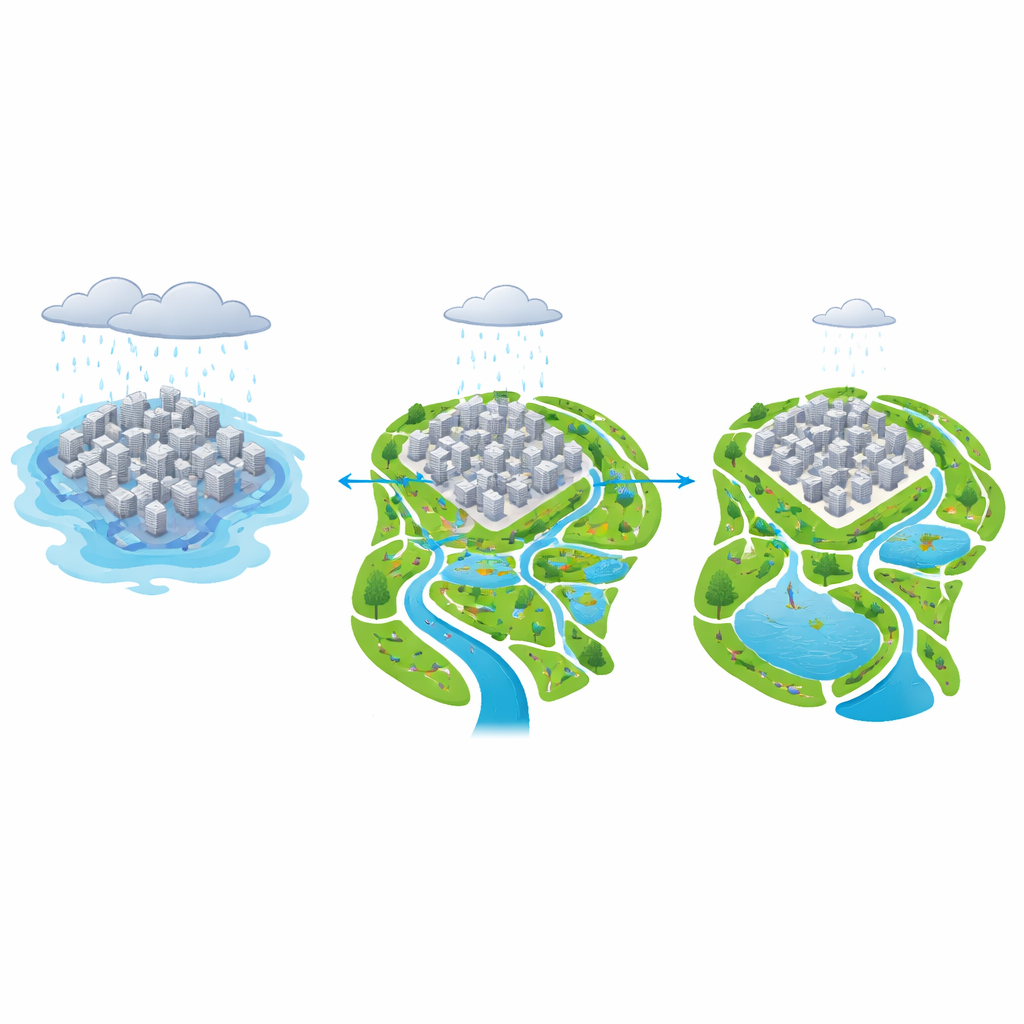
Many climate studies imagine idealized defenses or use generic land-use maps, but they rarely include the detailed plans that city departments are already working with. Here, the researchers gathered concrete measures from local planning documents: new reservoirs and pumping stations, upgraded drainage systems, green corridors and wetlands, and special “sponge” areas designed to soak up water. They translated these plans into a detailed computer model that simulates how extreme one-hour rainstorms move across streets, parks, and rivers, and how deeply water would pool on the ground. This allowed them to compare current conditions with the year 2035 under four different global development pathways, ranging from greener futures to highly fossil-fuel dependent ones.
How city design shifts where the water goes
When the team compared simulations with and without the planned measures, they found that overall flood levels in the region barely changed. On average, the amount of standing water stayed close to today’s levels. What did change was where the water went. Extra parks, greenways, and storage basins near cities helped keep many dense districts a bit drier, while some zones on the urban fringe and in ecological buffer areas became wetter. In other words, planning did not make storms weaker, but it rerouted and held back water so that heavily built-up neighborhoods were less exposed, using surrounding green and blue spaces as controlled holding areas.
Future people and wealth in harm’s way
The study then layered future population and economic projections on top of these flood maps. Across all four development futures, more people and more economic activity end up in places that can flood by 2035. Even in the most environmentally oriented pathway, the number of people exposed to flooding rises by about one-fifth, and the value of exposed assets by nearly half. In more growth-heavy pathways, exposure increases are much steeper—especially under a scenario of rapid, fossil-fueled development, where the value of assets in flood-prone areas more than doubles. In these futures, the benefits of planning are overwhelmed by the sheer speed and scale of urban expansion into risky zones.
Limits of planning without broader change
The results suggest that urban planning acts like a fine-tuning knob rather than a master switch. Drainage upgrades and green infrastructure can meaningfully reduce flooding in some districts and create helpful buffer zones, but they cannot fully offset choices about how fast and where cities grow. If large numbers of people and high-value buildings continue to concentrate on low-lying land, even well-designed parks and canals can only go so far. The study also highlights a common governance problem: real-world planning often struggles with fragmented responsibilities and weak follow-through, which means the modeled benefits may be hard to achieve unless institutions strengthen coordination and monitoring.
What this means for safer cities
For residents and decision-makers, the key takeaway is that smarter city design can help, but it must be aligned with broader development paths. Setting aside floodable parks and wetlands, improving drainage, and steering new growth away from the most flood-prone zones can all lessen damage from short, intense storms. Yet long-term safety depends even more on how societies choose to develop their economies, use energy, and manage land. This study shows that with today’s climate trends, urban planning can redistribute and soften flood impacts, but cannot by itself counteract the rising exposure of people and property unless wider economic and social choices also shift toward more sustainable and risk-aware futures.
Citation: Feng, W., Liu, Y., Zhu, A. et al. Modeling urban planning contributions to flood resilience under shared socioeconomic pathways. npj Urban Sustain 6, 45 (2026). https://doi.org/10.1038/s42949-026-00353-w
Keywords: urban flooding, climate change, urban planning, Pearl River Delta, flood resilience