Clear Sky Science · en
Multiscale flood-driven risk propagation across urban charging infrastructure
Why floods and charging stations matter
As cities switch to electric vehicles, we quietly begin to depend on thousands of roadside charging points to keep daily life moving. But when heavy rain overwhelms streets and rivers, these same charging stations can be knocked out, cutting power, stranding drivers, and disrupting whole regions. This study asks a deceptively simple question with big consequences: when floods hit, how exactly does risk ripple through such a vast, connected charging network, and which parts of the system are most likely to trigger wider trouble?
Looking at the country as a connected web
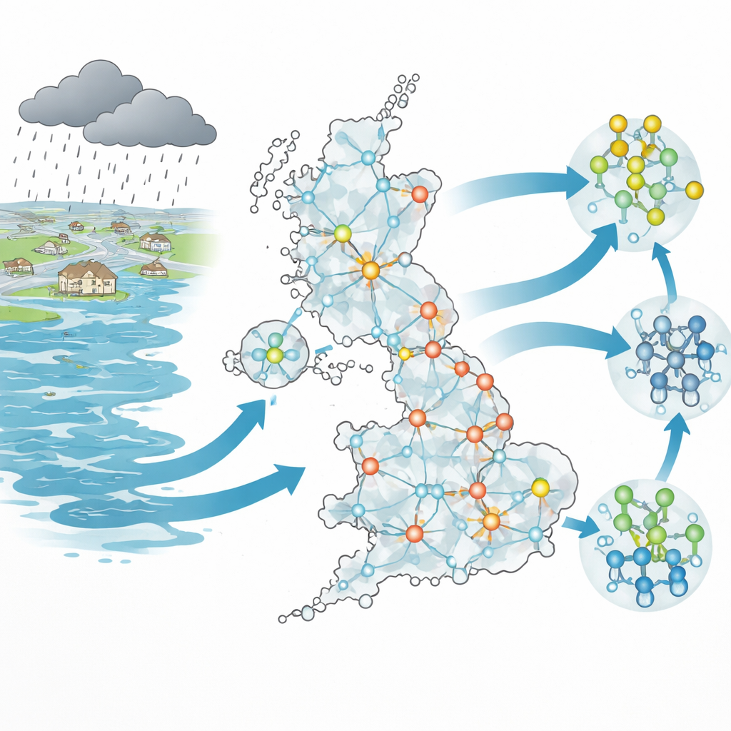
The researchers examined nearly 30,000 public charging points spread across the United Kingdom and treated them as a giant network of linked locations rather than as isolated plugs. They combined two types of information: detailed computer simulations of floods over 21 years and data on where and how charging stations are built. Instead of just asking which stations might get wet, they asked how a problem at one point could influence others through travel patterns, shared power links, and broader geographic conditions. To do this, they built a “risk-weighted” map in which the strength of the connection between any two stations depends both on how far apart they are and how difficult the flooded landscape between them would be to cross or support.
Three layers of stress on the system
The team broke down flood danger into three interacting layers. First is the station itself: its elevation, nearby roads and power lines, and how waterproof its equipment is. Here, they found that location matters more than hardware—surrounding terrain and urban layout explain far more of a station’s flood risk than its technical waterproof rating. Second is the immediate area: the shape of the land, how well soil and vegetation can soak up water, how much pavement prevents drainage, and the reach of flood defenses. Natural and built features turned out to be equally important at this scale, and some areas remained high-risk even when their individual chargers were relatively robust. Third is the wider disturbance layer: the intensity, depth, and spread of floods over time. Long-term flood patterns show that risk clusters around major cities such as London and Manchester, but smaller hubs can become volatile hotspots from year to year.
Hidden communities of shared risk
To make sense of such a dense web of connections, the authors looked for “communities” of charging stations that behave together—groups where risk is more likely to circulate internally than spill outward. They found 12 broad communities across the UK that roughly match familiar regions, then zoomed in again to split each region into smaller subgroups. This two-level view revealed that the most dangerous groups are not always the largest or the most obviously exposed. Some compact clusters with strong internal ties can trap and amplify risk, acting as local hotspots. Others, arranged in bands or stretched shapes, send risk outward along only a few key links, creating bridges between regions. Interestingly, stations classed as low-risk at the individual level often sit on dense, fast-moving pathways where flood impacts can travel farther and more easily than from isolated high-risk stations.
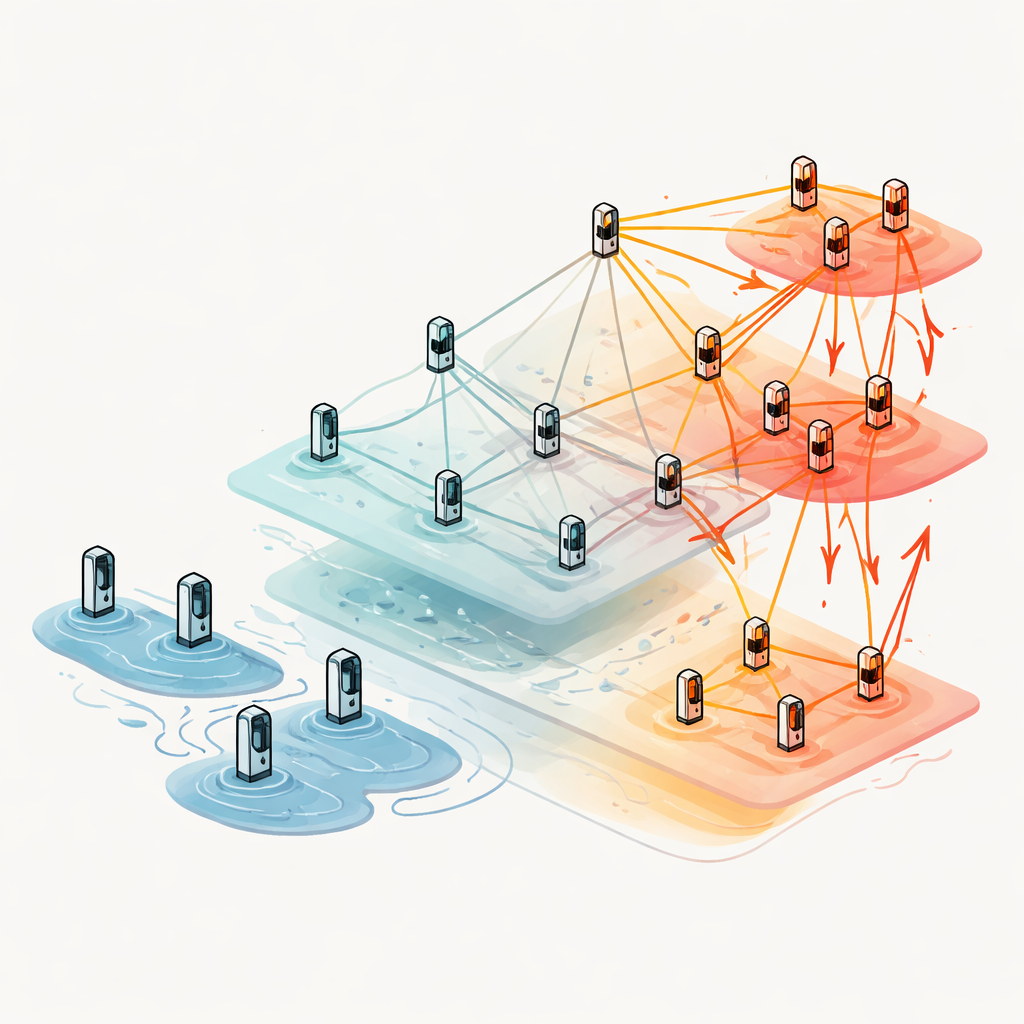
How risk spreads through the network
Over two decades of simulated floods, a pattern emerges: communities that constantly split and merge into new subgroups tend to become the main carriers of flood-driven risk. In these places, tightly packed stations and strong connections help problems spread quickly, especially when combined with unfavorable local geography. By contrast, geographically isolated regions, such as some island or peripheral areas, can be risky inside their own borders but have limited ability to pass problems on to others—natural distance acts like a barrier. The study also challenges a common assumption: simply having shorter paths between stations does not guarantee more dangerous cascades. Instead, the direction and shape of clusters—whether they point inward and contain risk or outward and link to many neighbors—matters more for whether small local failures snowball into wider disruptions.
What this means for a flood-ready future
For everyday users, the message is that a resilient electric-vehicle network is about more than waterproof plugs or extra chargers in busy spots. The study shows that flood danger travels through a web of relationships shaped by terrain, city design, and how stations are grouped and connected. Some modest-looking clusters of chargers may quietly play a critical role in stopping or enabling wider outages. By mapping these multiscale patterns, the framework helps planners pinpoint where upgrades, defenses, or backup options will do the most good, turning a sprawling set of charging points into a more robust backbone for low-carbon transport, even as floods become more frequent and severe.
Citation: Wan, Y., Xia, R., Zhang, Y. et al. Multiscale flood-driven risk propagation across urban charging infrastructure. npj Urban Sustain 6, 37 (2026). https://doi.org/10.1038/s42949-026-00344-x
Keywords: urban flooding, electric vehicle charging, infrastructure resilience, network cascades, climate adaptation