Clear Sky Science · en
Interaction between atmospheric rivers and marine heatwaves in the North Pacific
Why ocean heat and sky rivers matter
As the planet warms, the world’s oceans are breaking heat records, with serious consequences for marine life, fisheries, and coastal communities. At the same time, bands of moisture in the atmosphere known as “atmospheric rivers” are driving intense rain and floods on land. This study asks a timely question: how do these two powerful forces—marine heatwaves in the ocean and atmospheric rivers in the sky—interact with each other over the North Pacific, and what does that mean for future climate risks?
Two extreme players in a changing climate
Marine heatwaves are long‑lasting bursts of unusually warm ocean temperatures that can bleach coral, shift fish populations, and undermine marine ecosystems. Atmospheric rivers are vast, narrow plumes of water vapor that move moisture from the tropics toward higher latitudes, often unleashing heavy rain and strong winds when they hit land. While each has been studied on its own, their mutual influence across the ocean surface has remained unclear. Using four decades of satellite‑based sea surface temperature records and atmospheric reanalyses from 1982 to 2023, the authors systematically tracked where and when these oceanic and atmospheric extremes appeared over the North Pacific, and how often they overlapped in space and time.
2023: an exceptional year of overlap
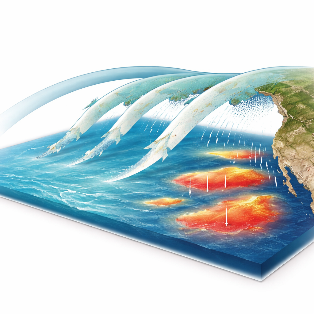
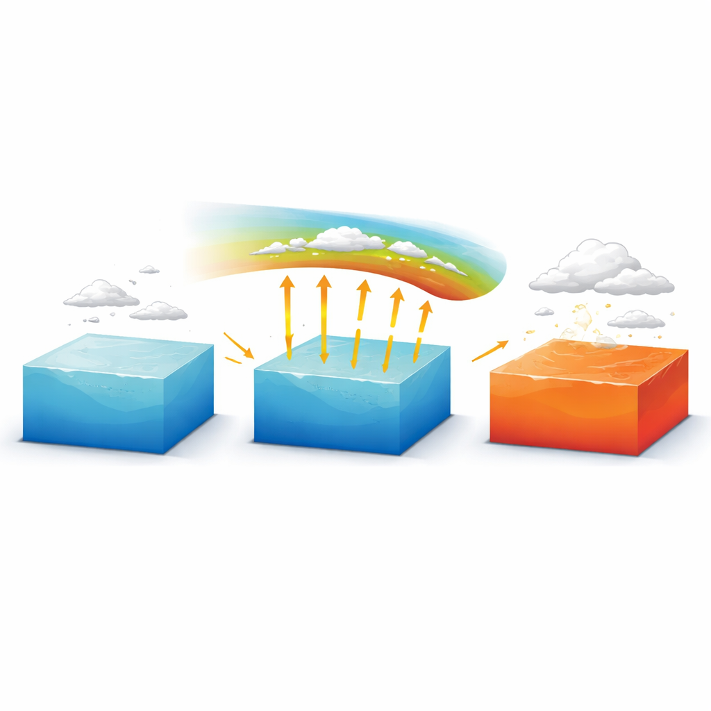
The year 2023 provided a striking natural experiment. Global ocean heat content reached record levels, and the North Pacific experienced marine heatwaves that were both widespread and unusually long‑lived, with some regions near Japan remaining hot for most of the year. At the same time, atmospheric rivers repeatedly swept across the basin, including storms that drenched California and fueled extreme rainfall in China. The study shows that in 2023, nearly one third of all atmospheric river events in the North Pacific occurred over waters already in a marine heatwave state, and about one in ten marine heatwave grid cells coincided with atmospheric rivers on a given day. By examining the ocean’s heat budget where the two phenomena overlapped, the authors found that extra warming of the upper ocean was dominated by enhanced heat flow from the atmosphere into the sea surface, mainly through moisture‑related (latent) heat, along with additional longwave and sensible heat.
Four decades of sky–sea coupling
Looking across the full 42‑year record, the researchers found that overlap is not a rare accident but a common feature of the North Pacific climate. About 85% of atmospheric river events and 57% of marine heatwaves were linked to the other system at some point in their lifetimes, especially in the mid‑latitude belt around 40° N where both phenomena are frequent. Marine heatwaves that intersected with atmospheric rivers tended to be longer and more intense than those that did not, particularly after 2010 as ocean warming accelerated. Detailed comparisons showed that on days when the two coincided, sea surface temperatures and subsurface warming rates were significantly higher in the northern part of the basin than on nearby marine heatwave days without atmospheric rivers, revealing that these moisture‑laden storms can actively boost ongoing ocean heat extremes.
When warm seas push back on sky rivers
The influence also runs in the opposite direction. When atmospheric rivers passed over marine heatwaves, the study detected subtle but consistent changes in the storms themselves. Over the same storm tracks, regions above unusually warm water showed slightly weaker horizontal winds and a small reduction in overall vapor transport, even as moisture and convective activity increased. In effect, the warm ocean surface helped stir more rising air and clouds, which disturbed the low‑level wind structure that typically organizes an atmospheric river. The net result was a modest dampening of the river’s strength in many regions, though some high‑latitude areas showed the opposite response where added moisture outweighed the wind weakening. This two‑way feedback highlights a complex dance between ocean warmth and atmospheric storms rather than a one‑sided influence.
What this means for future climate risks
Taken together, the findings reveal a bidirectional coupling between marine heatwaves and atmospheric rivers over the North Pacific. Atmospheric rivers act as moving belts of heat and moisture that can intensify and prolong marine heatwaves, especially in cooler northern waters, while marine heatwaves subtly reshape the structure and strength of the rivers that pass overhead. As climate change continues to warm the oceans and alter storm tracks, such tight linkages raise the likelihood of compound events—periods when dangerous ocean heat and damaging storms occur together. Understanding this sky‑sea interplay across different ocean basins and under future warming scenarios will be crucial for anticipating risks to coastal societies, marine ecosystems, and water resources in a rapidly changing climate.
Citation: Zhang, L., Song, Y., Huang, W. et al. Interaction between atmospheric rivers and marine heatwaves in the North Pacific. npj Clim Atmos Sci 9, 74 (2026). https://doi.org/10.1038/s41612-026-01350-7
Keywords: atmospheric rivers, marine heatwaves, North Pacific, air–sea interaction, compound climate extremes