Clear Sky Science · en
A synoptic view of the atmospheric circulation response to SST anomalies in the Kuroshio-Oyashio Extension Region: the importance of latent heating structure
Why this matters for our weather
Across the North Pacific, a powerful pair of ocean currents—the Kuroshio and Oyashio—forms a sharp boundary between warm and cold waters east of Japan. This region is a known troublemaker for winter storms and jet streams, but scientists still struggle to pin down exactly how changes in ocean temperature there reshape the atmosphere above. This study tackles that puzzle by zooming in from seasonal averages to day‑to‑day weather systems, showing how the pattern of storm tracks and high‑pressure systems over the North Pacific can be steered by subtle shifts in ocean warmth.
Where ocean heat meets winter storms
The researchers focus on the Kuroshio–Oyashio Extension, a stretch of ocean where warm and cold waters meet and where both the ocean and atmosphere are highly changeable in winter. Instead of asking, “What is the average winter response to a warmer ocean?”, they ask, “Which specific weather patterns respond most strongly?” To do this, they run high‑resolution computer simulations of the atmosphere, sharpening the grid over the North Pacific to about one‑eighth of a degree—fine enough to capture narrow ocean fronts, small atmospheric updrafts, and pockets of rising moist air. They compare two large ensembles of early‑winter simulations: one with typical sea surface temperatures and one in which the warm–cold boundary is shifted northward, mimicking a warmer‑than‑usual Kuroshio–Oyashio region. 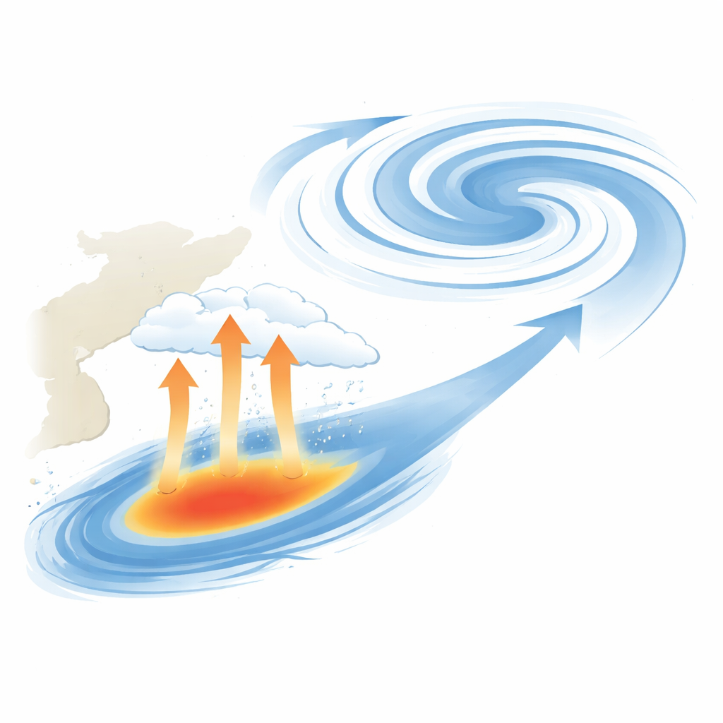
Two kinds of hidden heat
Central to the story is “latent heating”—the energy released when water vapor condenses into cloud droplets. The authors separate this invisible heat into two types. Large‑scale condensational heating comes from broad, organized clouds tied to storm systems, whereas convective heating comes from smaller‑scale rising plumes and shallow mixing in the lower atmosphere. In their model, large‑scale heating peaks along the North Pacific storm track, while convective heating is strongest in the tropics but also shows a local maximum right over the Kuroshio–Oyashio front. Each type of heating varies on synoptic, or weather‑system, timescales of a few days, but with different rhythms: large‑scale heating spikes quickly and fades within about a day, while convective heating tends to linger for roughly two days. These distinct patterns hint that different flavors of storms and pressure systems are involved.
Three recurring weather patterns
By tracking bursts of enhanced latent heating over the Kuroshio–Oyashio region, the team identifies three characteristic weather situations. In the first, large‑scale and convective heating flare up in quick succession as a classic baroclinic storm—an organized cyclone–anticyclone pair—sweeps across the region. In the second, only large‑scale heating is strong, linked to a pattern dominated by a robust anticyclone over the central North Pacific, with a weaker nearby cyclone. This setup funnels warm, moist air over the ocean front but does not necessarily trigger strong convective bursts. In the third, the opposite happens: convective heating spikes without a preceding large‑scale event, as a broad, nearly barotropic low‑pressure system pulls cold, dry air off the continent over the warm current, enhancing shallow convection. These three “synoptic” patterns are not just model curiosities; they also appear in an independent atmospheric reanalysis, lending confidence that they are real features of the climate system.
How a warmer current tips the balance
When the Kuroshio–Oyashio waters are made warmer in the simulations, the atmosphere does not respond uniformly. Instead, one pattern stands out. The overlapping cyclone–anticyclone cases and the rare, convective‑only cases show only modest or inconsistent changes. By contrast, the large‑scale‑only pattern—dominated by an anticyclonic system over the North Pacific—intensifies and persists noticeably longer. Warmer ocean water enhances rising motion and moisture over the front, boosting large‑scale latent heating by roughly 10 percent and subtly increasing convective heating as well. This added heat release helps maintain and strengthen a broad high‑pressure system that arches over the North Pacific, a response that closely mirrors the seasonal‑mean change in the simulations. In effect, the warm current selectively amplifies the most common and most sensitive synoptic pattern, which then dominates the average atmospheric response. 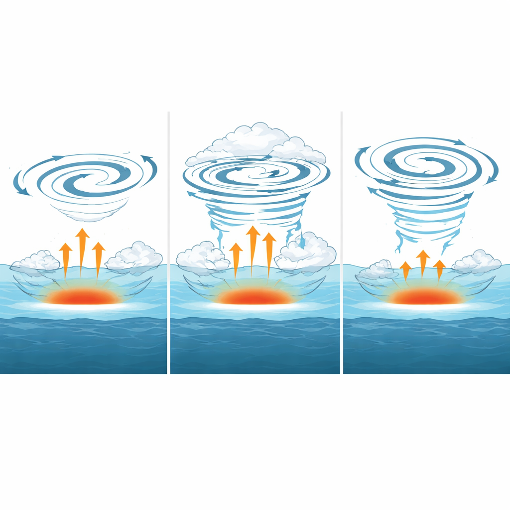
What this means for future climate understanding
For non‑specialists, the key message is that the atmosphere does not simply “feel” a warmer ocean in a smooth, averaged way. Instead, particular kinds of weather systems—notably anticyclonic patterns that sit over the Kuroshio–Oyashio front and draw in warm, moist air—act as amplifiers, converting ocean warmth into large‑scale changes in winds and pressure. Because these systems are both frequent and highly responsive, they largely determine how the wintertime North Pacific adjusts to shifts in the underlying current. This synoptic view helps explain why past studies, based on seasonal averages alone, often found complex or seemingly inconsistent relationships between ocean temperature anomalies and the overlying atmosphere. It also suggests that to predict how similar ocean fronts, such as the Gulf Stream, will shape regional climate in a warming world, scientists must carefully track which specific storm and high‑pressure patterns are being nudged, and how strongly, by the changing sea beneath.
Citation: Kim, D.W., Kwon, YO., Frankignoul, C. et al. A synoptic view of the atmospheric circulation response to SST anomalies in the Kuroshio-Oyashio Extension Region: the importance of latent heating structure. npj Clim Atmos Sci 9, 68 (2026). https://doi.org/10.1038/s41612-026-01340-9
Keywords: Kuroshio Oyashio Extension, air sea interaction, latent heating, North Pacific circulation, winter storm tracks