Clear Sky Science · en
Separating tectonic and climate signals in Holocene sea-level records using marine terraces in central Chile
Why ancient shorelines matter today
As modern seas creep higher, coastal cities, wetlands, and infrastructure all face growing risk. To prepare, scientists need to know not only how oceans will rise, but also how the land itself moves up and down. Along many coasts, slow tectonic uplift or subsidence can either hide or exaggerate climate-driven sea-level change. This study tackles that problem on the earthquake-prone coast of central Chile, using ancient rock-cut shorelines to separate the effect of moving land from the rise and fall of the sea, offering clearer clues to future coastal hazards.
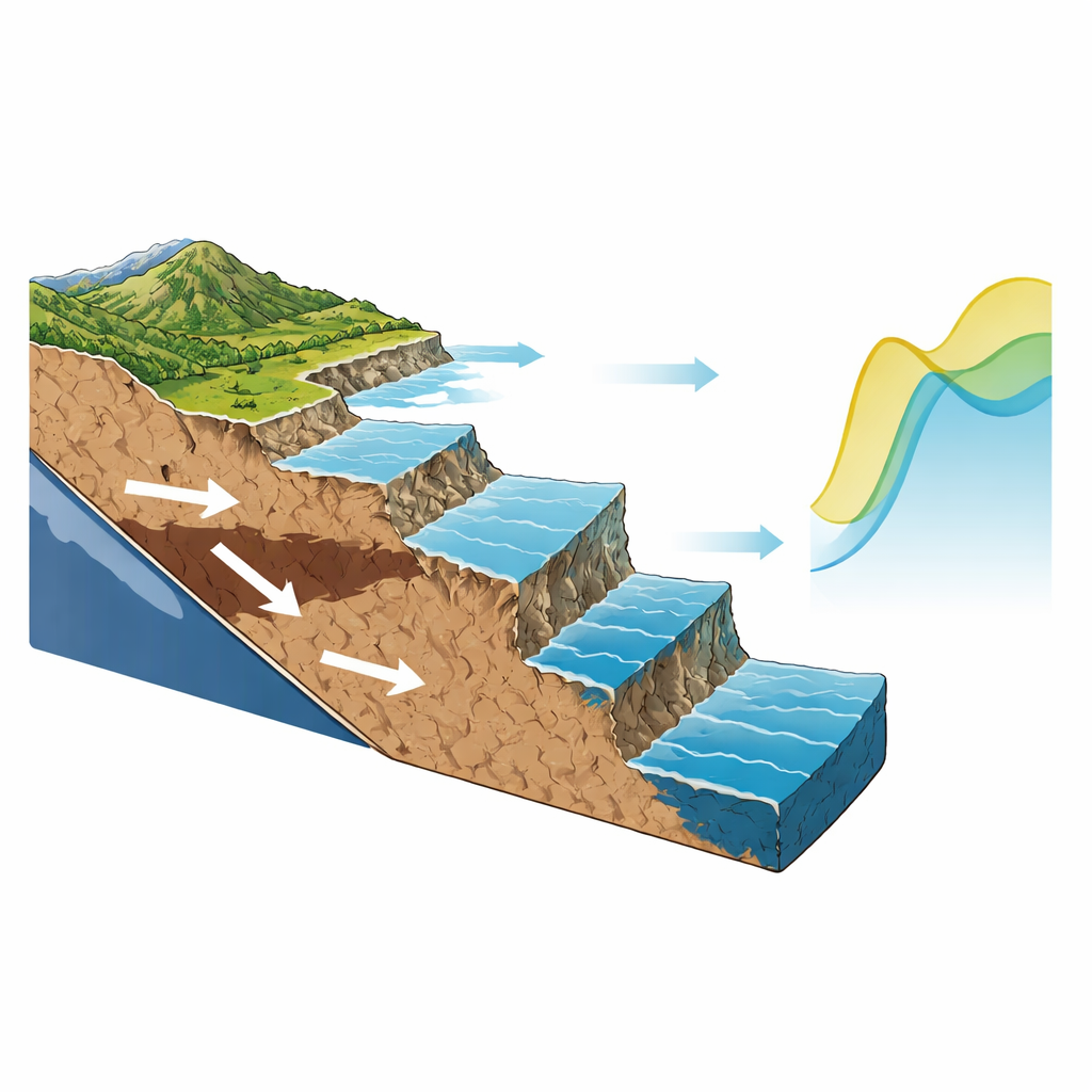
Stepped cliffs as natural tide gauges
The Chilean shoreline south of Santiago is lined with rocky benches and cliffs known as marine terraces. Each terrace is a flat platform carved by waves when sea level lingered at a particular height, later lifted out of the surf as the land rose. The authors mapped more than a hundred Holocene (last ~12,000 years) terraces and over two hundred older Late Pleistocene terraces along 500 kilometers of coast using high-resolution airborne laser scans. By carefully identifying the “shoreline angle” where old sea cliffs meet their former wave-cut platforms, they treated these terraces as natural tide gauges that record where the sea once stood.
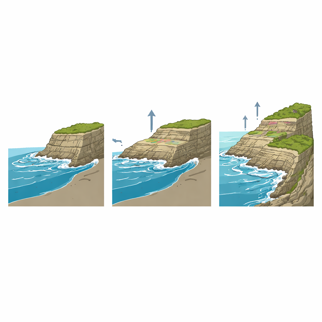
Decoding the slow rise of the land
To understand how much of each terrace’s height comes from tectonic uplift rather than ocean change, the team compared the younger Holocene terraces with older ones formed during the last interglacial period about 125,000 years ago. They found that the elevations of the younger and older terraces are strongly and linearly related along the coast, and that the uplift rates inferred from the older terraces match the pattern of the younger ones. This tight relationship indicates that the coastline has been rising at nearly steady rates for at least 125,000 years, despite many large earthquakes. That finding lets the researchers treat tectonic uplift as a long-term background trend that can be mathematically subtracted from the height of the Holocene terraces.
Revealing a past high sea and testing global models
Once the tectonic component was removed, the remaining height of the Holocene terraces reflects how high the sea actually stood relative to today. The analysis shows that during the mid-Holocene, sea level along this part of Chile peaked at about 3.2 meters above current mean sea level. The authors then compared this estimate with a suite of global “glacial isostatic adjustment” models, which simulate how ice sheets and the Earth’s soft interior interact to raise or lower local sea level over thousands of years. One particular model—with a relatively thick outer shell and a somewhat less viscous mantle beneath—predicted a mid-Holocene highstand only about 0.3 meters higher than the terrace-based estimate. Using a landscape evolution model that simulates wave erosion and coastal uplift, the team could also reproduce the observed pattern of terrace heights when they fed in this same sea-level history and uplift rates.
What steady motion means for future coasts
The Chilean coast is famous for giant earthquakes, such as the magnitude 8.8 Maule event in 2010 that abruptly raised some stretches of shore by more than two meters and lowered others. Yet when the authors compared terrace elevations referenced to before and after this earthquake, the inferred mid-Holocene sea level was essentially the same. Spanning many seismic cycles and hundreds of kilometers, the rocky-terrace record averages out short-lived ups and downs to reveal a stable long-term uplift rate. That stability suggests that, over coming millennia, vertical land motions here are likely to remain similar to those of the recent past.
Lessons for a changing shoreline world
By showing that the long-term rise of the land can be cleanly separated from past sea-level changes, this work strengthens confidence in both local geological records and global sea-level models. For planners and scientists concerned with future flooding, coastal wetland health, and carbon storage, the message is that millennial-scale uplift and subsidence must be accounted for, especially along tectonically active margins. Rocky shorelines, often overlooked compared with muddy marshes or sandy beaches, emerge here as powerful archives that can refine projections of future relative sea-level change and improve our understanding of how Earth’s solid surface and its oceans respond together to climate shifts.
Citation: Melnick, D., Jara-Muñoz, J., Garrett, E. et al. Separating tectonic and climate signals in Holocene sea-level records using marine terraces in central Chile. Sci Rep 16, 9083 (2026). https://doi.org/10.1038/s41598-026-43249-6
Keywords: sea-level change, tectonic uplift, marine terraces, Holocene highstand, Chile coast