Clear Sky Science · en
$$\beta$$ -plane correction for eddy detection and the drivers of eddy activity heterogeneity in a semi-closed maritime continent basin
Whirling Waters in a Crowded Sea
Between the islands of Indonesia, the ocean is anything but calm. Hidden beneath familiar shipping routes and fishing grounds, great spinning pools of water—called eddies—shuffle heat, salt, and nutrients from place to place. This study asks a deceptively simple question with big implications for climate and fisheries: how, where, and why do these ocean whirlpools form in one of the world’s most intricate marine crossroads, and what happens when we measure them more accurately?
Why Tropical Whirlpools Matter
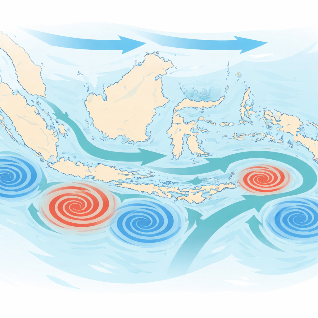
The seas of the Maritime Continent sit between the Pacific and Indian Oceans and host some of the warmest waters on Earth. These waters are threaded by the Indonesian Throughflow, a major current that carries warm Pacific water toward the Indian Ocean. As this flow squeezes through narrow straits and semi-enclosed seas, it spawns countless rotating features. These eddies, typically 60–80 kilometers across and lasting three to four weeks, are small compared with ocean basins but large enough to influence sea surface temperatures, nutrient supply, and even regional weather. Until recently, however, most eddy-detection techniques were designed for mid-latitude oceans and did not properly account for the special rules of motion that apply near the equator.
Fixing the Map of Ocean Whirlpools
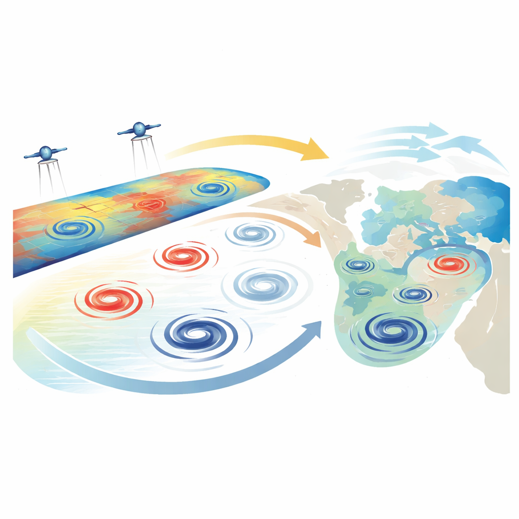
Earth’s rotation influences how water curves as it flows, and that effect changes quickly with latitude near the equator. Many earlier studies treated this rotational influence as constant over large areas, an assumption that breaks down in the tight island maze of Indonesia. The authors refined the physics used to convert satellite measurements of sea level into currents by applying what they call a localized “beta-plane correction,” which allows the rotational term to vary smoothly with latitude. They then applied a two-step detection method to three decades of satellite sea level data. First, they used a geometric approach that traces streamlines around peaks and valleys in sea level to locate candidate eddies. Second, they filtered these candidates using a dynamical test that keeps only genuinely spinning, vortex-like structures and discards short-lived, distorted swirls.
A Patchwork of Spinning Hotspots
With the improved detection in hand, the team cataloged more than fifteen thousand persistent eddies—roughly equal numbers spinning clockwise and counterclockwise. These eddies do not appear evenly across the region. Deep, semi-enclosed basins such as the Banda, Maluku, Celebes, and Savu Seas, as well as the margins of the open Pacific and Indian Oceans, emerge as hotspots packed with mesoscale activity. Shallow or weakly flowing areas like the Java Sea host far fewer eddies. The researchers also show a clear seasonal rhythm. During the southeast monsoon (June to August), anticyclonic eddies, which correspond to domes of higher sea level and warmer cores, are most common. In the northwest monsoon (December to February), cyclonic eddies, tied to lower sea level and cooler, upwelled water, take over—often forming closer to the equator and packing stronger rotation.
Winds, Currents, and a Wandering Rain Belt
The study goes beyond counting eddies to ask what drives this spatial and seasonal patchwork. Monsoon winds reverse direction over the course of the year, altering surface stress, sea level slopes, and the strength of the throughflow. These changes encourage different types of eddies in different seasons and basins. At the same time, the band of heavy rainfall known as the Intertropical Convergence Zone shifts north and south. Its movement reorganizes wind patterns and the twisting force they exert on the sea surface. By comparing eddy counts with the shifting latitude of this rain belt, the authors find a “seesaw” pattern: when the convergence zone sits farther north, one hemisphere tends to favor warm-core eddies while the other favors cold-core ones, and vice versa. Local bottom topography—ridges, sills, and steep continental slopes—further guides where eddies form, how long they survive, and which way they travel.
What These Findings Mean for People and Climate
Although each eddy is short-lived, together they account for a large share of the ocean’s swirling energy in this region and help control how heat and nutrients move between the Pacific and Indian Oceans. By correcting how rotation is treated and by carefully filtering the satellite signals, this work provides a cleaner map of where and when these features occur. For non-specialists, the message is that the Indonesian seas are not just a warm pool but a restless mosaic of rotating structures, tightly linked to monsoon winds, a shifting tropical rain belt, and the shape of the seafloor. Understanding this hidden turbulence will improve models of regional climate, guide ecosystem and fisheries assessments, and sharpen projections of how this crucial ocean gateway will respond as the planet warms.
Citation: Napitupulu, G., Yulianti, K.K., Kartadikaria, A.R. et al. \(\beta\)-plane correction for eddy detection and the drivers of eddy activity heterogeneity in a semi-closed maritime continent basin. Sci Rep 16, 10653 (2026). https://doi.org/10.1038/s41598-026-43244-x
Keywords: ocean eddies, Indonesian seas, monsoon winds, tropical climate, satellite altimetry