Clear Sky Science · en
Assessing the applicability of big data driven urban vibrancy analysis in mixed urbanized-depopulated contexts: a case study of a Japanese city
Why some places feel lively and others feel empty
Walk through almost any city today and you can move from a bustling main street to a nearly silent neighborhood in just a few minutes. This study asks why that happens, using a Japanese city that contains both crowded urban districts and shrinking, sparsely populated areas. By combining anonymous smartphone location data with digital maps, the researchers show how different features of the physical environment help create—or drain—street life, and how city planners might use these insights to keep both busy centers and fading districts alive.
Measuring buzz with phones and maps
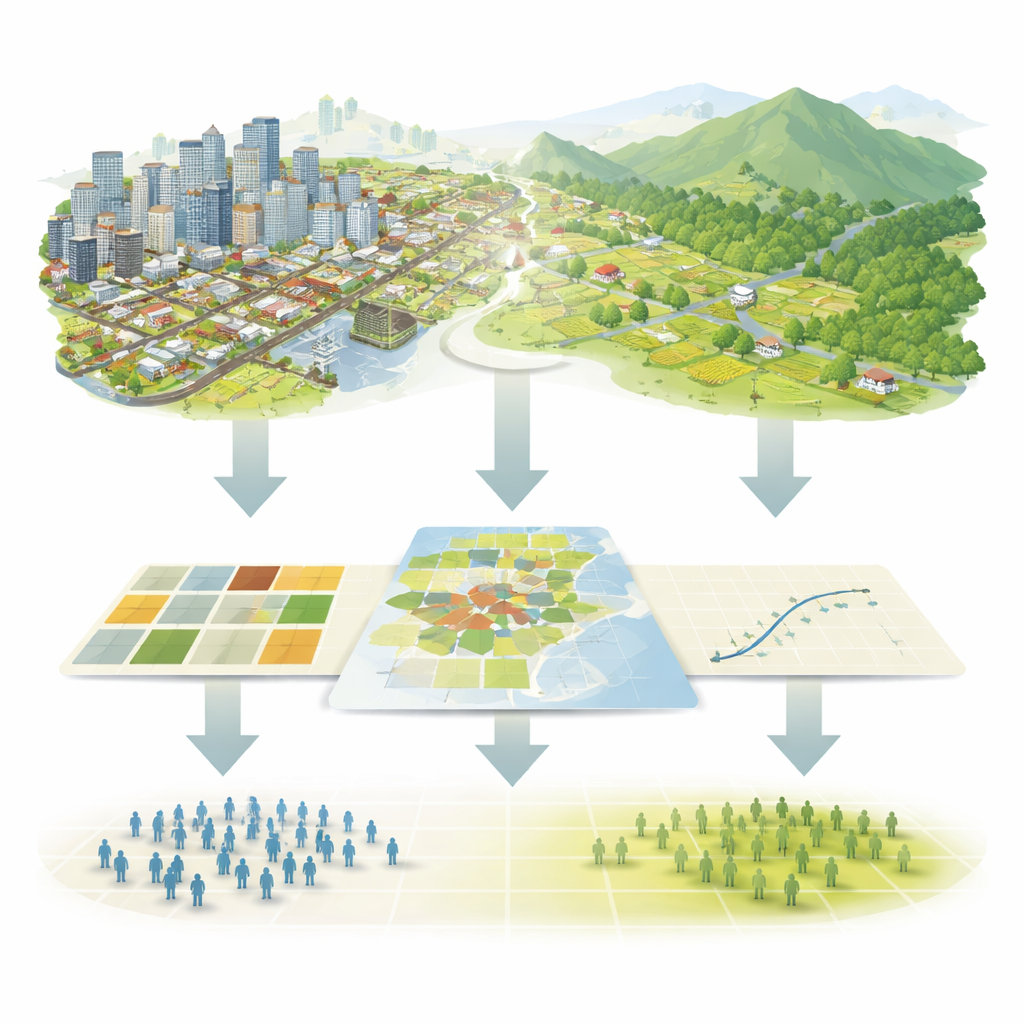
The researchers focused on Toyota City, a large municipality that includes a dense western core and an expansive, mountainous eastern area that has been losing people. Instead of sending surveyors into the streets, they used one year of anonymized GPS records from mobile phones to estimate how long people actually spent in each one–kilometer square cell across the city. More time spent in a place was treated as a sign of greater “vibrancy”—the everyday mix of presence, movement, and interaction that makes an area feel active.
To understand what might be drawing people to some cells and not others, the team built a set of simple indicators from publicly available digital maps. These captured three broad ideas: how mixed local building uses are (homes, shops, and offices), how dense the area is (numbers of homes and points of interest such as restaurants, stores, and services), and how easy it is to get around (share of land occupied by roads and railways). They also measured how much of each cell was taken up by natural land, like forests and rivers, and by “convertible” land such as fields and unused plots that could, in principle, be developed.
Citywide patterns: what matters most
When the researchers looked at Toyota City as a whole, some clear trends emerged. Places with more amenities—captured by a higher density of points of interest—were reliably more vibrant. So were locations with better road and rail coverage, underlining how important movement and access are for getting people to gather. In contrast, cells dominated by natural land or still-undeveloped land were much less active. Surprisingly, a common planning idea—that mixing different uses such as homes, shops, and offices in the same area will always boost street life—did not hold up at the city scale here. A simple measure of mixed building types showed little connection to vibrancy.
Even more counterintuitive, areas with more housing units often showed lower vibrancy when everything was averaged citywide. In Toyota City, where many people commute into a central business district for work, building more homes does not automatically translate into more daytime presence. Instead, activity is concentrated where destinations are clustered—offices, shops, and services—rather than where people sleep.
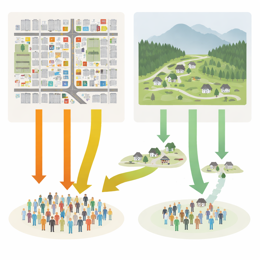
Zooming in: different rules for busy and shrinking areas
Citywide averages can hide important local differences, so the team used a method that allows the strength and direction of each relationship to vary from place to place. This local analysis revealed a split personality. In the dense western core, vibrancy was strongly tied to the number of amenities and to good transport links. In these already busy districts, adding more homes was actually associated with lower measured activity, reinforcing the view that these zones function primarily as workplaces and destinations for visitors.
In the sparsely populated eastern areas, however, the pattern flipped. There, adding more residents—raising the local housing density—was one of the few reliable ways to increase vibrancy. Points of interest had a weaker effect, likely because long travel distances and limited transport options made it hard for people to reach them. Natural and convertible land, while abundant, did not have much impact on activity patterns within these already quiet zones, but reduced vibrancy when they occupied space in the central city where land is scarce.
Planning with tight budgets and mixed goals
Using their local estimates, the authors then explored simple “what if” scenarios for how a fixed amount of investment might be spent. They compared boosting amenities in the urban core, adding housing in depopulated districts, converting unused land in central areas, or splitting the budget between core amenities and peripheral housing. Concentrating on more amenities in the busy core produced the biggest immediate increase in people’s time spent in the city. Yet supporting new housing in shrinking areas, while less efficient in pure numbers, was important for keeping basic services and community life viable there. This shows how big data can help planners weigh trade–offs between maximizing activity and supporting more fragile neighborhoods.
What the study means for everyday cities
For readers wondering why some districts thrive while others struggle, this study offers a clear message: there is no single recipe for urban vibrancy. In Toyota City, and likely in many other places where growing and shrinking areas coexist, lively urban cores depend most on a rich cluster of destinations and strong transport links, while fading outskirts depend more on simply having enough people nearby to keep shops and services going. Traditional ideas like mixing different building uses are not magic bullets and may matter only in certain contexts. By showing that even relatively simple, widely available data can reveal these nuances, the research suggests that cities of all sizes—not just global megacities—can use digital traces to design policies that balance efficiency, fairness, and long-term sustainability.
Citation: Ishii, Y., Hayakawa, K. Assessing the applicability of big data driven urban vibrancy analysis in mixed urbanized-depopulated contexts: a case study of a Japanese city. Sci Rep 16, 8716 (2026). https://doi.org/10.1038/s41598-026-43156-w
Keywords: urban vibrancy, big data cities, depopulated regions, urban planning Japan, built environment