Clear Sky Science · en
Analysis of the evolution and spatial effects of green space pattern in China’s urbanization process: a case study of Guangzhou City
Why city greenery still matters when the numbers look stable
Cities around the world are racing upward and outward, and many appear to be keeping respectable amounts of parks, trees, and waterways on the map. This study of Guangzhou, a fast-growing megacity in southern China, shows that looking only at the total area of green space can be misleading. Even when the numbers for green land barely change, the fine-grained pattern of that greenery can be quietly eroding, with real consequences for wildlife, cooling, and quality of life for urban residents.
How the study looked under the surface
The researchers examined how Guangzhou’s green spaces changed between 2005 and 2020, a period of intense urban expansion. Instead of just measuring how many square kilometers of green land existed, they analyzed how those lands were arranged: Are they in a few large pieces or many tiny ones? Are patches still connected to each other, or isolated by concrete and asphalt? Using satellite-based land-use maps and statistical yearbooks, they grouped cropland, forest, grassland, and water into a single category of “green space” and tracked how this fabric shifted over time across the city’s districts.
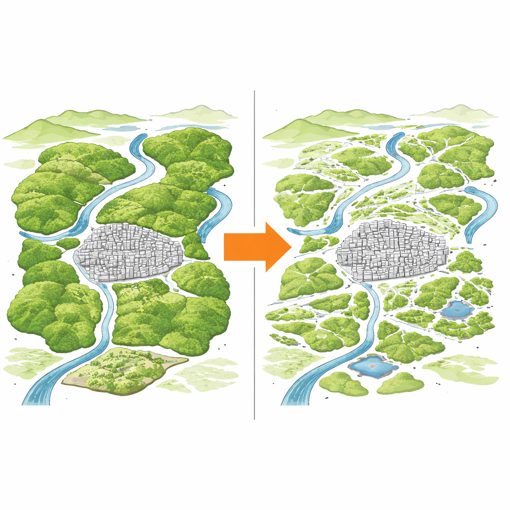
Stable area, but a fraying green fabric
On paper, Guangzhou’s total green space hardly changed across the 15-year period. But the pattern did. Large, continuous patches gradually lost their dominance, and the degree of connection between green areas dropped. In other words, the city’s green fabric became more fragmented and more finely sliced by built-up land, even though the overall area stayed almost the same. At the same time, the mix of different green types became more even, which sounds positive but can mask the fact that long, unbroken corridors of habitat and ventilation were giving way to a more chopped-up mosaic.
Farms lost to concrete and the ripple effects of growth
The main driver of this quiet reshaping was the steady conversion of farmland and grassland into construction land. In earlier years, rapid growth concentrated on turning large swaths of cropland and some forest into urban districts. Later, growth slowed but continued to nibble at ecological land, extending outward across multiple types of green space. Over the full 2005–2020 period, new urban land came mostly at the expense of cropland and forest. Some farmland did shift into forest, which partly compensated in terms of area, but this did not undo the growing fragmentation of the overall network. The study’s land-use transition tables reveal a long, cumulative pressure on green structure rather than a one-time shock.
City lights, people, money, and shared green futures
To understand why some districts lost more green quality than others, the team used a spatial Durbin model—a tool that can capture how what happens in one place spills over into its neighbors. They found strong spatial clustering: districts with lush vegetation tended to be near each other, and so did those with sparse greenery. Urbanization intensity, captured by nighttime light brightness, tended to have a harmful effect on neighboring areas’ vegetation, suggesting that the push of new development radiates across boundaries. In contrast, districts with higher population density and higher income per person often showed better green conditions both locally and in nearby districts, likely reflecting stronger planning capacity, shared infrastructure, and deliberate investment in parks and ecological projects.
What this means for livable cities
For non-specialists, the core message is that “how” green space is laid out can be as important as “how much” there is. Guangzhou’s experience illustrates a development-pressure–ecological-response pattern: urban expansion subtly breaks apart and rearranges green areas, creating hidden ecological costs even when total green area seems steady. At the same time, concentrated people and economic activity can, under the right policies, support better-coordinated green networks at a regional scale. The authors argue that city planners and decision-makers need to think beyond individual districts and area-based targets, designing continuous, interconnected green systems across the wider urban region if they want to safeguard cooling, clean air, biodiversity, and everyday access to nature as cities continue to grow.
Citation: Lian, M., Wang, J. & Zhang, X. Analysis of the evolution and spatial effects of green space pattern in China’s urbanization process: a case study of Guangzhou City. Sci Rep 16, 11340 (2026). https://doi.org/10.1038/s41598-026-41879-4
Keywords: urban green space, urbanization, land use change, spatial spillover, Guangzhou