Clear Sky Science · en
Integrating GIS and AHP for sustainable ecotourism site suitability analysis: a case study of Bahir Dar, Ethiopia
Why This Place Matters for Nature and Jobs
Bahir Dar, a lakeside city in northern Ethiopia, is already famous for its waterfalls, monasteries, and sweeping views over Lake Tana. As visitor numbers grow, the region faces a key question: where can new nature-based tourism be encouraged without damaging the very landscapes and cultures that attract people in the first place? This study tackles that question using digital maps and a structured decision method to pinpoint the most promising areas for low-impact, job-creating ecotourism.
Looking for the Right Spots
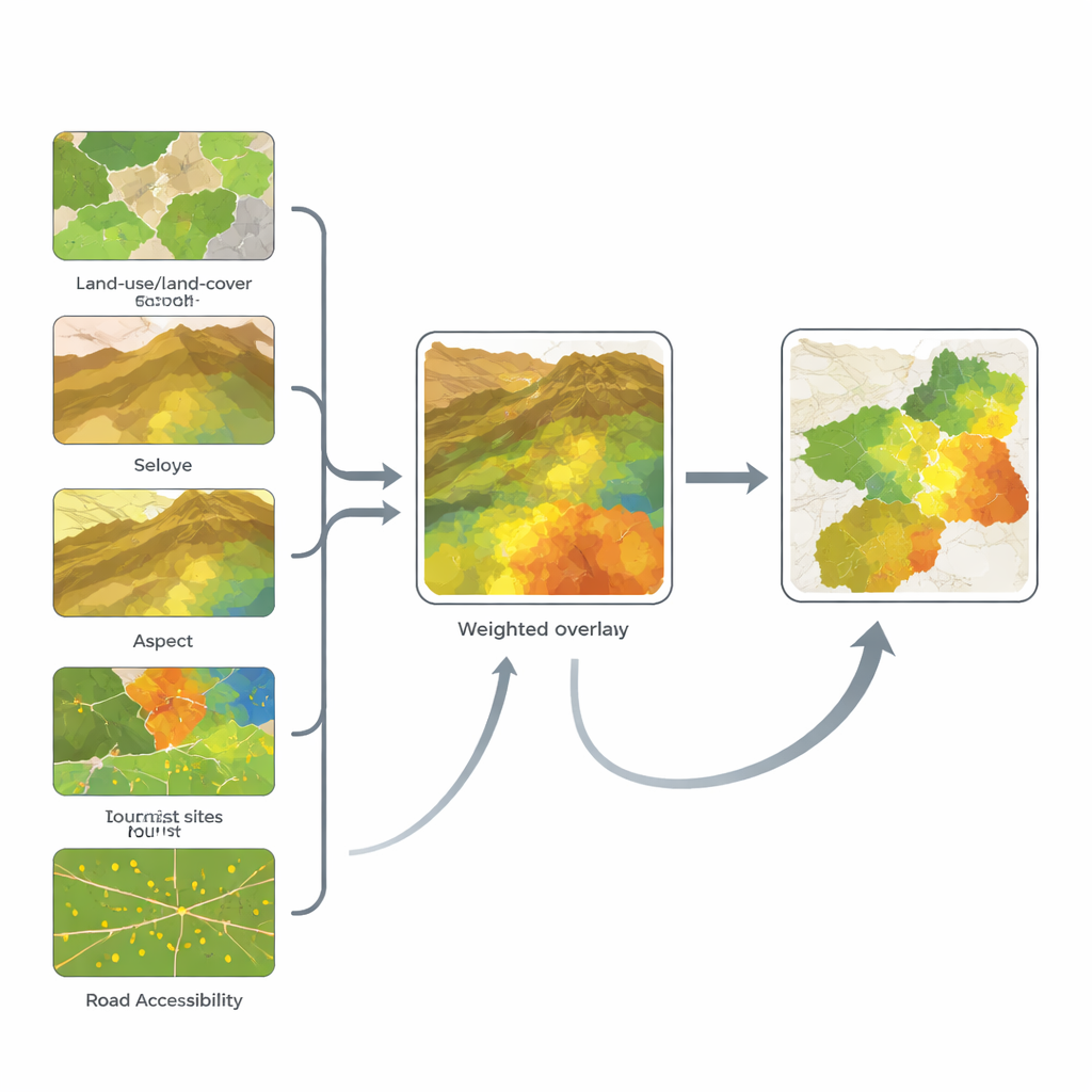
The researchers set out to find which parts of Bahir Dar and its surroundings are best suited for ecotourism, understood as travel that supports local livelihoods while protecting nature and heritage. They focused on six down-to-earth ingredients that shape a visitor’s experience and an area’s resilience: what the land is used for today (farms, forest, water, town), how high and steep the terrain is, which way hillsides face, and how close each place is to existing tourist attractions and roads. Together, these factors reflect both the beauty and sensitivity of the landscape, and the practical ease of getting there without carving new roads through fragile areas.
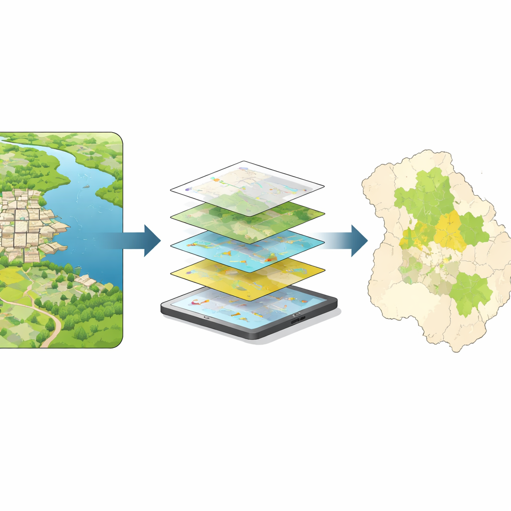
Turning Maps into Clear Choices
To turn this mix of ingredients into a single picture, the team combined Geographic Information Systems (GIS) with a method called the Analytic Hierarchy Process, which helps compare the relative importance of different factors. High-resolution satellite images were used to map farms, open land, vegetation, water, and built-up areas. Elevation and slope came from digital terrain models, while locations of churches, waterfalls, markets, and roads were compiled from local authorities and maps. Experts then judged which factors matter most for gentle, attractive, and accessible nature tourism. Land use turned out to be the dominant influence, followed by elevation and slope, with hillside direction, distance to current attractions, and road access playing smaller but still meaningful roles.
What the Suitability Map Reveals
After weighting and layering all six maps, the analysis produced an ecotourism suitability map divided from very low to very high potential. Most of the area—just over half—falls into a “moderate” category, where careful planning could support nature tourism but trade-offs with farming and settlement must be managed. A bit more than one-tenth of the land scores as “highly” suitable, while a tiny share is rated “very high,” suggesting that truly outstanding zones are scarce and valuable. About a third of the region is poorly suited, mainly because of dense urban areas, intensive agriculture, or steep, unstable terrain where building trails and lodges would be costly or damaging.
Four Places with Special Promise
The map highlights four priority zones that offer different flavors of ecotourism. Area A, along the Blue Nile southeast of Bahir Dar, blends lush vegetation, gentle hills, and churches, making it attractive for nature walks and cultural visits close to town. Area B, in the cooler northeastern highlands, has steeper slopes and traditional churches that lend themselves to trekking and spiritual retreats. Area C, in the rural southwest, features green countryside and limited urban intrusion, well suited to community-based stays, small eco-lodges, and farm visits. Area D, on the city’s edge near two hills and a church, offers accessible short hikes and religious visits for urban visitors who want a taste of nature without long travel.
What It Means for People and the Planet
For non-specialists, the core message is straightforward: using smart mapping and transparent rules, this study shows where Bahir Dar can grow nature tourism while keeping farmland, town expansion, and fragile habitats in view. The results suggest that about two-thirds of the region can host some form of ecotourism if done carefully, and that four zones deserve particular attention for investment and protection. By guiding trails, small lodges, and community ventures toward these priority areas, planners can help create green jobs, ease pressure on crowded city sites, and safeguard vegetation, wildlife, and cultural landscapes—advancing broader goals of decent work, climate-friendly travel, and life on land.
Citation: Mankelkelot, T.K., Ayele, N.A., Jothimani, M. et al. Integrating GIS and AHP for sustainable ecotourism site suitability analysis: a case study of Bahir Dar, Ethiopia. Sci Rep 16, 10261 (2026). https://doi.org/10.1038/s41598-026-41548-6
Keywords: ecotourism, GIS mapping, Ethiopia, sustainable tourism, site suitability