Clear Sky Science · en
Sociodemographic characteristics predict land use patterns by farmers near a protected area in Madagascar
Life at the Edge of a Rainforest
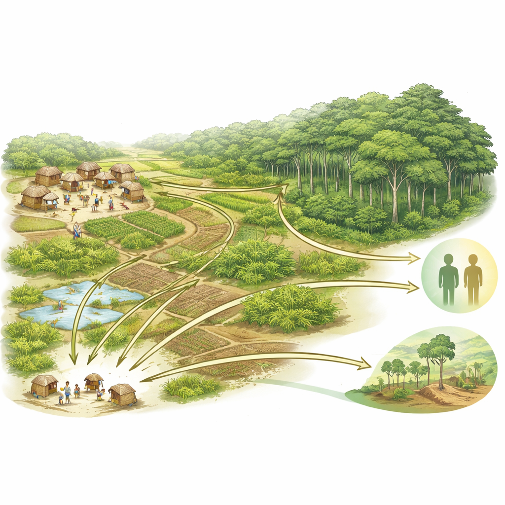
In northeastern Madagascar, families farm small plots of land that sit right next to one of the island’s last intact rainforests. How these farmers move through their fields, forests, and villages affects not only the local environment, but also their exposure to infectious diseases and their ability to feed their families. This study follows hundreds of people using GPS trackers and household surveys to reveal who goes where on the landscape, how long they stay there, and what that means for conservation, health, and everyday livelihoods.
Following People Step by Step
The researchers worked in three villages bordering Marojejy National Park, a protected mountain rainforest rich in wildlife. Most residents are smallholder farmers who grow rice and cash crops like vanilla on a patchwork of fields, regrowing brush, and forest fragments. Over three years, 1,297 adults completed a detailed survey about their age, schooling, family situation, work, land ownership, and material possessions. Of these, 902 agreed to wear small GPS devices for up to a month, which recorded their location every three minutes during daily life. Satellite images were used to divide the surrounding landscape into categories such as village area, flooded rice paddies, brushy regrowth, secondary forest where vanilla is grown, and the relatively intact national park forest.
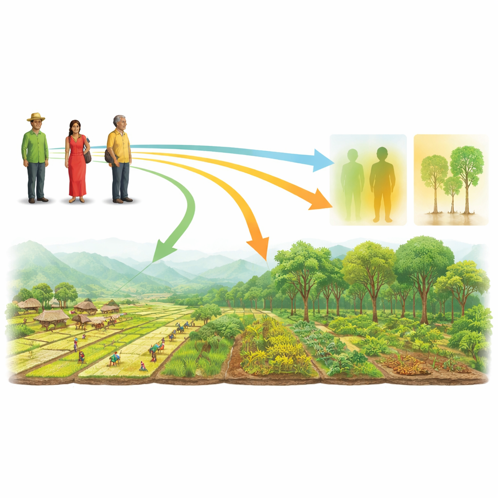
Different Paths for Men and Women
The GPS traces showed clear differences between men and women. Men used much larger areas around the villages and spent more time outside the village than women, whose movements were more tightly centered on the settlement itself. On average, men covered about two-thirds more area and spent roughly a third less time inside the village during the day. Having young children further limited how far people, especially women, traveled. Yet most people of any gender rarely entered the untouched park forest; more than 90 percent never stepped into it during the tracking period. Instead, daily routines concentrated in the village, rice fields, and especially secondary forest, where high-value vanilla is cultivated under shade trees.
Wealth, Work, and Where People Go
Not all farmers used the land in the same way. The team combined information about house building materials, household goods, livestock, and crops into several indicators of long-term wealth and short-term income. People who owned more animals, grew more kinds of crops—particularly cash crops—and had more material goods tended to range over larger areas. They also spent more time in secondary forests and less in low-value brushy regrowth or flooded rice fields. In contrast, farmers with fewer resources and lower-value animals spent more time in brush and bare areas where slash-and-burn methods are used to clear land. Older adults, surprisingly, often traveled farther and spent more time outside the village than younger adults, suggesting that experience and diversified livelihoods draw them across more of the landscape.
Seasons, Forest Use, and Hidden Risks
Seasonal farm work also shaped daily movement. During the mid-year vanilla harvest, people spent more time in secondary forests guarding and tending vanilla vines; after harvest, when vanilla is cured near homes, time in the forest dropped and village time increased. The few people who did venture into the semi-intact park forest were more often younger men with young children, who grew mainly subsistence crops and owned fewer animals. These patterns highlight how financial pressure and limited options can push certain households toward risky activities such as illegal logging. At the same time, the gendered split in land use means women are more exposed to indoor smoke from cooking, while men are more exposed to soil-borne parasites and farm injuries in distant fields.
What This Means for People and the Forest
By pairing GPS tracking with household surveys, this study shows that who you are—your gender, education, family situation, and economic standing—strongly shapes how you move across the land. Those movement patterns, in turn, influence health risks and pressures on forests at the edge of a protected area. For policymakers and community groups, the message is clear: efforts to improve food security, reduce disease, and curb deforestation must be tailored to specific social groups and seasons. Targeted support for resource-poor families, training in more sustainable farming, and careful use of anonymous movement data could help protect both people’s livelihoods and Madagascar’s remaining forests.
Citation: Kauffman, K.M., Pender, M., Rabezara, J.Y. et al. Sociodemographic characteristics predict land use patterns by farmers near a protected area in Madagascar. Sci Rep 16, 9193 (2026). https://doi.org/10.1038/s41598-026-40592-6
Keywords: land use, smallholder farmers, Madagascar, infectious disease risk, forest conservation