Clear Sky Science · en
Degradation trends in lakes and wetlands of Iran and their contribution to dust pollution
Why drying lakes matter for everyday life
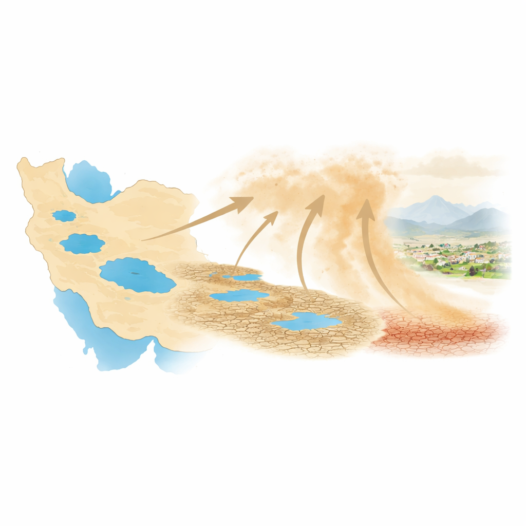
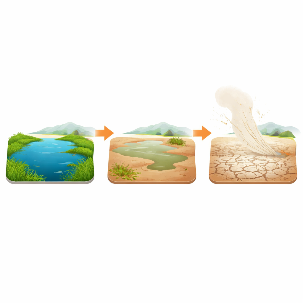
Across Iran, once-vibrant lakes and wetlands are shrinking, turning into cracked, dusty plains. This is not just a story about lost scenery or birds. As these watery havens dry out, their exposed beds can become powerful sources of dust, worsening air quality and affecting the health and livelihoods of millions. This study offers the first long-term, nationwide look at how Iran’s major lakes and wetlands are degrading and how that change is feeding the country’s growing dust problem.
Looking from space to track a slow crisis
Because many wetlands are remote, scattered, and change with the seasons, the researchers turned to satellites to watch them over nearly four decades, from 1986 to 2024. Using a series of Landsat images, they applied a composite measure called the Wetland Degradation Index, which blends signs of shrinking water, declining plants, and stressed soils into a single score for each pixel. Areas with high scores were labeled as “severely degraded beds” — places where open water has largely vanished and the land surface is badly altered. This approach allowed the team to follow 30 important Iranian lakes and wetlands through time, including famous sites such as Lake Urmia, Gomishan, Parishan, Maharlu, Bakhtegan–Tashk, Meyghan, and Namak Lake.
Where water has vanished and land has cracked
The satellite record revealed that almost a quarter of the studied water bodies show a strong, persistent rise in severely degraded area. Seven of them stand out as especially critical. Lake Parishan, for example, remained relatively healthy until the mid‑2000s, then dried completely around 2015 and has not recovered. Lake Urmia, one of the region’s largest salt lakes, suffered intense degradation in the mid‑2010s, especially along its eastern and southern shores. Gomishan on the Iran–Turkmenistan border lost roughly 70% of its water-filled area after 2006, while Maharlu, Bakhtegan–Tashk, Meyghan, and Namak Lake all shifted from mostly water-covered to mostly dry, salt- or crust‑covered basins. Only a few wetlands, such as Delta‑Rud‑e‑Gaz‑Haraz and Khuran, showed improving conditions.
What is driving the loss of water and life
To understand what is pushing these ecosystems toward collapse, the authors examined a broad set of climate and surface conditions: rain and runoff, air and land temperature, wind, moisture, drought indices, and the reflectivity (albedo) of the ground. Before each wetland’s “change point” — the time when degradation began to accelerate — climate-related factors dominated. Warmer air and land surfaces, drier air (lower vapor pressure), and reduced cold-season runoff were closely linked to the spread of degraded beds. For instance, higher land-surface temperature and brighter, saltier surfaces were key indicators for Urmia and Bakhtegan–Tashk, while changes in winter runoff strongly influenced Gomishan. After the change points, the direct influence of climate weakened in many places, and the growing number of people living within 10–100 kilometers of the wetlands became more important, hinting at the cumulative effects of dams, irrigation, and groundwater pumping, even though population growth alone did not statistically explain all the damage.
From bare lakebeds to dust in the air
Dry land does not automatically mean more dust, so the team combined their wetland maps with daily satellite measurements of airborne particles from 2000 to 2024. They counted how often the air over the severely degraded beds was dusty enough to indicate a dust event. The link was striking in several cases. At Gomishan, Parishan, and Lake Urmia, years with more degraded lakebed coincided with more frequent dust events, with roughly 30%, 12%, and 49% of dust activity, respectively, statistically tied to the growth of these dry, fragile surfaces. In other wetlands, like Meyghan or Maharlu, the relationship was weaker or masked by factors such as hard salt crusts that resist erosion, local winds, or efforts to stabilize the soil. Still, the overall pattern shows that a relatively small number of critically damaged wetlands can have an outsized impact on regional dust pollution.
What this means for people and policy
The study paints a clear picture for nonspecialists: when Iran’s lakes and wetlands shrink, they often leave behind exposed beds that can turn into dust factories. Climate shifts — hotter, drier conditions and altered runoff — started the decline, and growing human pressure has helped lock many wetlands into a degraded state. In several key regions, this has already translated into more dusty days and poorer air. The authors argue that safeguarding and restoring wetlands is not just about saving wildlife; it is also a practical way to reduce dust hazards, protect public health, and stabilize local climates. They call for continuous monitoring, better accounting of water use and dam impacts, and management plans that treat these fragile water bodies as vital infrastructure in the fight against worsening dust storms.
Citation: Samadi-Todar, S.A., Ebrahimi-Khusfi, Z. & Ebrahimi-Khusfi, M. Degradation trends in lakes and wetlands of Iran and their contribution to dust pollution. Sci Rep 16, 9503 (2026). https://doi.org/10.1038/s41598-026-40357-1
Keywords: wetland degradation, dust storms, remote sensing, Iran climate, lake desiccation