Clear Sky Science · en
Refined reservoir mapping while drilling for a strategic exploitation of deep-development reservoirs
Finding Hidden Oil in Old Fields
Many of the world’s oilfields are growing old. Wells that once gushed oil now mostly pump up water, yet large pockets of oil still hide between them. This study shows how a new way of “seeing” into the rocks while drilling can reveal those hidden pockets in time to steer a well directly into them, making better use of existing fields and reducing waste. 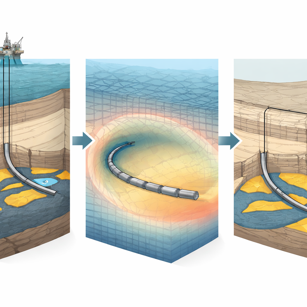
Why Old Reservoirs Still Matter
In mature oilfields, years of production often leave a confusing patchwork of oil, gas and water underground. The remaining oil is no longer held in one big pool but broken into small, scattered zones that are hard to target. If companies simply drill more wells or pump harder, they risk bringing up mostly water, damaging the field and cutting into long-term recovery. The authors focus on such a “deep-development” reservoir in China’s Bohai Bay Basin, where water already makes up more than 80–90% of what wells produce, yet computer models indicate that sizable pockets of oil remain.
Seeing Deeper and Sharper While Drilling
Traditional tools offer a frustrating trade-off. Seismic surveys can see hundreds of meters into the subsurface, but only in a blurry way. Instruments inside the wellbore can see rock properties in fine detail, but only a meter or so from the hole. The new ultra-deep reservoir mapping service (UDRMS) aims to bridge this gap. It uses a special drilling assembly equipped with electromagnetic antennas that sense how easily electrical currents move through the surrounding rocks. Because oil, water and different rock types conduct electricity differently, the tool can reconstruct a two-dimensional picture of the layers and fluid contacts as far as about 30 meters away, with vertical detail on the order of one meter. This picture is updated in near real time as the bit advances, turning drilling from a blind operation into a guided one.
Guiding Wells to the Sweet Spots
The team applied this technology in a block of the Q oilfield, where the rock layers are cut by faults and shaped by ancient braided rivers, creating strong changes in thickness and rock quality over short distances. In one example well, they aimed to drill horizontally through an oil zone that sits above rising bottom water. As the bit approached the target, the ultra-deep measurements picked up the top of the reservoir about 16 meters ahead and also revealed a conductive band interpreted as water, showing that the oil–water boundary had moved nine meters higher than expected. With this information, engineers bent the well gently upward to “soft land” near the top of the oil zone and then held the horizontal section safely above the water. Although they drilled only about 40% of the originally planned horizontal length, the well’s early oil rate and low water content beat forecasts by roughly 18%, and overall recovery from that pocket rose by about five percent.
Rescuing a Difficult Rock Layer
In another case, a horizontal well targeted a thin but promising sand layer shaped by river deposits. Nearby wells suggested this layer should be about six meters thick and close to a gas cap, a configuration that can trap high-quality oil. Instead, the ultra-deep images showed that the local geology was very different: the expected sand was thinner and broken, and its properties changed abruptly sideways. Rather than accept a poor result, the team used the real-time maps to redesign the well path. They steered into a neighboring part of the same layer that was thicker, cleaner and laterally continuous, then followed an irregular “sweet zone” along it. That sidetracked well produced more than twice the forecasted oil rate with almost no water at start-up, and over two years added roughly 7.5% extra recovery from the remaining oil in that area. 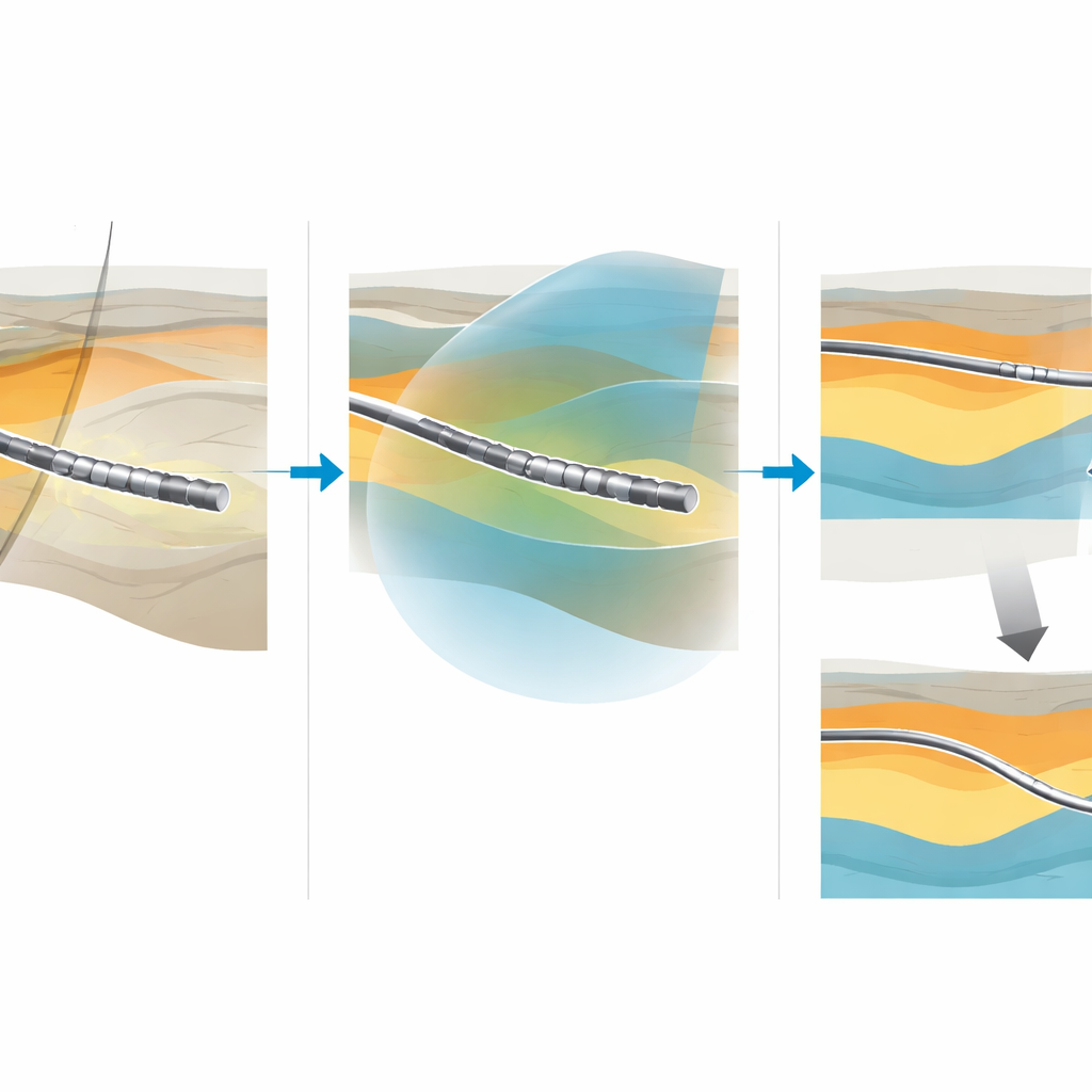
From Guesswork to Targeted Use of Old Fields
Overall, the study shows that combining deep reach with fine detail during drilling can turn a mature, water-flooded field into a more predictable and sustainable resource. By mapping rock layers, faults and fluid boundaries around the bit in real time, UDRMS lets engineers place wells where they drain the most oil while avoiding early water production. The authors argue that this approach shifts field management from short-term extraction to long-term, value-focused planning—“understanding an area by drilling one well.” Looking ahead, they see opportunities to extend the method into full three-dimensional imaging and to apply it beyond oil and gas, for example in underground energy storage and carbon dioxide injection, wherever knowing the hidden structure of the subsurface really matters.
Citation: Hu, X., Wang, F., Li, W. et al. Refined reservoir mapping while drilling for a strategic exploitation of deep-development reservoirs. Sci Rep 16, 9302 (2026). https://doi.org/10.1038/s41598-026-40240-z
Keywords: reservoir mapping, geosteering, ultra-deep resistivity, mature oilfields, Bohai Bay Basin