Clear Sky Science · en
Potential impacts of landuse changes on the supply–demand relationship of water resources in semiarid loess hilly regions
Why this matters for dry places
In many dry farming regions, the real bottleneck is not land or fertilizer but water. This study looks at Guyuan, a hilly, wind‑blown area on China’s Loess Plateau, to ask a basic question with global relevance: as fields, grasslands, forests and towns shift over the coming decades, will there still be enough water to go around? By combining detailed maps with a water‑balance model, the authors show how today’s planning choices could lock millions of people into long‑lasting water stress.
A fragile landscape on the edge
Guyuan sits in a semi‑arid zone where rain is scarce and uneven, summers are dry, and steep slopes are cut by deep gullies. Most local water is already spoken for: nearly four‑fifths goes to crop irrigation, with the rest split between homes and industry. At the same time, the area serves as an ecological shield, with forests and grasslands helping to hold back encroaching desert. This means every shift in land use—turning hillside fields into forest, or pasture into suburb—simultaneously affects food production, city growth and the health of local ecosystems.
Imagining three different futures
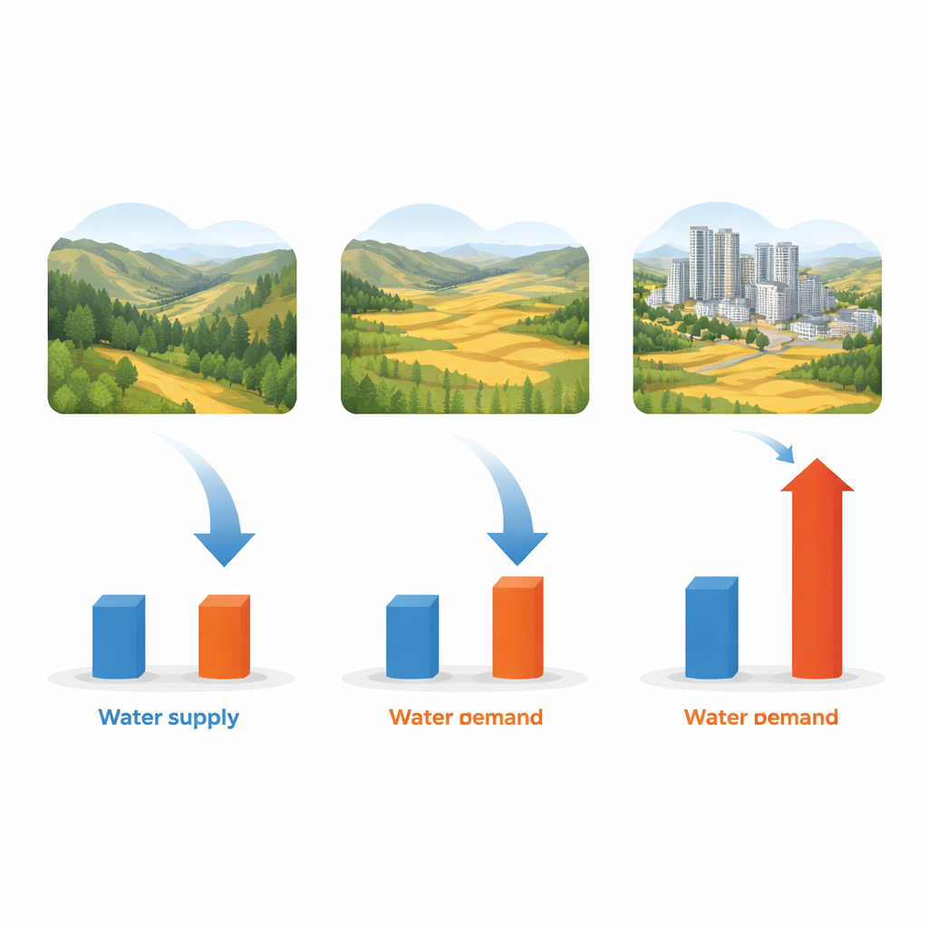
The researchers used a land‑change simulation tool to project how Guyuan’s landscape might evolve from 2030 to 2050 under three broad storylines. In the “natural increase” path, current trends continue, with modest expansion of forests and grasslands and a slow rise in built‑up areas. In the “food security” path, cropland is strongly protected and expanded at the expense of forests and grasslands to maximize grain output. In the “economic development” path, towns and industrial areas grow rapidly, mostly over former cropland. These simulations were checked against past land‑change data and matched real‑world maps with high accuracy.
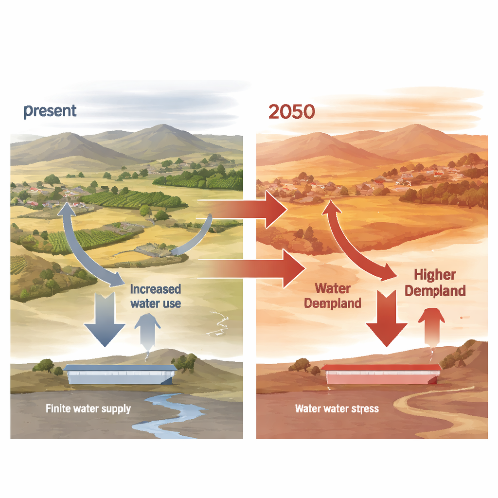
Water supply barely shifts, but thirst soars
Next, the team fed each future land map into a water‑yield model that estimates how much water the landscape can return each year after plants and soils have taken their share. Despite evident shifts in land cover, total water available to people changed very little—varying by less than 8% between 2030 and 2050 in all scenarios. By contrast, projected water demand rose steeply. As population, irrigation and economic activity grow, total demand increased by more than 40% across the study period. Crop irrigation remained the largest user, especially under the food‑security path, while expanding towns under the development path added concentrated pockets of high demand.
Growing pockets of risk across the region
By comparing local supply with local demand, the authors mapped where and how water shortages are likely to intensify. By 2030, roughly nine‑tenths of Guyuan’s area is already in a state the authors call “endangered” in terms of water balance. As time passes, high‑risk zones spread and deepen, though in different ways for each storyline. Under natural growth, risk climbs mostly in grasslands and forests, reflecting pressure on ecological areas. Under fast economic development, high‑risk zones expand over towns and surrounding fields, as paved surfaces and factories both consume more water and reduce the land’s ability to store it. Under the food‑security path, a surge of new cropland in already dry, high‑elevation districts drives strong local deficits even though it boosts grain supply.
Paths toward more resilient farming
The study argues that Guyuan—and similar dry farming regions worldwide—cannot solve its water dilemma by favoring only food production, only ecological restoration or only urban growth. Instead, it calls for a mix of measures: replacing leaky flood irrigation with drip and sprinkler systems, capturing more rainwater in small reservoirs and flexible tanks, re‑shaping forests and grasslands into step‑like belts that stabilize soil while using water more efficiently, and tightening industrial and urban water use. Because many farms are small and family‑run, success will depend on giving farmers both the tools and incentives to adopt water‑saving practices.
What the study means in simple terms
For a non‑specialist, the key message is straightforward: in Guyuan’s dry hills, future land decisions will not magically create more water. No matter which development path is chosen, natural water supply changes only a little, while the combined thirst of farms, cities and ecosystems rises sharply. If today’s practices continue, nearly the whole region will live under persistent water stress by mid‑century. The authors suggest that by carefully balancing where to farm, where to build and where to restore nature—while squeezing more value from every drop—semi‑arid regions can keep both people and landscapes viable in a hotter, drier future.
Citation: Qiao, L., Li, Q., Zhang, H. et al. Potential impacts of landuse changes on the supply–demand relationship of water resources in semiarid loess hilly regions. Sci Rep 16, 11074 (2026). https://doi.org/10.1038/s41598-026-40006-7
Keywords: land use change, water scarcity, semiarid agriculture, Loess Plateau, water management