Clear Sky Science · en
Designing multisource blue–green cooling networks by coupling landscape pattern metrics and circuit theory
Why cooler cities matter
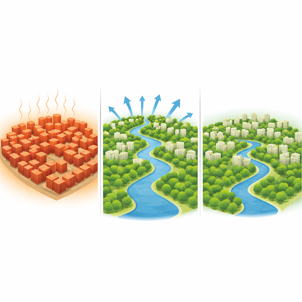
As more people crowd into cities and summers grow hotter, built-up areas are heating far faster than their rural surroundings. This “baking city” effect raises air‑conditioning use, energy bills, and health risks, especially in humid regions where the air already feels heavy and stifling. This study looks at Nanchang, a fast‑growing city in southern China, and asks a practical question: instead of treating parks and lakes as isolated oases, can we design them as a connected cooling network that channels fresh air across the whole city?
From scattered hot spots to a citywide heat problem
Using nearly two decades of satellite data, the researchers tracked how Nanchang’s surface temperatures changed between 2003 and 2022. Early in this period, cooler zones covered much of the city, and heat was confined to a handful of busy districts. As the city rapidly expanded, paved surfaces and dense development spread outward. By 2022, low‑temperature areas had shrunk by more than half, and high‑temperature zones more than doubled, forming broad, continuous “heat blankets” across the central districts. At the same time, big rivers, lakes and forested hills stayed several degrees cooler than their surroundings, acting as stubborn “cold anchors” in an otherwise warming landscape.
What drives the heat in a humid city
The team then dug into why some parts of the city are hotter than others. They compared temperature maps with information on land cover, vegetation, building height and density, roads, population and terrain. Two factors stood out: how green an area is, and what kind of surface covers the ground. Places dominated by concrete and asphalt were consistently hotter, while areas rich in trees, parks and water bodies were cooler. When vegetation and land use were considered together, they explained more than 60% of the pattern of surface temperatures. Building height and crowding also mattered, but mainly by amplifying or weakening the effects of greenery and hard surfaces. In flat Nanchang, hills played only a minor cooling role, underscoring that what we build, and where, is more important than subtle changes in elevation.
Seeing green spaces as a connected system
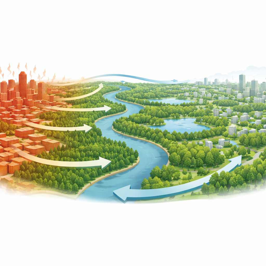
Instead of treating each park or lake as an isolated asset, the researchers re‑imagined Nanchang’s greenery and waterways as parts of a single network. They first identified key “cooling patches” such as forested hills, major lakes, riverside belts and a few strategically located parks that show strong local cooling. Then they examined how well these patches are connected and how much each one contributes to keeping the broader city cooler. Large, continuous areas of forest and water, like the Meiling Mountains and the Gan River, emerged as the main cooling hubs. Lakes and sizable parks act as important supporting nodes, while small, isolated green fragments cool only their immediate surroundings unless they help bridge gaps between larger cool areas.
Designing invisible airways through the city
To turn these scattered cool spots into a working system, the team borrowed an idea from electrical engineering. They treated the city as a surface that either resists or invites the flow of cool air, much like how different materials resist or conduct electric current. Paved, dense districts were assigned high “resistance”, while lakes, rivers, and green belts offered low resistance. By running virtual “currents” from major cool patches through this landscape, the model revealed the paths where cool air would most naturally travel. These paths form potential ventilation corridors: invisible airways that, if kept open and green, can carry cooler, cleaner air deep into overheated neighbourhoods. The resulting plan includes 56 primary and 60 secondary corridors, plus recommendations for small “stepping‑stone” green pockets to close critical gaps.
What this means for future cities
The study suggests that connecting parks, rivers and lakes into a coherent blue–green network can trim daytime temperatures by about 1–3 °C in dense urban areas—enough to ease heat stress and energy demand during hot spells. For Nanchang and similar flat, humid cities, the message is clear: it is not just how much greenery a city has, but how it is arranged. Long, continuous corridors of trees and water that link large cool patches and follow natural or planned wind paths are far more effective than scattered pocket parks alone. By planning green and blue spaces as functional cooling infrastructure, cities can build low‑cost, nature‑based “air‑conditioning systems” that also offer cleaner air, flood control and better places to live, walk and play.
Citation: Xu, Y., Jiang, M., Li, Q. et al. Designing multisource blue–green cooling networks by coupling landscape pattern metrics and circuit theory. Sci Rep 16, 8065 (2026). https://doi.org/10.1038/s41598-026-39813-9
Keywords: urban heat island, green infrastructure, cooling corridors, blue–green networks, climate-resilient cities