Clear Sky Science · en
The influence of non-oceanic forces on the mean sea level of the Brazilian coast: a bivariate and multivariate approach
Why sea level is more than just rising oceans
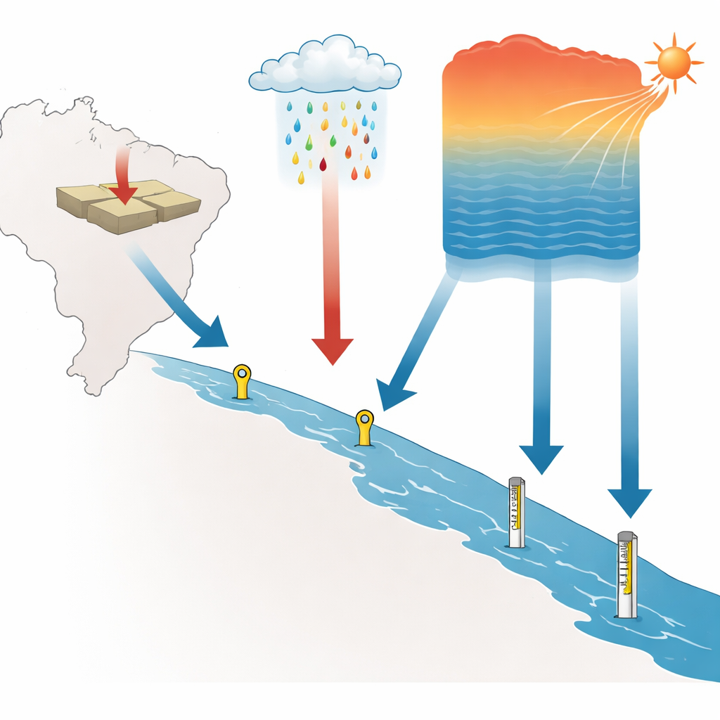
People who live near the coast often hear about global sea-level rise driven by melting ice and warming oceans. But in any given harbor, the story is more complicated. The land itself can move up or down, rainfall can swell rivers, and air temperature can subtly reshape the sea surface. This study looks at seven locations along the Brazilian coast to untangle how these non-oceanic forces combine with the oceans to shape the water levels that ports, cities, and coastal communities actually experience day to day.
Looking at the coast as a connected system
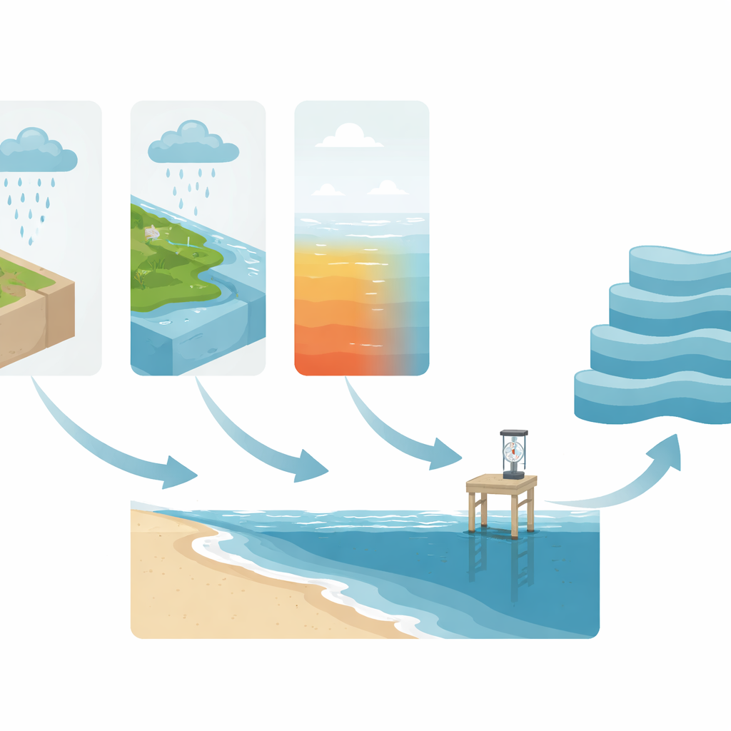
The researchers started from a simple but powerful idea: what tide gauges measure at the shoreline is not just the ocean, but the ocean plus whatever the land and local climate are doing. To capture this full picture, they examined long records (up to two decades) from Brazilian tide gauges, nearby weather stations, and satellite-based positioning systems that track the slow vertical motion of the Earth’s crust. Instead of treating these as isolated data sets, they analyzed them together, asking how changes in land height, rainfall, and air temperature are linked with shifts in mean sea level over days, months, and years.
Following patterns across many time scales
Sea level and climate fluctuate on multiple rhythms—from daily tides to seasonal cycles and long-term trends related to climate change. Standard correlation tools often miss these layered patterns, especially when the data wander over time rather than staying neatly around a fixed average. To overcome this, the team used specialized techniques that strip away long-term drifts and then measure how strongly variables move together at different time scales. They also calculated a form of entropy—a measure of how predictable or chaotic the sea-level record is at each station—by sliding a 30-day window along the time series. This allowed them to compare not only how high or low sea level was, but also how orderly or intricate its fluctuations were.
Land movement, rain, and heat: who matters most?
The analysis revealed that slow vertical land motion, captured by satellite positioning, had the clearest and most stable link with mean sea level. At Salvador and Santana, the sea-level records and ground motion were strongly anticorrelated: as the land sank, sea level at the gauge appeared to rise, even if the open ocean did not change as much. This indicates that subsiding ground can exaggerate the impression of sea-level rise, a crucial consideration for risk assessment and the design of coastal defenses. Air temperature also played a consistent role at some sites, particularly Arraial do Cabo and Belém, where warmer conditions were associated with higher sea levels, in line with the idea that warmer water expands and takes up more space. Rainfall, by contrast, showed weaker and more erratic links, likely because its influence depends heavily on local river systems, coastal shape, and how water is stored or released on land.
When forces act together
To see how all three factors jointly shape sea level, the authors used a multivariate measure that captures their combined influence across different time scales. For most stations, the joint effect grew stronger at longer scales—seasonal to yearly—suggesting that the accumulation of subsidence, climate-driven warming, and hydrological changes is what really matters for long-term coastal planning. Salvador and Santana again stood out, with especially high combined correlations that point to a potent mix of sinking land and changing climate. A sliding-window view through time showed that these relationships are not fixed: at some points, such as an extreme episode in Fortaleza in 2021, the combined influence of land motion, temperature, and rainfall on sea level spiked, likely reflecting compound events like heavy rain coinciding with heat and unusual ocean conditions.
What this means for people and coasts
For a layperson, the key message is that the sea level seen at the pier is not just a simple thermometer of global warming. It is the outcome of interacting processes: the slow sinking or rising of the ground, the way heat builds up in the ocean, and the shifting patterns of rain on land. This study shows that properly interpreting sea-level trends—especially in a large, diverse country like Brazil—requires tracking all of these influences together and paying attention to how they evolve over different time scales. By doing so, planners and policymakers can better distinguish true ocean-driven change from land-related effects, sharpen forecasts of future coastal risk, and design more resilient ports, cities, and infrastructure in the face of a changing climate.
Citation: Junior, N.S.R., Guedes, E.F., de Castro, A.P.N. et al. The influence of non-oceanic forces on the mean sea level of the Brazilian coast: a bivariate and multivariate approach. Sci Rep 16, 8850 (2026). https://doi.org/10.1038/s41598-026-39554-9
Keywords: sea level, Brazilian coast, land subsidence, climate variability, tide gauges