Clear Sky Science · en
Spatiotemporal land use land cover dynamics and rainfall-runoff responses in the urbanizing Gdynia, Poland
Why City Growth and Rainstorms Matter to Everyday Life
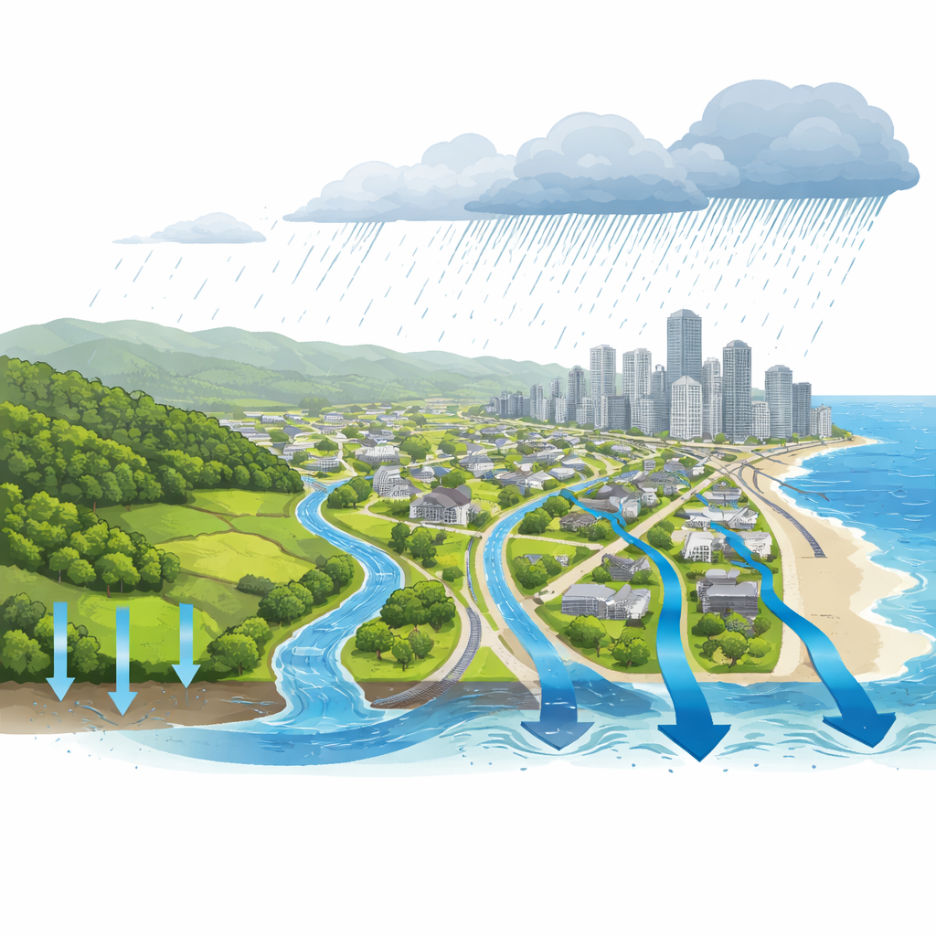
When heavy rain hits a city, where that water goes can mean the difference between a routine shower and flooded streets, basements, and transit lines. This study looks at Gdynia, a fast-growing coastal city in northern Poland, to understand how decades of building development and shifting rainfall patterns are changing the way water moves across the landscape. The findings help explain why flash floods are becoming more likely in many cities—and what can be done to reduce that risk.
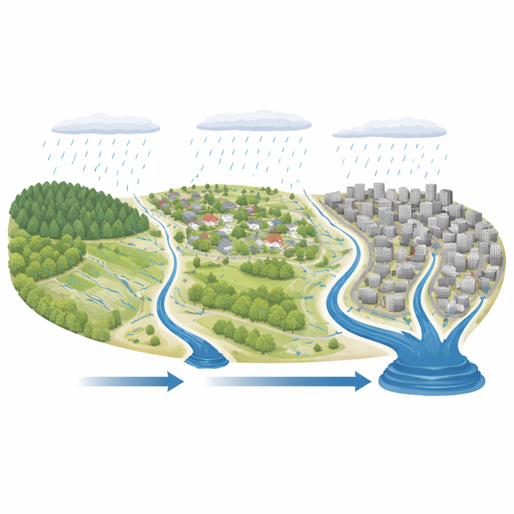
From Fields and Forests to Pavement and Rooftops
Over the last four decades, large parts of Gdynia have been transformed. Using satellite images and machine learning, the researchers reconstructed how land use changed between 1985 and 2024 across the whole city, and between 1949 and 2030 in the flood‑prone Kacza River basin. They found that farmland and grassy areas shrank sharply, while built‑up areas and forests grew. In Gdynia as a whole, built surfaces such as housing estates, roads, and industrial zones expanded by about half, while agricultural land fell to less than a third of its former extent. In the Kacza basin, building footprints increased more than fivefold since 1949 and are projected to keep growing by 2030, mainly along slopes and road corridors that feed water quickly into streams.
How Scientists Measured Runoff in a Changing City
To translate these map changes into flood risk, the team applied a widely used engineering formula that links land cover, soil type, and slope to how much rain becomes surface runoff instead of soaking into the ground. They combined this with a digital elevation model and soil data to estimate how different surfaces—from forests to parking lots—respond during intense storms. Rather than relying on a single historic downpour, they used synthetic “design” rain events representing rare but dangerous storms lasting 15 minutes, one hour, and 24 hours, each with a 1‑in‑100 chance of occurring in any year. They also brought in climate projections for two greenhouse‑gas pathways (RCP4.5 and RCP8.5) to see how future daily rainfall might change runoff across the city.
What Happens to Rainwater as the City Spreads
The results show a clear pattern: as Gdynia has urbanized, more rainfall is converted directly into fast‑moving runoff. For the whole city, the amount of water running off during a 24‑hour extreme storm rose from about 25.9 millimeters in 1985 to 31.7 millimeters in 2024, even though the storm itself was assumed to be the same. Shorter, more intense events showed similar increases. The fraction of rainfall turning into runoff (the runoff coefficient) climbed steadily, especially in districts where new neighborhoods and transport links replaced fields and open land. Maps of the city reveal that the largest jumps in runoff line up with newly urbanized belts in the north, east, and southwest, while forested hills still act as relative “sponges” with lower runoff.
Looking Ahead Under a Warmer Climate
Land change is only part of the story. When the researchers combined today’s land cover with future rainfall projections, they found further increases in runoff for Gdynia. Under a moderate emissions pathway (RCP4.5), surface runoff during intense daily events is projected to increase by around 1–2% by mid‑century and by a bit more by 2100. Under a higher‑emissions future (RCP8.5), increases reach roughly 7% by century’s end. The runoff coefficients follow a similar upward trend. In the Kacza River basin, where past floods have already damaged infrastructure, the same type of analysis shows that runoff has risen dramatically since 1949 and will likely continue to grow as development spreads, even if some forest cover is maintained.
What These Findings Mean for Flood‑Safe Cities
For non‑specialists, the study’s message is straightforward: when a city replaces fields and grass with connected networks of streets, roofs, and drains—and when storms grow heavier—rainwater reaches rivers faster and in greater volumes, raising the odds of urban flooding. In Gdynia, this trend is strongest where new building areas sit directly above streams and drainage lines, meaning local planning decisions upstream can have big consequences for neighborhoods downstream. The authors argue that traditional hard defenses alone will not be enough. Instead, they highlight the need for “sponge city” ideas: protecting remaining forests, adding green corridors, retention basins, and permeable pavements, and placing these measures where runoff is generated. Their combined mapping and modeling framework offers city planners a practical way to identify such priority zones and design future growth that keeps both feet and foundations drier when the next big storm arrives.
Citation: Galata, A.W., Gulshad, K. & Szydłowski, M. Spatiotemporal land use land cover dynamics and rainfall-runoff responses in the urbanizing Gdynia, Poland. Sci Rep 16, 11153 (2026). https://doi.org/10.1038/s41598-026-39241-9
Keywords: urban flooding, land use change, surface runoff, coastal cities, climate change impacts