Clear Sky Science · en
Hydrochemical and GIS-based evaluation of groundwater suitability for irrigation using IWQI in the desert hinterland of western Nile Delta Egypt
Why Water Under the Desert Matters
In Egypt’s rapidly expanding “New Delta,” much of the country’s food future depends on water you cannot see. As farmers push into the desert beyond the Nile’s traditional floodplain, they increasingly rely on groundwater pumped from deep beneath the sand. This study asks a deceptively simple question with big consequences: Is that hidden water actually safe to use for crops over the long term, or could it slowly poison the soil with salt? The answer, based on dozens of wells and advanced mapping tools, is a cautious “yes—but only with careful management.” 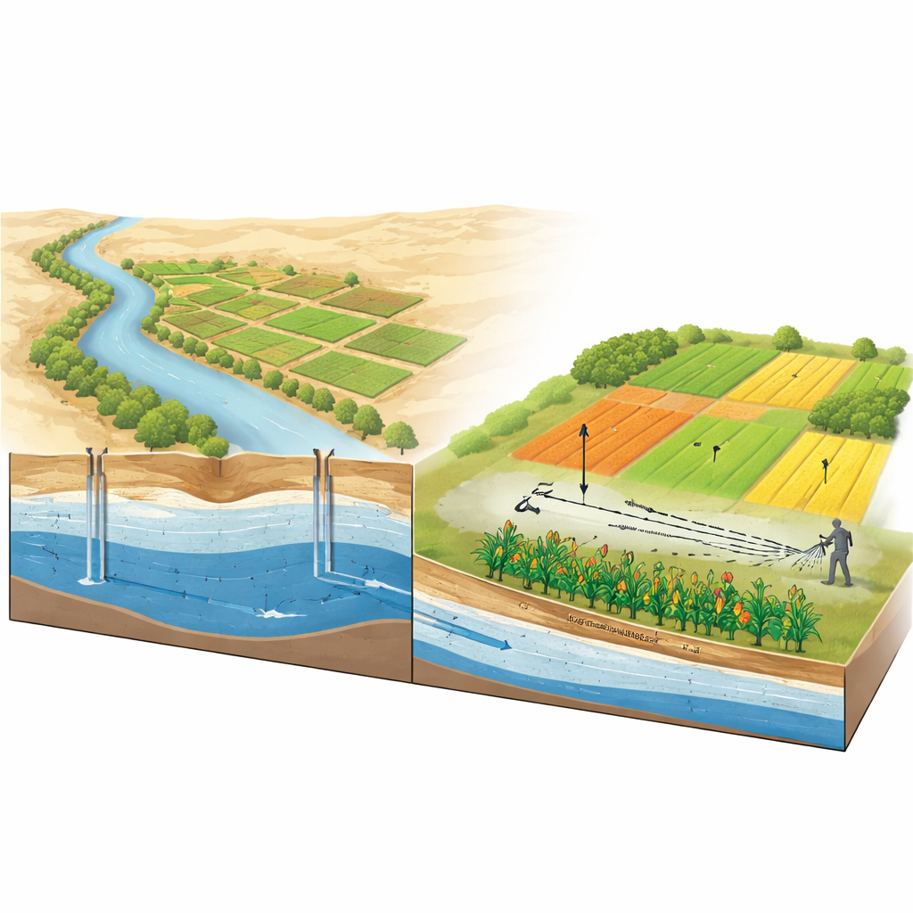
Growing Food in a Dry Land
The western Nile Delta is a flat, sun‑baked landscape where rainfall is scarce and evaporation is intense. Surface water from the Nile cannot easily reach every new field, so farmers turn to two linked underground reservoirs, or aquifers, that store ancient river and desert water. This groundwater is now a backbone of Egypt’s strategy to expand agriculture into the desert and improve food security. But in arid climates, water quality can change quickly as pumping, fertilizers, and natural rock salts all influence what ends up in a farmer’s irrigation canal.
What the Researchers Measured
To understand how suitable this groundwater is for crops, the scientists collected 41 samples from wells spread across more than 7,000 square kilometers. In the laboratory, they measured basic properties such as acidity, dissolved solids, and electrical conductivity, along with major dissolved ingredients like calcium, magnesium, sodium, chloride, sulfate, and bicarbonate. From these, they calculated several widely used indicators that show how irrigation water might affect soil: measures of overall salt content, the dominance of sodium relative to other elements, and how water might alter soil permeability. They then used Geographic Information Systems (GIS) to turn these numbers into detailed maps, revealing how water quality changes from place to place.
Salt, Sodium, and Patchy Risk
The results offer a mixed picture. On the positive side, most wells had pH (acidity), calcium, magnesium, and sulfate levels that fall within international guidelines for irrigation. Many waters would look acceptable if one only checked traditional thresholds. However, two troublemakers stand out: sodium and chloride. In a large portion of the area, sodium levels are high enough to threaten soil structure, particularly in fine‑textured, clay‑rich soils. Chloride, a key component of salinity, is also elevated over most of the region, which can stress sensitive crops and reduce yields. An integrated “Irrigation Water Quality Index” that combines several indicators shows that only a small share of samples face moderate limits, while over one‑third fall into a “high restriction” category and nearly three‑fifths into “severe restriction.” In other words, the water can often be used, but not without constraints. 
How Rocks and Farming Shape the Water
By comparing the chemistry of the groundwater with classic geochemical diagrams, the team found that most of the dissolved material comes from water slowly dissolving the surrounding rocks—carbonates, silicates, and gypsum—as it flows westward away from the Nile. Evaporation and mixing with deeper, more saline water add extra salt in some areas. Statistical analyses showed that just a few factors—overall salinity, sodium, and chloride—explain most of the variation in water quality. Maps of these variables line up with zones where pumping is intense and soils are finer, suggesting that human use and natural geology together are concentrating salts where they can do the most damage to fields.
Guiding Smarter Farming in the New Delta
For a lay reader, the bottom line is that groundwater in Egypt’s New Delta is not a simple, uniform resource. Much of it can support productive farming today, but in many places it is already salty enough that long‑term use, without precautions, will cause soils to become hard, crusted, and less able to absorb water. The authors recommend practical steps: choosing more salt‑tolerant crops in risky zones, blending salty groundwater with fresher sources where possible, improving drainage and soil structure with amendments like gypsum, and continuously monitoring high‑sodium and high‑chloride “hotspots.” By combining on‑the‑ground sampling with modern mapping and index tools, the study provides a roadmap for using desert groundwater carefully—so that the New Delta can feed people now without sacrificing the health of its soils for generations to come.
Citation: Youssef, Y.A., Abuarab, M.E., Mahrous, A. et al. Hydrochemical and GIS-based evaluation of groundwater suitability for irrigation using IWQI in the desert hinterland of western Nile Delta Egypt. Sci Rep 16, 8724 (2026). https://doi.org/10.1038/s41598-026-39089-z
Keywords: groundwater irrigation, salinity and sodicity, Nile Delta agriculture, irrigation water quality index, GIS water mapping