Clear Sky Science · en
Integrated assessment of ecological land capability and land suitability for irrigated agriculture in Alborz Province Iran
Why mapping the right fields matters
Feeding a growing population without exhausting land and water is one of this century’s biggest challenges. In many dry regions, including parts of Iran, farms have expanded into places that are simply not well suited to long-term irrigation. This study focuses on Alborz Province, west of Tehran, and asks a deceptively simple question with global relevance: if we carefully match crops to climate, soil, water and terrain, how much land is truly suitable for irrigated cereal farming—and how does that compare with how much is being used today?
A landscape under pressure
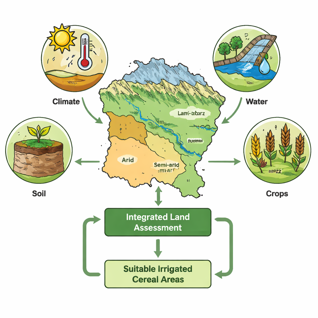
Alborz Province is a compact but varied region stretching from high, cold mountains to warm, dry plains. Most of its land is rangeland, with only a smaller share already used for farming. Like many places, Alborz faces competing demands: cities and industries are growing, water is limited, and farmers are under pressure to produce more food. When fields are pushed into marginal areas or water is over-pumped, the results can include soil erosion, dust storms, loss of vegetation, and falling groundwater—problems that threaten both rural livelihoods and urban food supplies.
Two ways of judging the land
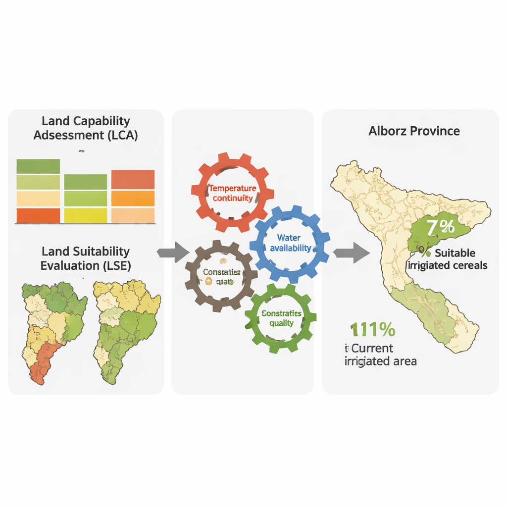
To guide smarter planning, scientists often use two related tools. One, called land capability assessment, looks at the land itself—its climate, slopes, soils, water and natural vegetation—to judge what kinds of uses it can handle in general. The other, land suitability evaluation, asks a more specific question: how good is a given spot for a particular crop, such as wheat or maize, given that crop’s needs? Until now these methods were usually applied separately, which could lead to optimistic maps that ignore either ecological limits or crop requirements. This study set out to weave the two approaches together for four irrigated cereals already grown in Alborz: wheat, barley, maize and sorghum.
Building a more realistic map
The research team gathered detailed spatial data on elevation, slope, soil depth and fertility, drainage, salinity, rangeland and forest cover, protected and cultural sites, flood and erosion risk, water availability and climate. Using geographic information systems, they first updated a national ecological model that identifies where irrigated agriculture is possible at all, while excluding steep slopes, fragile rangelands, important habitats and heritage sites. They then added crop-centered information: how many days each cereal needs to grow, the range of monthly temperatures it can tolerate, and how much irrigation water it requires. Crucially, instead of relying on a single yearly average temperature, they tracked whether suitable temperatures continue for 3–5 months in a row—matching the real growing season.
What the numbers reveal
When all of these layers were combined, the picture that emerged was sobering. Only about 7% of Alborz Province turned out to be genuinely suitable for irrigated production of the four cereals once temperature continuity, water limits, soil quality and ecological constraints were fully considered. Yet more than 11% of the province is currently under irrigated agriculture according to planning documents. In other words, some existing fields are likely operating in places where climate or soils are marginal or where farming competes with conservation needs. The integrated method was more conservative than earlier, simpler models because it better reflected how crops actually experience heat and water over time and because it paid full attention to land that should be off-limits to expansion.
Implications for farmers and planners
To a non-specialist, the takeaway is clear: not every green field is in the right place. By coupling broad ecological limits with the specific needs of each crop, this study offers a more honest map of where irrigated cereal farming can thrive in the long run. For Alborz, and potentially for other provinces and countries, the approach can help redirect future investment toward lands that are both productive and resilient, while steering farming away from areas that would degrade quickly or conflict with vital ecosystems.
A clearer path to sustainable harvests
In plain terms, the article concludes that if we want reliable harvests and healthy landscapes, we must stop treating all arable-looking land as equal. By using season-by-season temperature data, realistic water budgets and strict protection of fragile areas, the authors show that truly suitable land for irrigated cereals in Alborz is smaller than previously assumed. That may sound like bad news, but it is actually a roadmap: with better planning based on this kind of integrated assessment, Iran—and other nations with similar challenges—can design crop patterns that respect nature’s limits while helping secure food supplies for decades to come.
Citation: Baghkhanipour, M., Sayahnia, R., Mobarghaee Dinan, N. et al. Integrated assessment of ecological land capability and land suitability for irrigated agriculture in Alborz Province Iran. Sci Rep 16, 7584 (2026). https://doi.org/10.1038/s41598-026-38871-3
Keywords: irrigated agriculture, land suitability, sustainable land management, cereal crops, spatial planning