Clear Sky Science · en
Multi-scale effects of soil and water conservation on runoff and sediment transport in a Chinese loess plateau basin
Why slowing muddy rivers matters
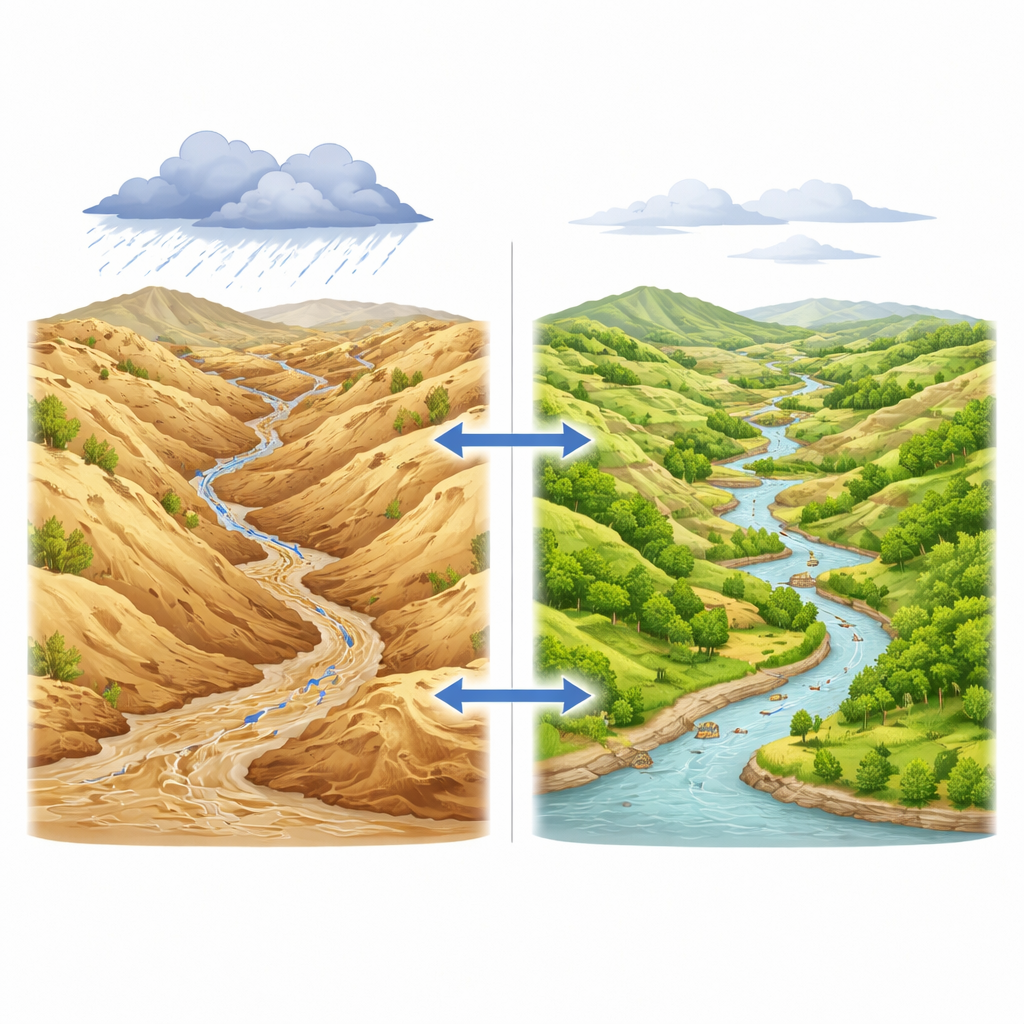
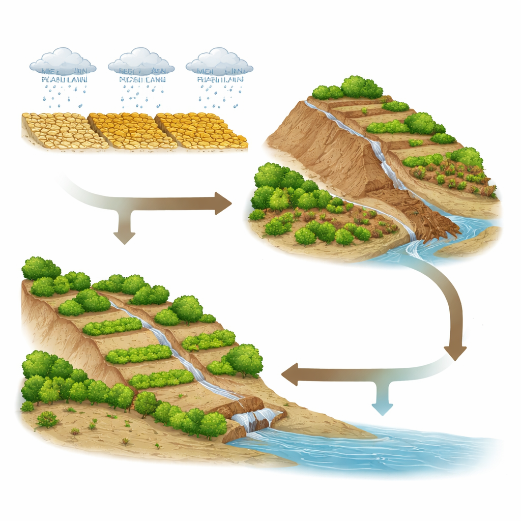
Every year, huge amounts of yellow, muddy water rush down from China’s Loess Plateau into the Yellow River, carrying soil away from farmers’ fields and clogging reservoirs downstream. For decades, China has invested heavily in reshaping hillsides, planting trees, and building small dams to keep that soil in place. This study asks a deceptively simple question with big consequences for water, food, and flood safety: how much difference have these efforts actually made over the last 60 years, and at what point do they start to deliver lasting benefits?
One river basin, sixty years of change
The researchers focused on the Sanchuan River Basin, a hilly, erosion‑prone area in the middle reaches of the Yellow River. Here, summer rainstorms can quickly turn dusty gullies into roaring torrents loaded with sediment. Using daily records of rainfall, river flow, and sediment from 1960 to 2019, the team compared present‑day conditions with the 1960s, when very few conservation measures were in place. Over the decades, the landscape has been transformed with terraces cut into slopes, expanded forests and grasslands, and hundreds of small check dams in channels. The data show a clear story: while heavy rain events still occur, river flows and especially sediment loads during the rainy season have dropped sharply, and the once‑frequent extreme sediment events have virtually disappeared.
Reading patterns with smart algorithms
To move beyond simple before‑and‑after comparisons, the authors turned to a machine‑learning method called a random forest to tease out what controls day‑to‑day changes in runoff and sediment. They fed the model not only current rainfall, but also rainfall from the previous one to three days, plus information about the time of year and long‑term trends. An interpretability tool known as SHAP then allowed them to see which factors the model relied on most. A key insight emerged: rainfall from the preceding day had a stronger influence on both river flow and sediment than the rain that fell on the same day. In plain terms, whether the ground is already wet matters more than the latest cloudburst, especially for how much soil gets carried away.
Different stories for water and soil
When the team looked at patterns over months and decades, they found that conservation measures helped water and soil in different ways. Runoff reduction was strongest in the main rainy months of May through September, and peaked in July at about half the baseline flow. Over the long term, runoff reduction grew steadily from the 1960s to the 2000s, then declined in the 2010s, possibly because the easiest gains from new terraces and forests had already been made or because other land‑use changes offset some benefits. Sediment reduction, by contrast, was impressively stable: across all months of the year, sediment loads were cut by more than 84 percent, and by the 2010s the average reduction reached about 97 percent. This suggests that conservation structures and vegetation are particularly effective at locking soil in place, even when their influence on total water flow begins to level off.
Finding tipping points in restoration
Beyond average trends, managers want to know how much land must be treated before big improvements show up at the basin outlet. By smoothing the long‑term records and fitting curves to runoff and sediment changes, the researchers identified two threshold periods. Around 2001–2003, when terrace area had expanded to roughly five times ten thousand hectares and forest cover had also grown substantially, runoff began to decline much more sharply. For sediment, the turning point came later, around 2013–2015, when forest and grassland areas reached their highest levels. Statistical change‑point tests, independent of the curve‑fitting, pointed to similar years, strengthening confidence that these were real shifts rather than random wiggles in the data.
What this means for future river management
For non‑specialists, the takeaway is straightforward: reshaping and revegetating the Loess Plateau has dramatically reduced the amount of soil washing into the Yellow River, and it has done so in a durable way. Water flows have also been reduced, especially during the flood season, though there are signs that gains in runoff control may plateau without smarter maintenance and planning. The study shows that the land’s recent wetness and the long‑built stock of terraces, forests, grasses, and dams together determine how a storm plays out—from raindrops on hillsides to mud or clear water in the river. By pinpointing when and at what scale conservation measures start to pay off, this work offers practical targets for other erosion‑prone regions that hope to tame muddy rivers while safeguarding water supplies.
Citation: Ding, X., Yu, Y., Feng, X. et al. Multi-scale effects of soil and water conservation on runoff and sediment transport in a Chinese loess plateau basin. Sci Rep 16, 10206 (2026). https://doi.org/10.1038/s41598-026-38546-z
Keywords: soil erosion, loess plateau, watershed restoration, runoff and sediment, soil and water conservation