Clear Sky Science · en
Enhancing the classification of spectrally similar land use/land cover classes using transfer learning in arid regions
Why this matters for our changing landscapes
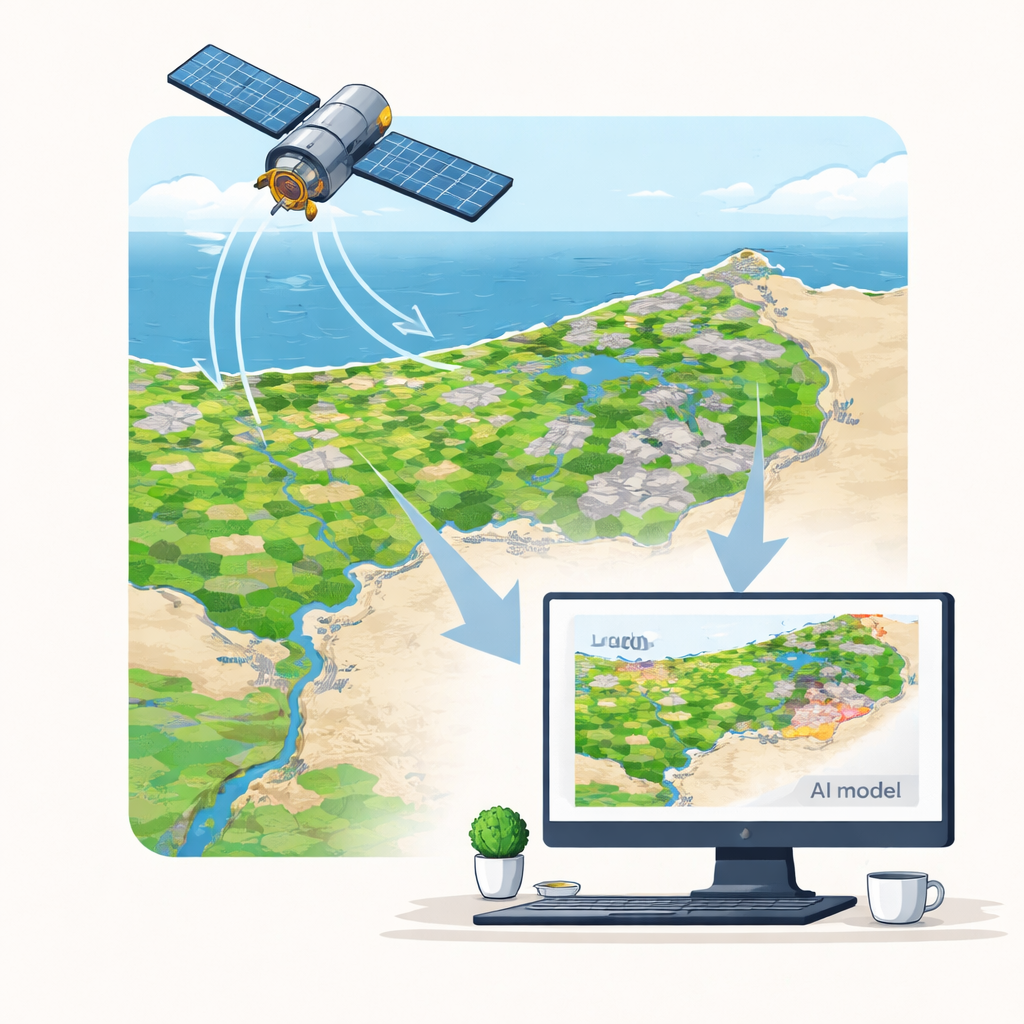
From expanding cities to shrinking fields, the way we use land is shifting rapidly, especially in dry regions. Governments and planners rely on satellite images to monitor these changes, but in deserts and semi-deserts, cities and bare soil can look surprisingly alike from space. This study shows how advanced artificial intelligence, specifically a technique called transfer learning, can sharpen our view of where people live and build in Egypt’s Nile Delta—information that underpins food security, environmental protection, and safer urban growth.
The challenge of telling city from desert
Land use describes how people use the land—such as farms, towns, or industrial zones—while land cover describes what physically lies on the ground, like crops, water, or bare soil. Around the world, these patterns are shifting because of population pressure, economic growth, and human-driven environmental change. In fertile but fragile areas such as Egypt’s Nile Delta, urban sprawl is eating into farmland. To manage this, we need accurate maps made from satellite images. Yet in arid and semi-arid landscapes, both concrete and dry bare soil reflect light in similar ways, making it very hard for traditional computer methods to tell them apart.
From classic mapping to deep learning
Conventional mapping tools, such as the long-used Maximum Likelihood classifier, mainly compare the brightness of pixels in different colors (or bands) of satellite images. These tools work reasonably well where green vegetation or water stand out clearly, but they struggle when two land types share nearly the same “spectral signature”—as happens with built-up areas and bare ground in dry regions. Earlier advances added machine learning and special indices to make better use of satellite data, but even these approaches often mislabel cities as barren land, or vice versa, when the terrain is flat, dry, and sparsely vegetated.
Teaching an AI to learn from one region and adapt to another
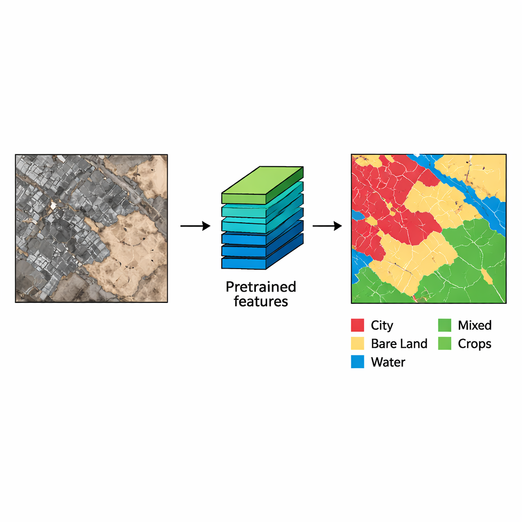
The authors tackled this problem in the Nile Delta, focusing on the complex northern coastal strip where farms, towns, wetlands, water bodies, and bare land are tightly interwoven. They used freely available medium-resolution images (30-meter pixels) from the Landsat 8 satellite, processed through Google Earth Engine. Because the land classes in this area are unbalanced—there are far more pixels of some types than others—they first built a more even “pretraining” dataset from another part of the delta. Four modern image-segmentation models (Resnet50-Unet, Resnet50-FPN, Resnet50-PSPNet, and Unet++) were first trained on this balanced set to learn general patterns of fields, water, cities, and bare land. The same models were then fine-tuned on the imbalanced northern data, an approach known as transfer learning.
Sharper maps with smarter models
The team evaluated each model using measures that look at how well predicted land types match expert-checked reference maps, paying special attention to the balance between missed areas and false alarms. All deep learning models clearly outperformed the traditional Maximum Likelihood method. The best overall performer was the Resnet50-FPN model, which achieved a high F1-score (0.877) and Intersection over Union (0.792), indicating strong agreement with the reference maps. Its strength lies in using a “pyramid” design that examines the scene at multiple scales, allowing it to pick out both broad patterns and fine details while preserving the shapes of objects. Despite the added sophistication, the AI models produced results in fractions of a second per image patch, far faster than the hours required by the conventional method.
What this means for people and the planet
For non-specialists, the message is straightforward: smarter AI can turn freely available satellite images into much more reliable maps of where cities are growing and farmland is retreating, even in harsh, dusty landscapes where the ground looks deceptively similar from space. By showing that transfer learning and multi-scale deep networks like Resnet50-FPN can reliably separate built-up areas from bare soil in the Nile Delta, this work points the way to better monitoring of urban sprawl, more informed land-use planning, and improved protection of vital agricultural land in arid regions worldwide.
Citation: Farag, N.H., Abdelhafiz, D., Abdrabo, M.A. et al. Enhancing the classification of spectrally similar land use/land cover classes using transfer learning in arid regions. Sci Rep 16, 7729 (2026). https://doi.org/10.1038/s41598-026-38540-5
Keywords: land use and land cover, remote sensing, deep learning, Nile Delta, urban expansion