Clear Sky Science · en
Response of erosive rainfall thresholds on Loess slopes to land cover and rainfall intensity
Why heavy rain on dusty hills matters
Across northern China’s Loess Plateau, steep yellow hills made of fine, powdery soil feed the Yellow River with enormous amounts of sediment. When storms hit these bare or thinly vegetated slopes, the soil can be stripped away in hours, damaging farms, clogging reservoirs, and degrading ecosystems. But not every shower is dangerous. This study asks a practical question with wide relevance for land managers and policy makers: exactly how intense does rainfall have to be, under different types of ground cover, before it starts to cause serious erosion on loess hillsides?
Tracking storms on fragile yellow hills
To answer this, researchers turned to a rare resource: decades of detailed observations from runoff plots on the Loess Plateau, at three representative sites called Suide, Xifeng, and Tianshui. Each site includes many small experimental hillslopes planted with forest, grassland, or crops, or left as abandoned land with natural regrowth. For hundreds of natural rainstorms, technicians had measured both rainfall and the muddy runoff leaving each plot. Using a refined regression method, the team treated runoff as the “response” and rainfall as the “trigger,” calculating, for each land cover and slope type, the smallest amount of rain needed to start moving soil in earnest—the erosive rainfall threshold.
How vegetation and soil change the danger point
Across all three regions and land covers, one pattern stood out: as vegetation became denser and more complex, the rainfall needed to initiate erosion increased. Forest plots generally required more rain to erode than grassland, and grassland more than farmland. Trees intercept raindrops, their roots help bind the soil, and leaf litter cushions the impact of intense storms, all of which delay the onset of runoff and soil loss. The study also compared the same land covers in different places. Moving from the coarser, sandier soils of Suide toward the finer, more clay-rich soils of Xifeng and Tianshui, thresholds tended to drop for forest, grassland, and abandoned land. Finer loess can seal and crust more quickly under pounding rain, so runoff begins sooner even if the soil can hold more water overall. 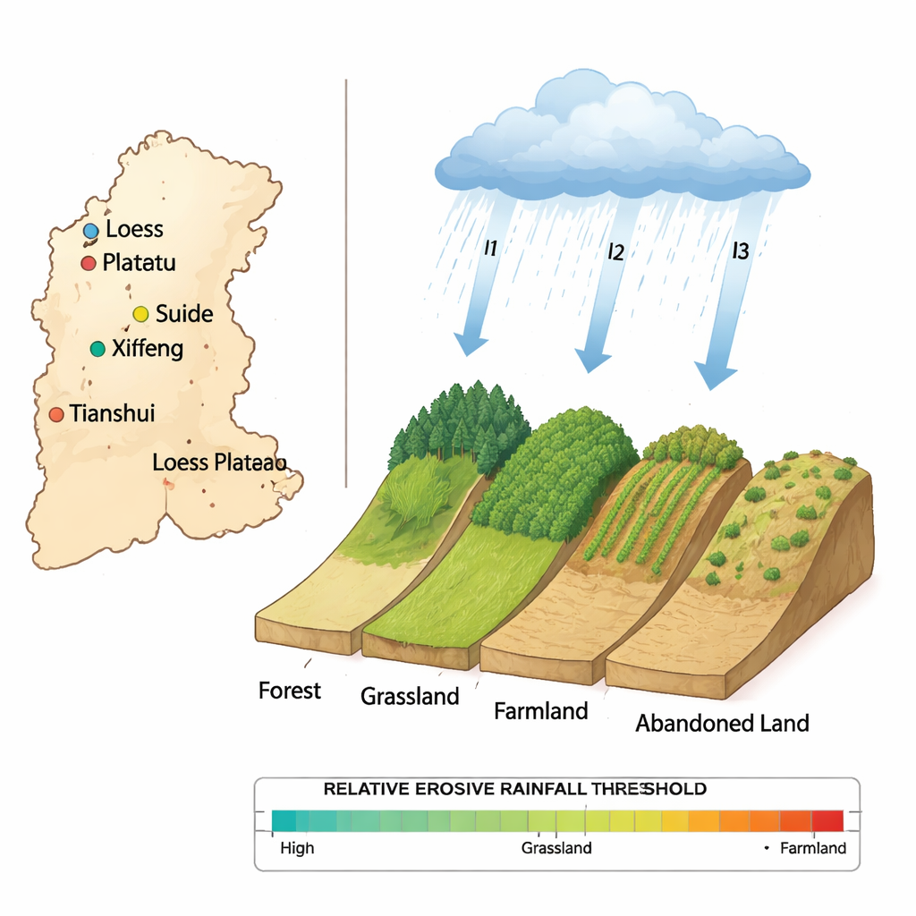
Storm intensity: not just how much, but how hard and fast
The most striking result is that erosive rainfall thresholds do not stay fixed; they shrink rapidly as storms become more intense. When rainfall arrives in short, heavy bursts, raindrops smash the loose loess particles, clog pores at the surface, and form a thin crust. Water then can’t soak in, so it runs off quickly down the slope, carrying sediment with it. Mathematically, the team found an exponential relationship: as average storm intensity increased, the threshold rainfall depth needed to start erosion fell along a smooth curve for each land-cover type. For example, on Suide slopes, a gentle storm might need several centimeters of rain to cause trouble, whereas a very intense downpour could trigger erosion with only a fraction of that total. This means a region’s “danger point” for erosion depends strongly on the nature of its storms, not just their total rainfall.
Local landscapes, different tipping points
The study also compared how these relationships play out in different parts of the plateau. In Suide, at low intensities, forest had the highest thresholds, while farmland had the lowest; abandoned land and grassland fell in between. As intensity rose, all thresholds came down, but not at the same speed, reshaping the ranking. In Xifeng, with finer soils and slightly different land use, the order at low intensities was different again, and the curves flattened more slowly as intensity increased. These regional contrasts underscore that soil texture, slope, vegetation, and storm patterns interact in complex but predictable ways. Simple one-size-fits-all rules for erosive rainfall—such as “any event over 10 millimeters”—can therefore mislead when applied across diverse landscapes. 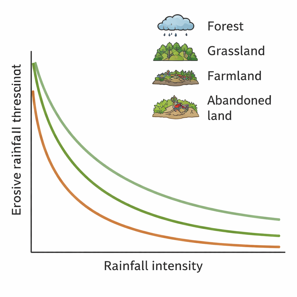
What this means for protecting soil
For non-specialists, the key takeaway is that there is a moving “tipping point” where rain stops soaking in and starts tearing soil away, and that tipping point depends on both how the land is covered and how violently the rain falls. The authors provide easy-to-use mathematical curves that link local storm intensity to the expected erosion threshold for forests, grasslands, croplands, and abandoned land on loess slopes. These curves can help improve widely used erosion prediction tools, guide where to prioritize tree planting or grass restoration, and refine early-warning systems for erosion and muddy floods. In a changing climate, with more frequent intense storms, understanding and raising these thresholds—especially by restoring vegetation—is crucial for keeping the Loess Plateau’s fragile soils, and similar dryland regions worldwide, from literally washing away.
Citation: He, Z., Yuan, G., Liu, Z. et al. Response of erosive rainfall thresholds on Loess slopes to land cover and rainfall intensity. Sci Rep 16, 6963 (2026). https://doi.org/10.1038/s41598-026-38479-7
Keywords: soil erosion, Loess Plateau, rainfall intensity, land cover, runoff