Clear Sky Science · en
An integrated approach to unravel the deep-shallow aquifer connectivity in the Eastern Sahara
Hidden Water Beneath the Desert
In one of the driest places on Earth, southern Egypt’s deserts may be sitting above a vast, slowly rising reserve of ancient groundwater. This study explores how deep, long‑stored water buried kilometers below the Eastern Sahara can naturally leak upward into shallower layers that farmers already tap, potentially offering a lifeline for Egypt’s expanding desert agriculture—if it is understood and managed wisely.
Why Deep Groundwater Matters
Egypt’s growing population is pushing farms and towns outward from the Nile Valley into surrounding desert. Most of these new projects rely on shallow wells, because they are cheaper and easier to drill. Yet beneath the sands lies the Nubian Aquifer System, one of the largest fossil groundwater bodies in the world, holding water that infiltrated during wetter climates tens of thousands to more than a million years ago. Whether this deep aquifer can safely support modern development depends on how strongly it is connected to the shallower aquifers that supply most wells today.
Following the Cracks in the Earth
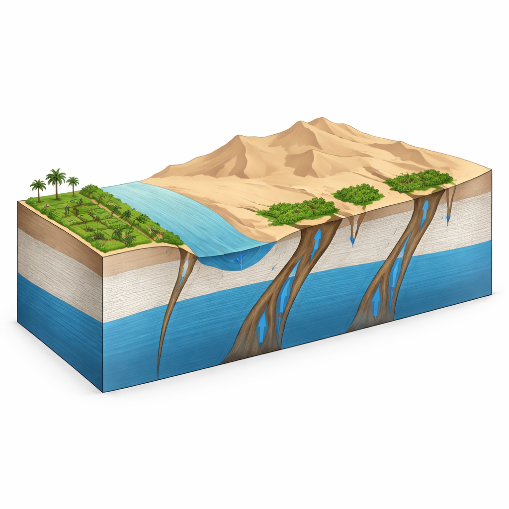
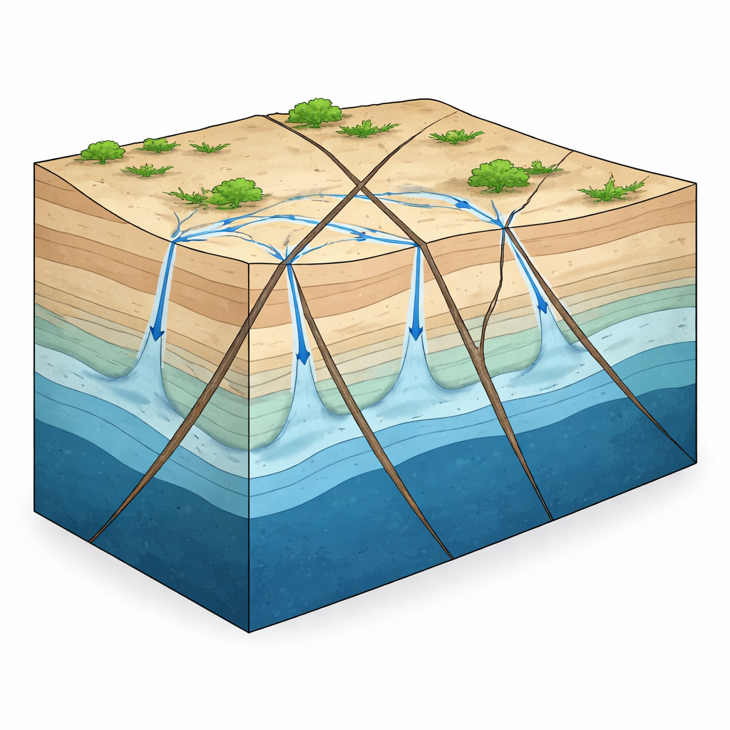
The researchers combined satellite images, topographic data, and sensitive measurements of Earth’s magnetic field to map both surface fractures and deep faults in the crust across an area of more than 100,000 square kilometers. They constructed dozens of underground cross‑sections using data from deep boreholes to estimate how far down the solid basement rocks lie. In the south, this basement sits only a few hundred meters below the surface, while in the north it can be more than four kilometers deep. The team found that in southern and central parts of the study area, major fault systems with several intersecting directions cut through the entire rock pile from basement to surface, creating potential pathways for water to move vertically.
Tracing Ancient Water with Isotopes
To see whether deep water is actually traveling upward along these faults, the scientists analyzed the chemical “fingerprints” of 35 groundwater samples and compared them with many previously published measurements. They focused on stable forms of oxygen and hydrogen that differ between old, cool‑climate water from the Nubian aquifer and modern Nile water that has undergone strong evaporation in today’s heat. By treating these signatures as mixing between two end‑members—ancient Nubian water and Nile water—they calculated how much of each sample came from depth. In some shallow wells and springs on the western side of the Nile, the contribution from the deep aquifer reached as high as 98 percent, even where wells were only tens of meters deep and a few kilometers from the river.
Where the Upwelling Happens
The pattern of this “deep flavor” in shallow groundwater closely matched the mapped fault networks. South of about 26°30′N, where the sedimentary cover is relatively thin and faults trending northwest, east‑northeast, and northeast intersect, many wells and springs showed strong input from the Nubian aquifer. Natural artesian springs with no need for pumping provide visible evidence of pressurized water rising along these structures. In contrast, farther north near Assiut, where the sedimentary rocks are much thicker and certain tight, less permeable layers dominate, even relatively deep wells showed little sign of Nubian water; there, the shallow aquifers are mainly recharged sideways from the Nile and irrigation canals.
What This Means for Future Desert Farms
Taken together, the structural maps and isotopic measurements support a conceptual picture in which faults act as vertical “pipes” that allow pressurized water from the Nubian aquifer to leak upward into carbonate and Quaternary aquifers in southern Egypt. This process appears strongest where intersecting fault systems and thin overlying sediments coincide, potentially providing a renewable‑like feed of deep water to areas targeted for new agricultural projects, such as the limestone plateau west of the Nile. However, because this deep water accumulated over very long timescales, the authors stress that it should be used carefully and in coordination with Nile water, modern irrigation techniques, and crop choices. Understanding where and how this hidden upwelling occurs can help Egypt and other arid regions design groundwater development plans that tap ancient reserves without exhausting them.
Citation: Ibrahim, I.A., Abotalib, A.Z., Mohamed, H.S. et al. An integrated approach to unravel the deep-shallow aquifer connectivity in the Eastern Sahara. Sci Rep 16, 7952 (2026). https://doi.org/10.1038/s41598-026-38324-x
Keywords: groundwater, Sahara aquifers, fault-controlled flow, Egypt desert agriculture, stable isotopes