Clear Sky Science · en
Intensification and spatial shifts of heatwave hotspot across India under climate and ENSO influences with health risk assessment
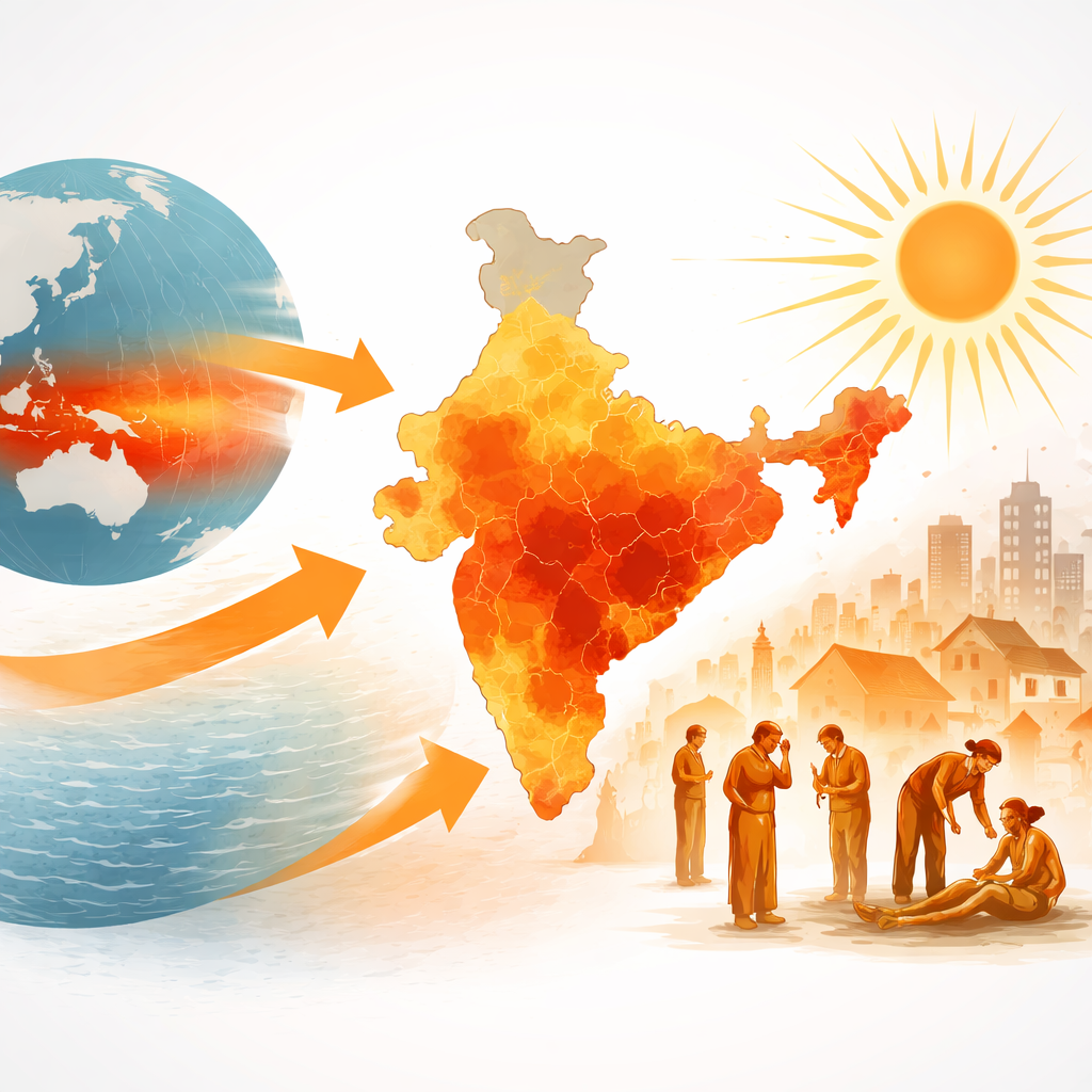
Why growing heat matters for everyday life
Across India, summers are not just becoming uncomfortable—they are turning dangerous. This study looks at how heatwaves have strengthened and spread across the country over the last forty years, how a distant Pacific Ocean pattern called El Niño helps to crank up the heat, and which communities face the greatest health risks. By combining weather records, satellite maps and population data, the authors show that large parts of India are entering a new era of extreme heat where simple daily activities—working outdoors, traveling, or even staying at home without cooling—can threaten health and livelihoods.
How India’s summers are changing
The researchers examined daily daytime highs for April and May from 1981 to 2020 using a detailed global weather reanalysis. Over these four decades, India’s average summer maximum temperature rose by about 1 °C, with a steady climb of roughly a quarter of a degree per decade. The hottest years have clustered in the last twenty years. Heatwaves—defined here as stretches of at least three days when temperatures exceed a local threshold—have become more frequent, longer, and hotter. Between 1981–2000 and 2001–2020, the number of heatwave days increased by roughly one and a half times, their typical duration grew, and peak temperatures during these events jumped by up to threefold in intensity measured relative to the past. What were once rare, short-lived spikes in heat are increasingly prolonged and widespread.
Where the worst heat now strikes
Heat is not rising evenly. Earlier in the record, the main hotspots were in northwest and central India, the Gangetic plains, and coastal Andhra Pradesh, which saw several heatwave days each year. In the most recent decade, severely hot conditions have spread diagonally from the deserts of the northwest through central India into the southern peninsula, with many places now enduring 8–10 heatwave days per year and single events that can last more than a week. Temperatures above 47–50 °C have become more common in the northwestern and central regions, while much of the country regularly hits 44–50 °C during the peak pre-monsoon months. Mountain areas like Jammu and Kashmir are also warming quickly, threatening fragile ecosystems even if human heat stress there is currently lower.
How a distant ocean pattern turns up the heat
To understand the role of natural climate swings, the study looked at the El Niño–Southern Oscillation (ENSO), tracked by sea-surface temperatures in the central Pacific. During El Niño years, warm waters in the Pacific alter atmospheric circulation and can raise temperatures over faraway regions, including India. The authors compared Indian heat during El Niño, La Niña, and neutral years for two periods: 1981–2000 and 2001–2020. They found that during El Niño, the most common summer temperature over India shifted upward by about 1.5 °C in the later period, with the whole distribution skewed toward more extreme heat. On average, April–May maximum temperatures in El Niño years warmed by just over 1 °C between the two periods—more than during neutral years and far more than during La Niña. This means El Niño now adds an extra layer of heat on top of long-term warming, especially boosting the number and intensity of heatwave days in peninsular, eastern, and western-central India.
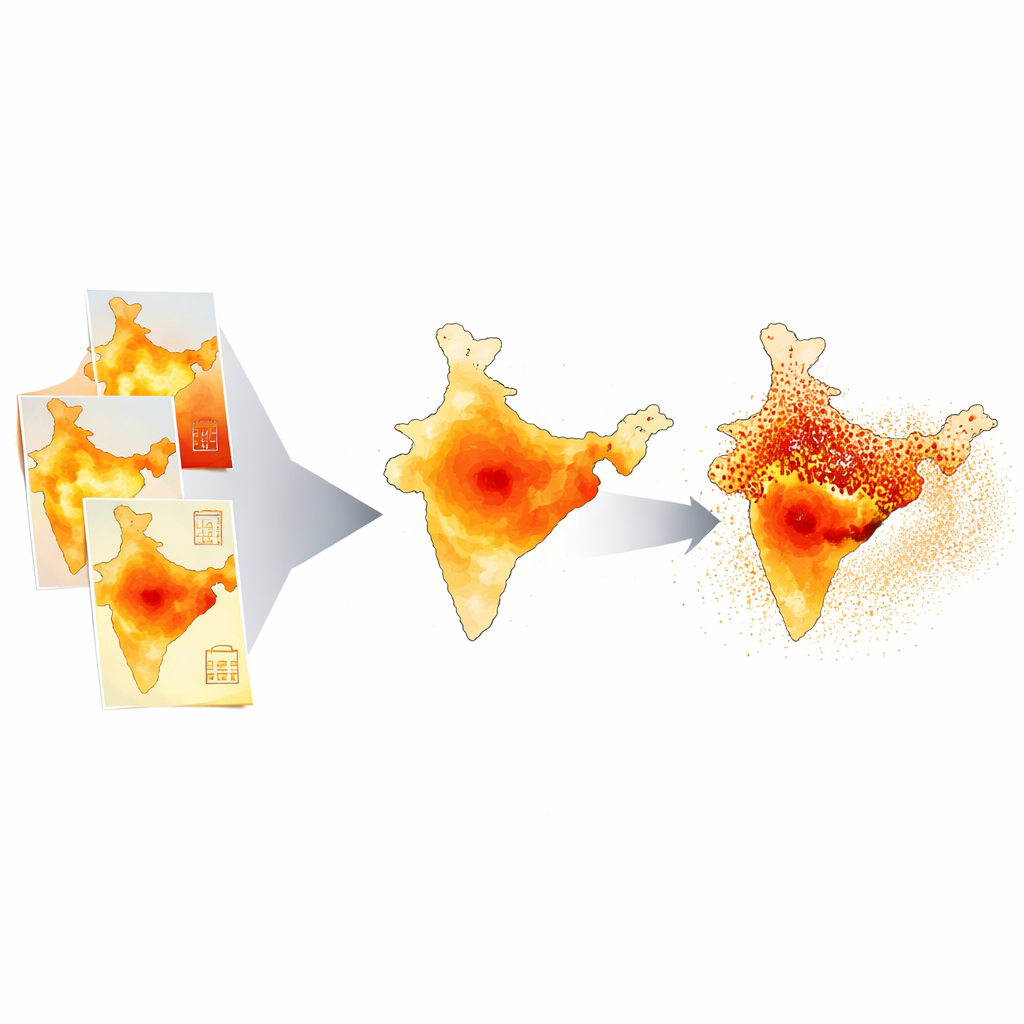
Finding and mapping the true danger zones
Because simple temperature averages do not fully capture risk, the team built a Heatwave Hotspot Index that blends five factors: how often heatwaves occur, how long they last, how intense they are, how much temperatures depart from normal, and how many days exceed 40 °C. They used a common mapping technique to weight and combine these ingredients into a five-level scale, from low to very high. Satellite data on land surface temperature and vegetation confirmed that higher index scores align with hotter, barer landscapes. Between 1981–2000 and 2001–2020, the total area in India classified as a hotspot grew by about 50 percent, expanding from the Gangetic plains and parts of central India into much of western, central, eastern, and peninsular India.
Who is most at risk from the rising heat
To translate these patterns into health risk, the authors adopted an approach used by the Intergovernmental Panel on Climate Change, which views risk as a combination of hazard (the physical heat), exposure (how many people are in harm’s way), and vulnerability (how sensitive and how well protected those people are). They overlaid the heatwave hotspot index with fine-scale maps of population, age structure, outdoor workers, medical facilities, green cover, water bodies and literacy. The results show that the greatest health risks now lie in the central plains, the southeastern coast, parts of western India, Gangetic West Bengal, and stretches of the central Indo-Gangetic Plain. These areas combine intense heat, dense populations, many elderly people, young children and outdoor laborers, and limited capacity to cope. By contrast, some districts in Rajasthan, Gujarat and parts of Madhya Pradesh and Jharkhand experience severe heat but somewhat lower risk, thanks to better green cover or healthcare access.
What this means for people and policy
The study paints a clear picture: India’s heatwaves are becoming hotter, longer and more widespread, and natural climate swings such as El Niño are now amplifying a background of human-driven warming. As a result, millions more people live in areas where hot-season conditions can threaten health, strain hospitals, disrupt work and agriculture, and push power and water systems to their limits. By pinpointing where heat hazards and human vulnerability overlap, the new hotspot and health-risk maps offer a guide for action—helping planners focus on local heat action plans, cooling centers, tree planting and water management, and better medical preparedness in the districts that need them most.
Citation: Banerjee, S., Padmakumari, B. & Ramana, M.V. Intensification and spatial shifts of heatwave hotspot across India under climate and ENSO influences with health risk assessment. Sci Rep 16, 8437 (2026). https://doi.org/10.1038/s41598-026-38289-x
Keywords: India heatwaves, climate change, El Niño ENSO, heat health risk, heatwave hotspots