Clear Sky Science · en
Spatiotemporal-decoupled interactive learning for traffic flow prediction
Why Smarter Traffic Forecasts Matter
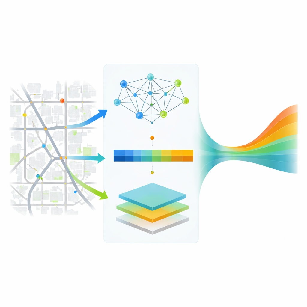
Every commute is shaped by countless, constantly changing decisions: when lights switch, how drivers choose routes, and where jams suddenly form. Behind the scenes, cities increasingly rely on computer models that forecast traffic a few minutes to an hour ahead to tune signals, manage incidents, and guide navigation apps. This paper introduces a new way to make those short-term forecasts more accurate and reliable, especially in complex urban networks where traffic patterns differ from one neighborhood to another and change over days, weeks, and seasons.
Traffic Patterns Are Not One-Size-Fits-All
Urban traffic is both a story of place and a story of time. A quiet suburban street and a busy downtown artery behave very differently, and rush-hour waves roll through a city on daily and weekly cycles. Traditional forecasting tools often smooth over these differences or assume that relationships between roads stay fixed. In reality, far-apart road segments can suddenly move in lockstep when a sporting event ends, while a sensor’s current reading may depend more on conditions an hour ago than on the last five minutes. The authors argue that capturing this rich mix of local quirks, long-distance links, and multi-day rhythms is essential for trustworthy predictions—and that existing models, even many deep-learning systems, still fall short.
Separating Space and Time to See More Clearly
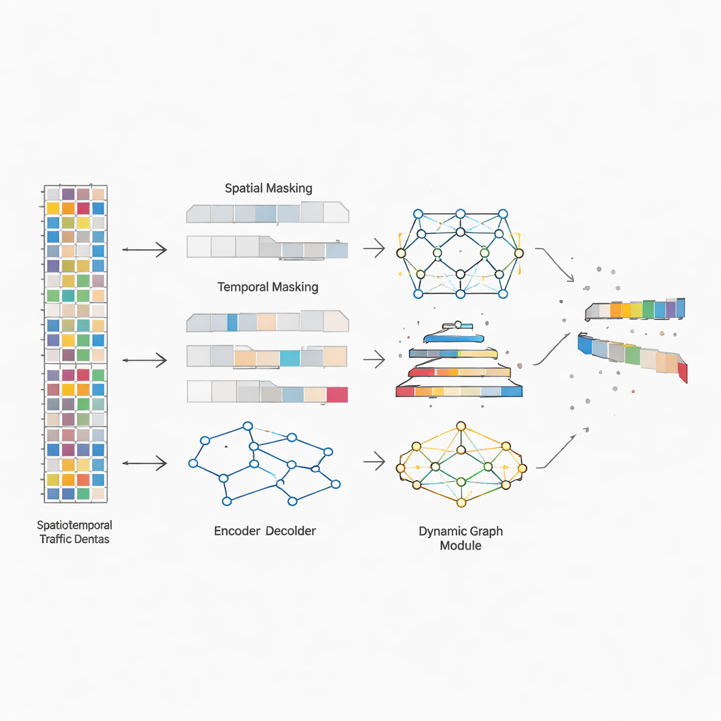
To tackle this, the researchers design a framework they call Spatiotemporal-Decoupled Interactive Learning, or STDIL. The central idea is to first pull apart the “where” and “when” aspects of traffic data so each can be studied in depth, then knit them back together. They feed long histories of sensor readings—spanning from one to seven days—into a pair of reconstruction tasks. One deliberately hides whole road segments in the data and forces the model to guess their missing histories from other roads. The other hides chunks of time and asks the model to fill the gaps using surrounding moments. By practicing these two games of hide-and-seek, the system learns richer signatures of how different locations behave and how traffic evolves across minutes, hours, and days.
Letting the Road Network Rewire Itself
Beyond understanding space and time separately, STDIL learns how roads influence one another in a flexible, data-driven way. Instead of fixing the road network as a static map of who is connected to whom, the model continuously adjusts its internal “graph” of relationships as new data arrive. It starts from the physical layout of the highways, then adds learned links that may connect distant sensors that frequently rise and fall together. Special graph-processing layers propagate information along these evolving connections, capturing both neighborhood effects—like queues spilling back through a corridor—and wide-area influences, such as citywide slowdowns triggered by a storm. This interactive learning structure is arranged in a tree-like fashion so that short-term ripples and long-range trends reinforce each other rather than compete.
Training on Real Highways and Testing the Payoff
The authors put STDIL to the test on four large freeway datasets from California’s Performance Measurement System, which continuously records traffic conditions across hundreds of sensors. They compare their method with a broad spectrum of baselines, from classic statistical tools to modern neural networks that already use graphs and attention mechanisms. Across all datasets and all forecasting horizons up to one hour ahead, STDIL delivers lower errors than competing methods. Notably, its accuracy degrades much more gently as the prediction window lengthens, suggesting that its design really does help it hold onto useful long-range information. Additional experiments show that removing any of its key ingredients—spatial masking, temporal masking, or dynamic graph interaction—makes performance worse, confirming that each piece contributes to the overall gains.
What This Means for Everyday Travel
In practical terms, STDIL shows that traffic forecasts improve when models are allowed to treat each road segment and each timescale on its own terms, and when the web of interactions between roads can adapt as conditions change. For travelers, that could translate into routing suggestions that better anticipate sudden slowdowns and recoveries, rather than merely extrapolating from the last few minutes. For city agencies, more robust forecasts mean signal plans and control strategies that hold up under unusual events, not just typical weekdays. While the authors focus on freeway data, the same ideas could extend to city streets and to other systems where space, time, and interaction all matter—from public transit to energy grids—offering a path toward smarter, more responsive urban infrastructure.
Citation: Chen, L., Wu, Q. Spatiotemporal-decoupled interactive learning for traffic flow prediction. Sci Rep 16, 9050 (2026). https://doi.org/10.1038/s41598-026-38244-w
Keywords: traffic forecasting, graph neural networks, urban mobility, time series prediction, intelligent transportation systems