Clear Sky Science · en
Groundwater quality assessment for agricultural utilizing indexical and machine learning techniques in Ouled Djellal Aquifer, Southern Algeria
Why Water Beneath the Desert Matters
In the pre-Saharan town of Ouled Djellal in southern Algeria, hidden groundwater keeps farms, families, and date palm groves alive. As droughts worsen and wells run low, people increasingly depend on this unseen resource. But if the water becomes too salty or chemically unbalanced, soils can be damaged and crops may fail. This study asks a simple but urgent question: Is the groundwater here still good enough to grow food—and how can we predict its future quality more smartly?
A Desert Town’s Lifeline Underground
Ouled Djellal sits in a hot, dry belt where rain is scarce and rivers are mostly dry channels. Farmers draw water from a shallow aquifer made of sands, gravels, and clays beneath the main wadi, or seasonal river. This aquifer, though not very deep or productive, is the primary source of water for both households and agriculture, especially date palms. Because natural refilling by rain is limited and withdrawals for irrigation are heavy, even small changes in water quality or level can have outsized effects on local livelihoods.
When Natural Salts and Human Activity Mix
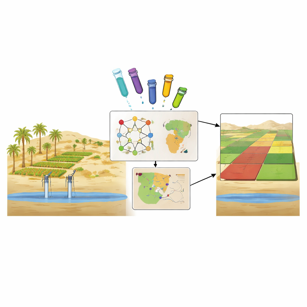
The researchers collected 23 groundwater samples from wells across the region and measured common dissolved ingredients such as calcium, magnesium, sodium, chloride, sulfate, and nitrate, along with salinity and hardness. They combined classic chemical diagrams with modern statistical tools to decode how the water acquired its character. The picture that emerged is of groundwater strongly shaped by the desert climate: intense evaporation concentrates salts, and the surrounding rocks and soils—rich in evaporite minerals like gypsum and halite—contribute large amounts of calcium, magnesium, and chloride. At the same time, fertilizers and wastewater add nitrates, revealing a human fingerprint on the water chemistry.
What the Water Means for Farmers’ Fields
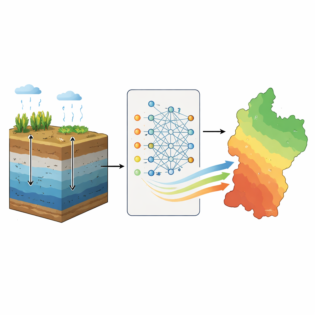
To translate complex measurements into something farmers and planners can use, the team calculated several irrigation water quality indices. These indices capture both how salty the water is and how much sodium it contains relative to beneficial calcium and magnesium. High salt levels can make it harder for plants to absorb water, while too much sodium can cause soils to crust and lose permeability. Maps produced with geographic information systems show that much of the Ouled Djellal aquifer falls into the “moderate to poor” range for irrigation, with particularly risky pockets in the northern and central areas. In these zones, electrical conductivity and dissolved solids far exceed recommended levels for agriculture, pointing to a serious threat of soil salinization and long-term yield loss if water is used without careful management.
Teaching Computers to Read the Water
Beyond simply describing current conditions, the study set out to predict groundwater quality using machine learning—computer models that learn patterns from data. The scientists fed 12 measured water properties into three types of models: simple linear equations, a support vector machine, and an artificial neural network. They trained these models on part of the dataset and tested them on the rest. The neural network stood out, capturing subtle, non-linear relationships between ions and salinity. It reproduced the main irrigation index with very high accuracy, outperforming the other methods. The team then combined these model predictions with an advanced mapping approach that better handles uncertainty, producing detailed, smoothly varying maps of where water is safer—or riskier—for crops.
A Clear Warning and a Practical Roadmap
For a lay reader, the study’s message is twofold. First, the groundwater that sustains Ouled Djellal’s agriculture is already heavily mineralized: more than 60% of sampled wells supply water that is only of restricted suitability for irrigation, mainly because of high salinity and sodium. Without changes in how water and soils are managed, farmers risk slowly poisoning their own fields. Second, the work shows that combining field sampling, statistical analysis, and modern machine learning can turn scattered measurements into clear, actionable maps. These tools can help local authorities decide where to plant salt-tolerant crops, where to limit pumping, and where to monitor more closely—offering a science-based roadmap to safeguard a fragile water lifeline in an increasingly dry world.
Citation: Athamena, A., Gaagai, A., Aouissi, H.A. et al. Groundwater quality assessment for agricultural utilizing indexical and machine learning techniques in Ouled Djellal Aquifer, Southern Algeria. Sci Rep 16, 8185 (2026). https://doi.org/10.1038/s41598-026-38208-0
Keywords: groundwater quality, irrigation salinity, arid agriculture, machine learning, Algeria aquifer