Clear Sky Science · en
Predictive hybrid scan-to-BIM method improves heritage building documentation completeness and accuracy
Why measuring old buildings is harder than it looks
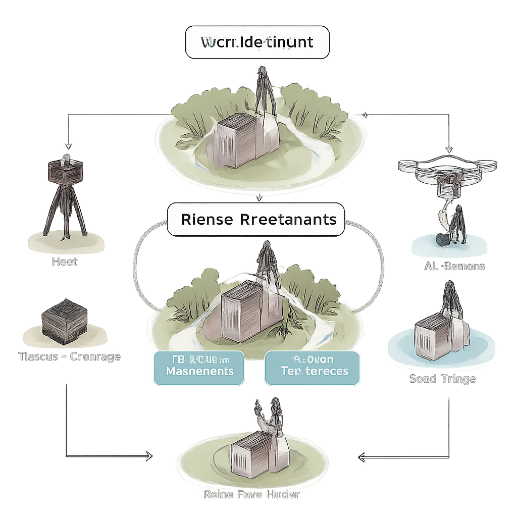
Historic buildings may look solid and unchanging, but understanding how to care for them today depends on highly detailed digital replicas. These 3D models guide repairs, monitor damage, and help plan future uses. Yet in the real world, cramped alleyways, tall towers, and overgrown trees can leave big blind spots in our measurements, threatening the reliability of these digital twins. This study shows how combining ground-based lasers, ordinary cameras, and drone photography—guided by a simple predictive check—can capture almost an entire church in precise 3D, even under tight site constraints.
The challenge of seeing every corner
Conservation teams increasingly rely on Historic Building Information Models (HBIM), which are richly detailed 3D models that store both shape and information about heritage structures. For these models to be useful, two things matter most: accuracy (how close measurements are to reality) and coverage (how much of the building is actually captured). In many historic sites, surveyors cannot simply set up their instruments wherever they like; narrow lanes, nearby houses, and vegetation block views of roofs, towers, and hidden corners. The researchers selected a 13th-century chapel in Sopronhorpács, Hungary, as a test case because its tight surroundings made it nearly impossible to fully scan using only ground-based methods.
First try: ground instruments hit a wall
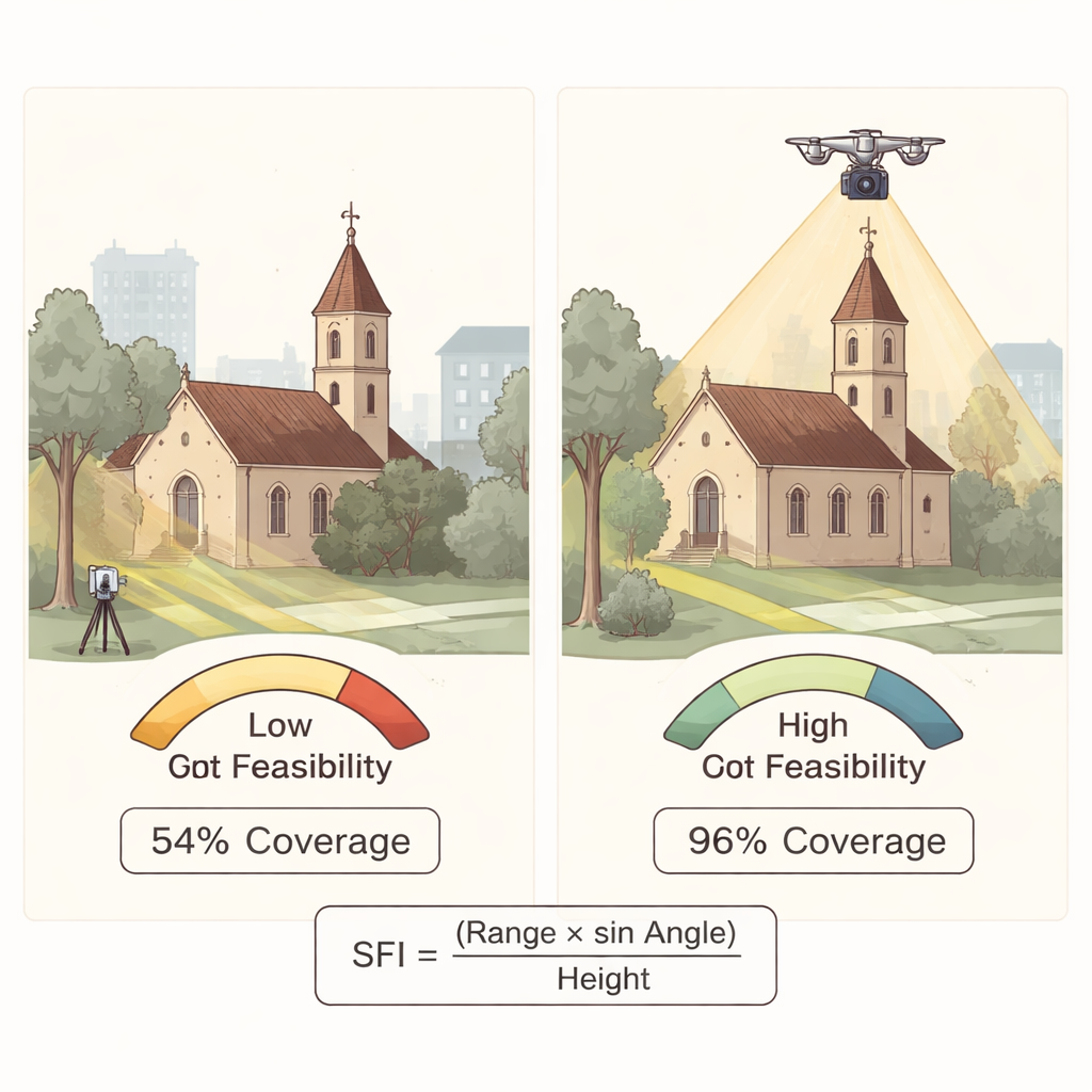
In the first phase, the team used a terrestrial laser scanner on a tripod together with hundreds of photos from smartphones. Laser scanning excels at capturing very precise geometry at street level, while image-based 3D modeling adds color and detail. The team experimented with different image counts and camera paths, finding that a smaller, carefully planned set of photos could outperform much larger, unplanned image collections. Even with these optimizations, the upper parts of the chapel—roof ridges, tower caps, and decorative cornices—remained only partially reconstructed. Physical obstacles and limited viewpoints meant the instruments simply could not “see” enough of the building, and the final dataset covered only about 54 percent of the chapel’s surface.
Thinking ahead: a simple test for what ground scans can really do
Rather than continuing with trial and error, the authors asked a more fundamental question: given the site geometry and scanner capabilities, is it even possible to capture the whole building from the ground? From this, they developed the Predictive Scan Feasibility Estimation Model (PSFEM). At its core is a compact index that relates three intuitive quantities: how far the scanner can reach, the angle it can “look up,” and how tall the building is. If the index is at least one, the scanner should, in principle, see the whole height; if it is below one, important areas will stay hidden unless another method is added. A more detailed version of the model also considers the scanner’s full field of view and working distance. When these formulas were applied to the chapel, they clearly showed that a ground-only survey could never achieve full coverage under the existing constraints.
Second try: adding drones to fill the gaps
Armed with that insight, the team planned a second phase focused on what the ground instruments could not reach. A drone flew above and around the chapel, capturing over 1,500 images from high and oblique angles, while a second laser scanner added extra ground data in difficult zones. All of these datasets were carefully cleaned, aligned, and merged into a single point cloud—a dense swarm of 3D points representing the surfaces of the building. This hybrid dataset nearly doubled the number of measured points and raised coverage to about 96 percent, successfully filling in roofs, tower details, drainage elements, and other previously missing features. Checks comparing different scans confirmed that the added information expanded the model without sacrificing measurement quality.
From one chapel to many heritage sites
For non-specialists, the key message is straightforward: high-quality digital records of historic buildings are possible even in cramped, complex settings, but only if we plan measurements intelligently. This study demonstrates a repeatable workflow: first survey what you can from the ground, then use a simple predictive test like PSFEM to decide whether drones or extra scans are needed before sending teams back to the site. By shifting from a “scan first, fix later” mindset to a “predict then capture” approach, heritage professionals can reduce wasted trips, control costs, and still obtain detailed 3D models that support careful, minimally invasive conservation. In the long run, approaches like this can be adapted and scaled to many different monuments, helping safeguard cultural landmarks for future generations.
Citation: Salah, R., Géczy, N. & Ajtayné Károlyfi, K. Predictive hybrid scan-to-BIM method improves heritage building documentation completeness and accuracy. Sci Rep 16, 7622 (2026). https://doi.org/10.1038/s41598-026-38200-8
Keywords: heritage 3D scanning, drone photogrammetry, building information modeling, laser scanning, historic chapel documentation