Clear Sky Science · en
An integrated approach of hybrid ensemble machinelearning-based efficient seismic slope fragilityassessment and GIS mapping
Why shaking slopes matter to everyday life
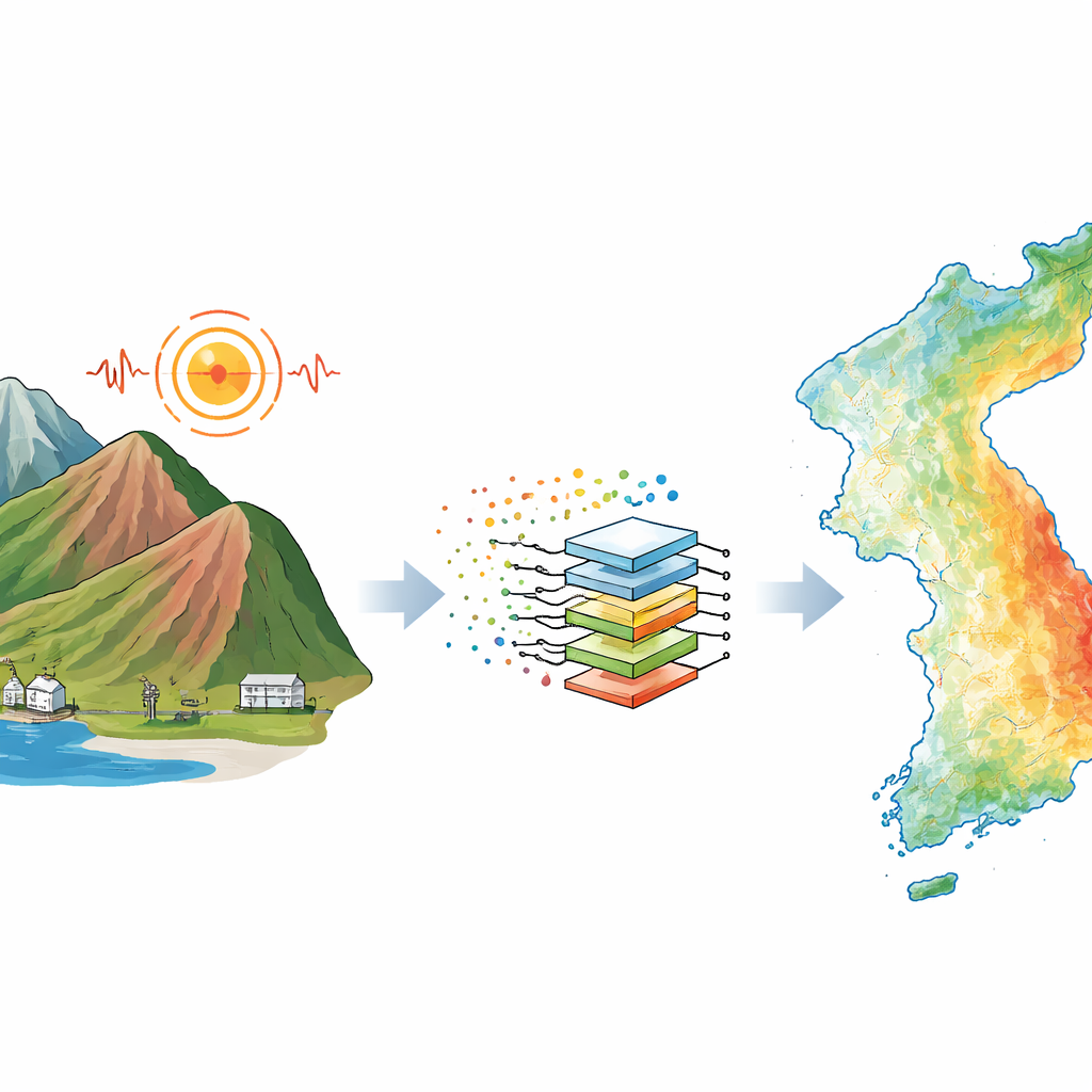
When an earthquake strikes hilly or mountainous regions, the ground itself can give way. Slopes above homes, roads, and power plants may slide, turning solid ground into fast-moving debris. Yet mapping which slopes are most at risk across an entire country is usually so computationally demanding that it cannot be updated quickly. This article presents a faster, data‑driven way to forecast where earthquake‑induced slope failures are most likely, allowing planners to create national‑scale risk maps that still preserve much of the accuracy of traditional, heavy simulations.
From real landslides to a practical failure yardstick
The authors start from a simple question: at what level of shaking does a slope begin to move enough to be considered dangerous? Using field observations from past earthquakes, they test different displacement cutoffs and compare the resulting failure curves with what was actually seen on the ground. They find that once permanent movement along a slope reaches about 14 centimeters, the probability of a damaging slide rises sharply. This 14‑centimeter shift is then adopted as a benchmark “failure” level, allowing many different slope conditions to be judged on a common scale and providing a clear link between measured shaking and the likelihood of damage.
Turning complex ground behavior into a single safety number
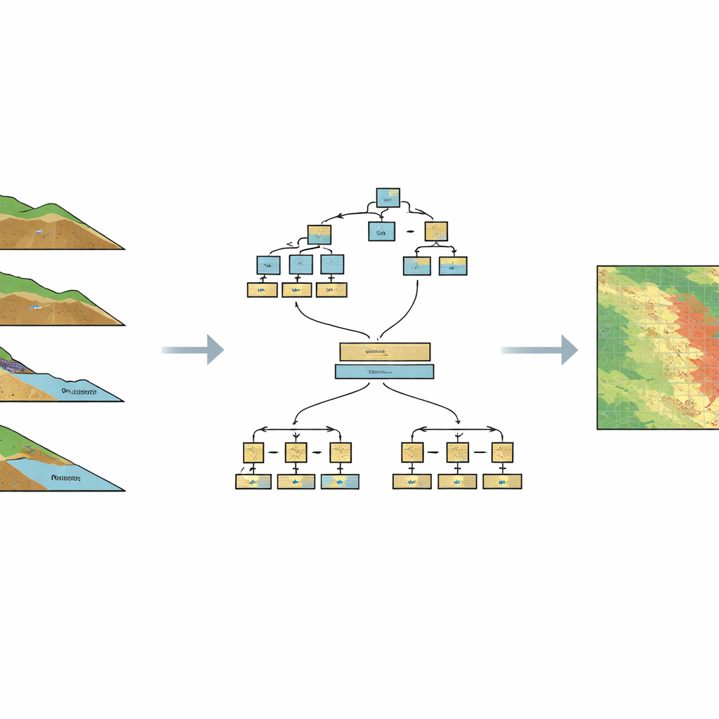
Earthquake damage to slopes depends on a tangle of uncertain factors: soil strength, slope angle, soil depth, water content, and how hard and long the ground shakes. To capture this uncertainty, the study uses a classic sliding‑block model to simulate how much a slope would move under many random combinations of these factors. For each synthetic slope, thousands of simulations are run to trace a full curve of failure probability versus shaking level. From each curve, the team extracts a single summary value called HCLPF, which can be thought of as the shaking intensity a slope can withstand while keeping the chance of failure extremely low. This condenses a complex probabilistic description into one intuitive number that can be stored, compared, and plotted on a map.
Teaching machines to imitate heavy simulations
Running such high‑fidelity simulations for every slope in a country would take an impractical amount of time. To overcome this, the researchers generate a large training dataset of 10,000 artificial slopes that span realistic ranges of soil and geometric properties. For each, they compute the HCLPF value using full probabilistic analysis. They then train a range of machine‑learning models to predict HCLPF directly from basic slope and soil inputs. A hybrid ensemble approach emerges as the best performer: it combines a boosting method (which builds a series of decision‑tree models that refine each other’s errors) with a bagging method (which averages over many slightly different models to stabilize predictions). A clever hyperparameter strategy reuses information from earlier tuning rounds and samples efficiently from likely settings, reducing the usual trial‑and‑error burden of model calibration.
Drawing a national map of fragile slopes
With this trained hybrid model in hand, the authors turn to the Republic of Korea as a test case. Using national‑scale digital elevation data and soil information, they prepare over 100,000 locations, each representing a distinct slope with its own angle, soil depth, strength, and moisture range. Instead of rerunning thousands of simulations at each point, they ask the machine‑learning model to predict the HCLPF directly. These point predictions are then interpolated to form a smooth, high‑resolution map showing where slopes are more or less likely to fail under strong shaking. When compared with a reference map built from full simulations, the machine‑learning map agrees at roughly the 95% level, yet it requires only about 4% of the computing time.
A faster lens on earthquake‑triggered landslide risk
In plain terms, this study shows that a carefully designed machine‑learning system can stand in for extremely costly simulations when assessing earthquake‑induced slope failures at regional scale. By boiling each slope’s complex behavior down to a single safety number and training a hybrid ensemble model to predict that number, the authors create a tool that produces detailed national fragility maps in hours instead of days. While site‑specific engineering decisions will still demand detailed studies, this approach offers emergency planners and infrastructure managers a rapid, reasonably accurate way to spot vulnerable hillsides, prioritize monitoring and retrofits, and revisit risk assessments whenever new terrain or soil data become available.
Citation: Mostafizur, R.M., Go, C., Kwag, S. et al. An integrated approach of hybrid ensemble machinelearning-based efficient seismic slope fragilityassessment and GIS mapping. Sci Rep 16, 9190 (2026). https://doi.org/10.1038/s41598-026-38171-w
Keywords: earthquake-induced landslides, slope stability, seismic risk mapping, machine learning ensemble, geospatial hazard analysis