Clear Sky Science · en
Statistical downscaling reproduces high-resolution ocean transport for particle tracking in the Bering Sea
Why Tiny Ocean Details Matter
The ocean’s surface may look smooth from above, but just beneath lies a constantly shifting maze of currents, eddies, and swirling fronts. These features decide where oil spills drift, how plastic pollution spreads, where fish larvae end up, and even how well future climate technologies like marine carbon dioxide removal might work. Yet the computer models that cover the whole globe often blur these fine details, especially in remote but important places like the Bering Sea between Alaska and Russia. This study shows how a smart statistical shortcut can recreate those missing small-scale patterns without running massive, slow supercomputer simulations.
From Blurry Oceans to Detailed Maps
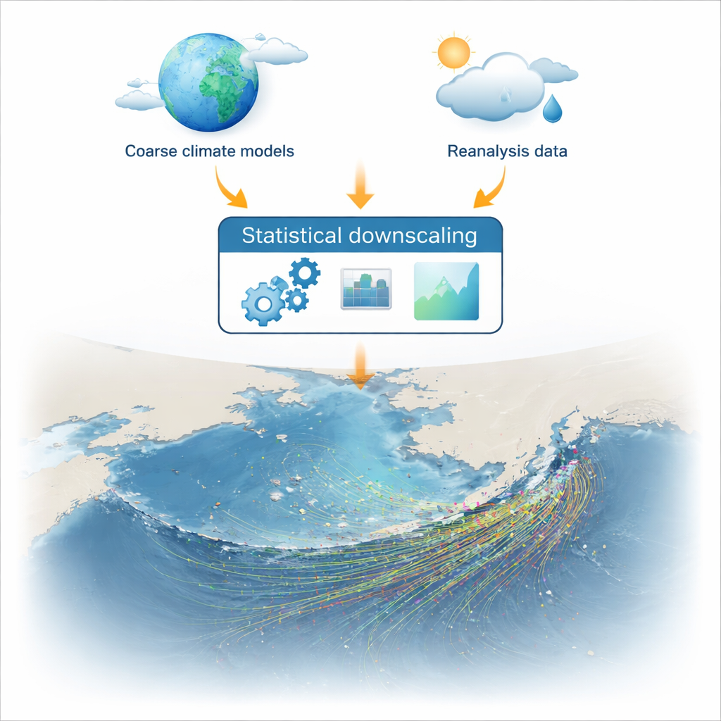
Global climate and ocean models usually divide the world’s oceans into grid boxes tens or even hundreds of kilometers wide. That is good enough to capture major currents and winds, but far too coarse to show the smaller whirls and jets that actually move water parcels, pollution, or drifting organisms from place to place. High-end regional models like ROMS or NEMO can zoom in to a few kilometers, but they are expensive to run and typically cover only limited areas and time periods. The authors tackled this bottleneck by using a statistical technique called “downscaling” to translate coarse, global-style data into fine-scale, coastal-resolving fields for the Bering Sea, using existing high-resolution reanalysis products as a learning reference.
A Shortcut that Learns from History
The researchers began with detailed historical reconstructions of ocean currents (the GLORYS reanalysis) and atmospheric winds (ERA5). They mathematically “coarsened” these datasets to mimic the blurry output of typical climate models, then trained a bias-correction and downscaling method to rebuild high-resolution patterns from the coarser input. In simple terms, the method learns how fine-scale structures—like eddies and sharp coastal currents—tend to sit inside each large-scale pattern. Once trained on the period 1993–2015, it was used to generate high-resolution currents and winds for 2015–2020 solely from coarse inputs, without rerunning any expensive physics-based ocean model.
Testing the Ocean’s Hidden Highways
To see if this shortcut produced realistic physics, the team compared the downscaled fields with the original high-resolution data in several ways. Basic statistics showed that wind patterns were reproduced extremely well, and ocean currents with good skill overall, especially along strong, steady flows like the Alaska Coastal Current. They then examined more subtle features that matter for transport, such as eddies and zones where water converges or diverges. Using established diagnostics, they found that the downscaled fields captured the main swirling structures and coherent pathways that organize how water masses and drifting material move through the Bering Sea, though the most energetic, small eddies were somewhat smoothed.
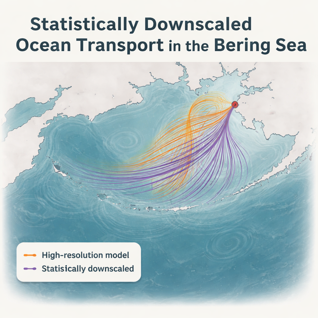
Following Virtual Drifters Through the Bering Sea
The real test was whether these statistically reconstructed currents could stand in for a full dynamic model when tracking individual water parcels. The authors released virtual particles along Alaska’s Aleutian coast and let them drift for a year under three different forcings: the original high-resolution fields, the downscaled version, and a coarse-resolution case. The downscaled simulations produced spreading patterns and pathways that closely matched the full-resolution benchmark, including key routes through narrow passages. In contrast, the coarse model tended to miss important pathways and keep particles too far offshore. A quantitative measure of overlap between particle clouds showed that the downscaled runs were consistently much closer to the benchmark than the coarse runs, especially in coastal regions with complex currents.
What This Means for Future Oceans
For non-specialists, the takeaway is that this approach can give us “near high-resolution” views of the ocean’s hidden highways almost anywhere on Earth, without the usual supercomputer bill. By learning from past detailed simulations, the method can turn future coarse climate projections into fine-scale current maps suitable for tracking oil spills, plastics, fish larvae, or plumes from marine carbon dioxide removal experiments decades ahead. While it still struggles in the most turbulent zones and needs testing in other regions, the study shows that statistical downscaling is a powerful and practical bridge between global climate models and the local ocean physics that matter for ecosystems, safety at sea, and climate solutions.
Citation: Kristiansen, T., Miller, J. & Butenschön, M. Statistical downscaling reproduces high-resolution ocean transport for particle tracking in the Bering Sea. Sci Rep 16, 7290 (2026). https://doi.org/10.1038/s41598-026-37904-1
Keywords: ocean currents, particle tracking, statistical downscaling, Bering Sea, marine carbon dioxide removal