Clear Sky Science · en
Improving precision agriculture using integrated bio-inspired optimization models for crop recommendation in Rajasthan, India
Smarter Farming for a Changing World
Choosing the right crop can make or break a farming season, especially in dry, climate‑stressed regions like Rajasthan in India. This study shows how satellite images, weather data, and advanced computer models can work together to guide farmers toward crops that are better suited to their land and seasons. By copying the problem‑solving tricks of animals and natural forces, the researchers greatly improved how accurately computers can suggest which crops to grow, offering a path to higher yields and more stable incomes.
Turning Space Images into Field Insights
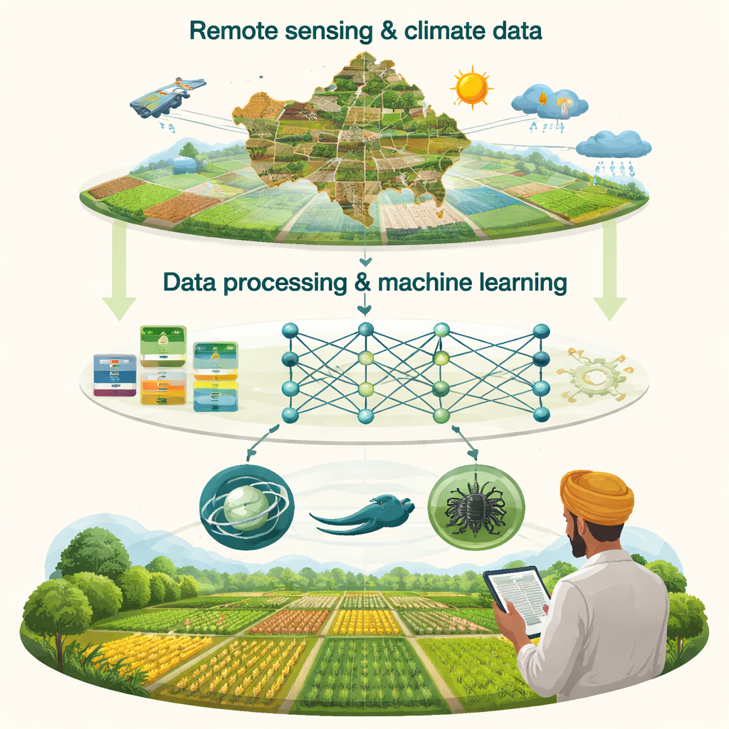
At the heart of the work is a rich data picture of Rajasthan’s agriculture. The team combined satellite images from the Landsat 8 and 9 missions with official crop statistics and village boundary maps. These satellites capture light in many colors, including those invisible to the human eye, which reveal clues about soil moisture, texture, and organic matter. The researchers cut the imagery into small tiles about the size of a field patch and extracted 16 soil‑related features, along with three climate indicators such as humidity, rainfall, and soil moisture. In total, they built a dataset of over 120,000 samples covering 29 major crops grown in both the monsoon (Kharif) and winter (Rabi) seasons across Rajasthan.
A Five‑Layer Digital Assistant for Farmers
The study organizes this information into a five‑layer system that resembles a digital assistant for crop planning. First comes data retrieval, where satellite and government sources are gathered. Next, data preparation cleans and filters the information, keeping only the most meaningful indicators. A third layer standardizes these features and applies basic machine‑learning methods to set baseline performance. The core fourth layer trains an artificial neural network, a computer model loosely inspired by the brain, to recognize patterns linking soil and climate conditions to successful crops. Finally, a user‑friendly interface turns model outputs into simple crop suggestions that a farmer or planner can view on a screen, based on a chosen location and set of conditions.
Learning from Gravity, Hunger, Eels, and Porcupines
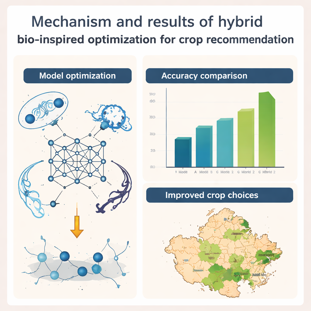
To make the neural network as accurate as possible, the authors turn to nature‑inspired optimization—algorithms that imitate how animals search for food or how physical forces act. They develop two new hybrid methods. The first blends a "gravitational" search, where better solutions pull others toward them like planets, with a "hunger"‑driven search, where weaker solutions move toward stronger ones as if competing for scarce resources. The second hybrid mimics electric eels roaming widely for food and porcupines using a mix of resting, moving, and hunting behaviors to refine their position. These hybrids systematically adjust the internal weights of the neural network so it can better distinguish among crops, even when their satellite signatures look similar.
High Accuracy Across Seasons
When tested on real data from Rajasthan, the hybrid approaches clearly beat traditional methods such as random forests, support vector machines, and several earlier optimization techniques. For crop classification—deciding which crop is most suitable or likely for a given patch of land—the gravitational‑hunger hybrid reached accuracy of about 95% for Kharif and 95% for Rabi, while the eel‑porcupine hybrid came very close behind. These models also proved stable across repeated runs, converging reliably rather than getting stuck on poor solutions. Detailed checks showed that they performed especially well on challenging crops like rice and wheat, which often confuse simpler models due to similar soil and climate signatures.
What This Means for Farmers
For a non‑specialist, the key message is that combining satellite data with clever, nature‑inspired algorithms can turn complex environmental signals into practical crop advice tailored to local fields and seasons. Although the current system is tuned specifically for Rajasthan and for a single year of data, it demonstrates that such tools can guide farmers toward crops that match their soil and weather, reducing risk and improving sustainability. With future extensions to include multi‑year climate trends, economic factors, and additional regions, this kind of smart decision support could become a powerful ally for smallholders facing uncertain rains and rising demand for food.
Citation: Goel, L., Kumar, N., Jain, S. et al. Improving precision agriculture using integrated bio-inspired optimization models for crop recommendation in Rajasthan, India. Sci Rep 16, 6925 (2026). https://doi.org/10.1038/s41598-026-37863-7
Keywords: precision agriculture, crop recommendation, satellite remote sensing, bio-inspired optimization, artificial neural networks