Clear Sky Science · en
Remote sensing assessment of vegetation and moisture dynamics in semi-arid regions
Why drying landscapes matter
Semi-arid regions around the world are on the front lines of climate change and human pressure. In Algeria’s Oued Louza watershed, farmers, herders, and towns all depend on limited water and fragile vegetation. This study uses decades of satellite images to show how quickly green cover and moisture are disappearing, and how expanding cities and shifting rainfall patterns are reshaping the land. Understanding these trends is vital for protecting soils, water supplies, and livelihoods in dry regions.
A shrinking green carpet
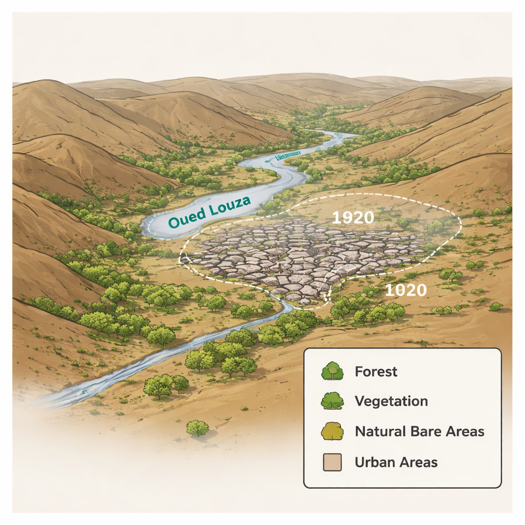
The researchers focused on the Oued Louza watershed in the Sidi Bel Abbès province of northwestern Algeria, an area with a Mediterranean, semi-arid climate marked by wet winters and hot, dry summers. Using satellite data from 1987 and 2020, they mapped four main land types: forests, general vegetation (such as crops and pastures), natural bare or sparsely covered areas, and urban zones. The picture is stark: overall vegetation cover plunged from 42% of the area in 1987 to just 10% in 2020. Forest cover dipped from 21% to 17%, while natural bare areas expanded to nearly half the watershed. Most striking of all, urban areas exploded from roughly 1% to 27%, reflecting rapid growth of built-up land at the expense of fields and natural vegetation.
Reading the land from space
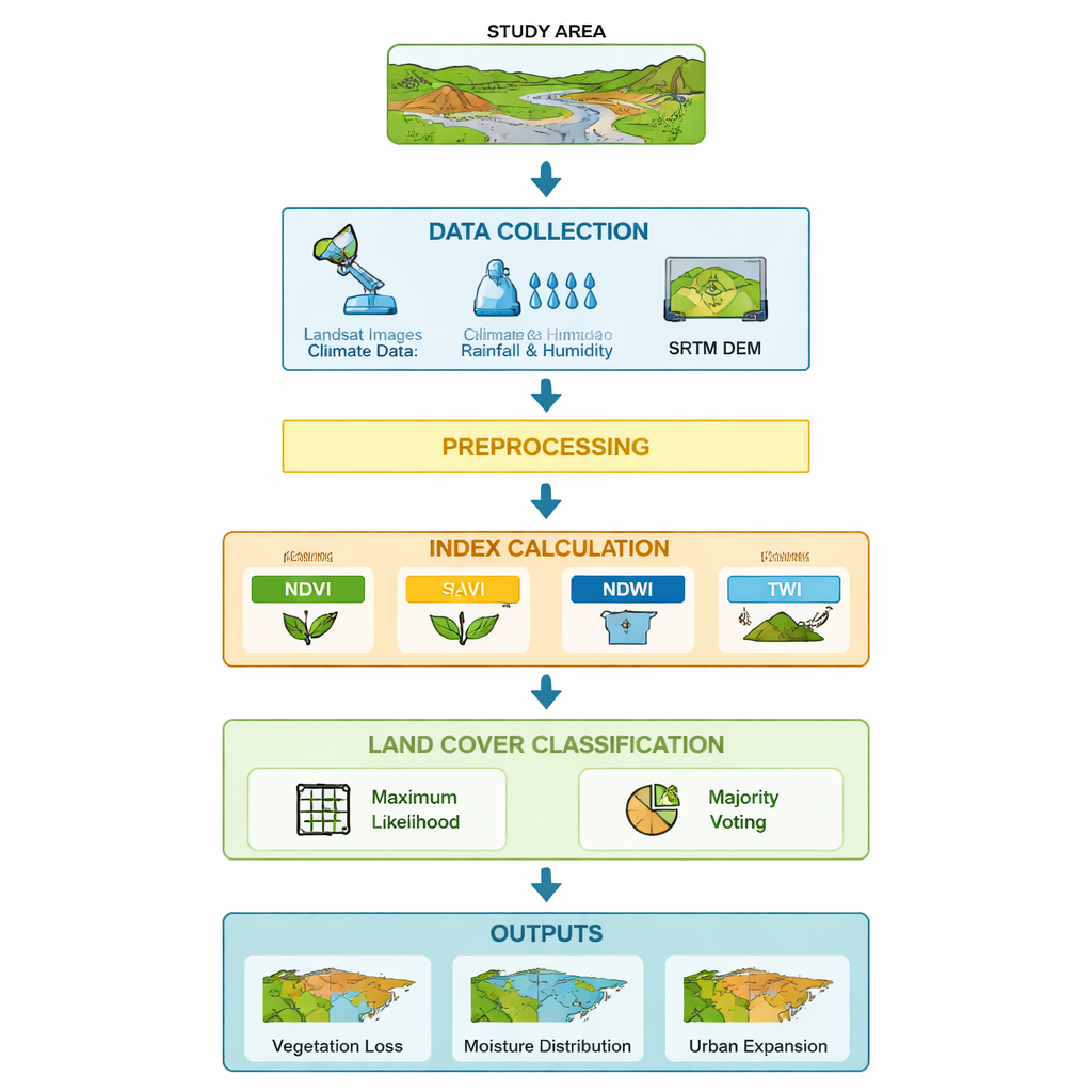
To make sense of these changes, the team used satellite-based “indices” that translate different wavelengths of light into simple measures of plant health and water. The Normalized Difference Vegetation Index (NDVI) and the Soil Adjusted Vegetation Index (SAVI) track how lush or sparse vegetation is, while the Normalized Difference Water Index (NDWI) reflects how much water is stored in plants and surface moisture. They also calculated the Topographic Wetness Index (TWI) from elevation data to show where water naturally tends to collect in valleys and low slopes. By combining all of these indicators and using a majority-voting classification method, they produced detailed maps that are far more reliable than any single index on its own.
Climate stress and thirsty soils
Climate records from 1987 to 2020 reveal a region under growing stress. Annual rainfall and air humidity swing sharply from year to year, with some very wet years and pronounced droughts. Overall, rainfall dropped by about 23% and relative humidity fell by around 7%, while temperatures crept upward. The satellite indices mirror this story. In 1987, vegetation showed higher water content, especially in southern forested zones, with NDWI values indicating well-hydrated plants. By 2020, maximum NDWI values had shrunk dramatically, signaling widespread drying. TWI maps show that wetter valley bottoms and depressions still retain more moisture and support denser vegetation, but steeper slopes shed water quickly and are much more vulnerable to drought and degradation.
People’s footprint on the landscape
Human activity intensifies these climatic pressures. The study links urban sprawl, agricultural expansion, overgrazing, deforestation, and frequent forest fires to the sharp loss of vegetated land. As the city and infrastructure around Sidi Bel Abbès expand into former farmland and natural zones, vegetation is cleared and soils are left more exposed to erosion and drying. By overlaying the land-cover maps with the vegetation and moisture indices, the authors show how built-up areas tend to coincide with zones of degraded vegetation and lower moisture, while remaining green pockets are often found where topography favors water retention.
What this means for the future
For a non-specialist, the core message is clear: in this semi-arid Algerian watershed, green cover is rapidly shrinking and the land is getting drier, driven by both a changing climate and human expansion. The study demonstrates that satellite images, combined with smart mapping techniques, can reliably track where vegetation is lost, where soils are drying, and where towns are spreading. These insights can help planners and decision-makers target reforestation, protect key wet areas, manage grazing, and guide more sustainable urban growth. In short, the work offers a powerful aerial diagnosis of a fragile landscape—and a warning that without careful management, the region’s natural support systems could be pushed beyond recovery.
Citation: Kreri, S., Farhi, N., Bennia, A. et al. Remote sensing assessment of vegetation and moisture dynamics in semi-arid regions. Sci Rep 16, 6549 (2026). https://doi.org/10.1038/s41598-026-37781-8
Keywords: semi-arid ecosystems, remote sensing, vegetation loss, urban expansion, soil moisture