Clear Sky Science · en
MLS-based recognition and parameter extraction of roadway roof bolts/cables from 3D point clouds
Keeping Mine Tunnels Safe
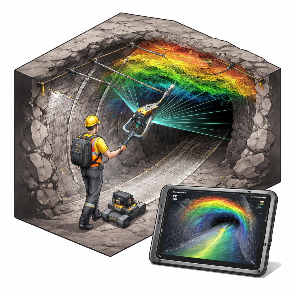
Deep underground coal mines rely on metal bolts and cables drilled into the tunnel roof to keep the rock from collapsing. If these supports are badly placed or begin to fail, workers’ lives are at risk. Yet today, checking thousands of bolts is still done largely by hand, with tape measures and gauges, in dark, dusty tunnels. This study introduces an automated way to “see” and measure those hidden lifelines using mobile laser scanners and 3D data, promising faster, more objective safety checks for modern mines.
Scanning a Tunnel in Three Dimensions
The researchers built a portable mobile laser scanning system designed specifically for underground roadways. Mounted with a laser rangefinder and motion sensors, the device is carried or pushed along the tunnel, rapidly firing laser pulses at the surrounding rock. As it moves, a navigation technique called SLAM (Simultaneous Localization and Mapping) stitches the incoming measurements into a continuous 3D model of the tunnel. Even without GPS signals, which do not reach underground, the system can reconstruct the shape of a 50-meter stretch of roadway with centimeter-level accuracy, capturing not only the rock surfaces but also support hardware like bolts, cables, and steel plates.
Cleaning Up the Digital Tunnel
Raw 3D scans from a mine are messy. Dust, water mist, workers, and machinery all create stray points that clutter the data. The team first applies a two-step denoising process that removes obvious outliers while recovering real surfaces that may have been mistakenly discarded. They then isolate just the roof of the tunnel, since that is where the support bolts and cables are anchored. By mathematically rotating the data, they align the roof so it lies flat in a standard orientation, making it easier to reason about “up” and “down” and to measure the direction and length of each support element in a consistent way across the entire scene.
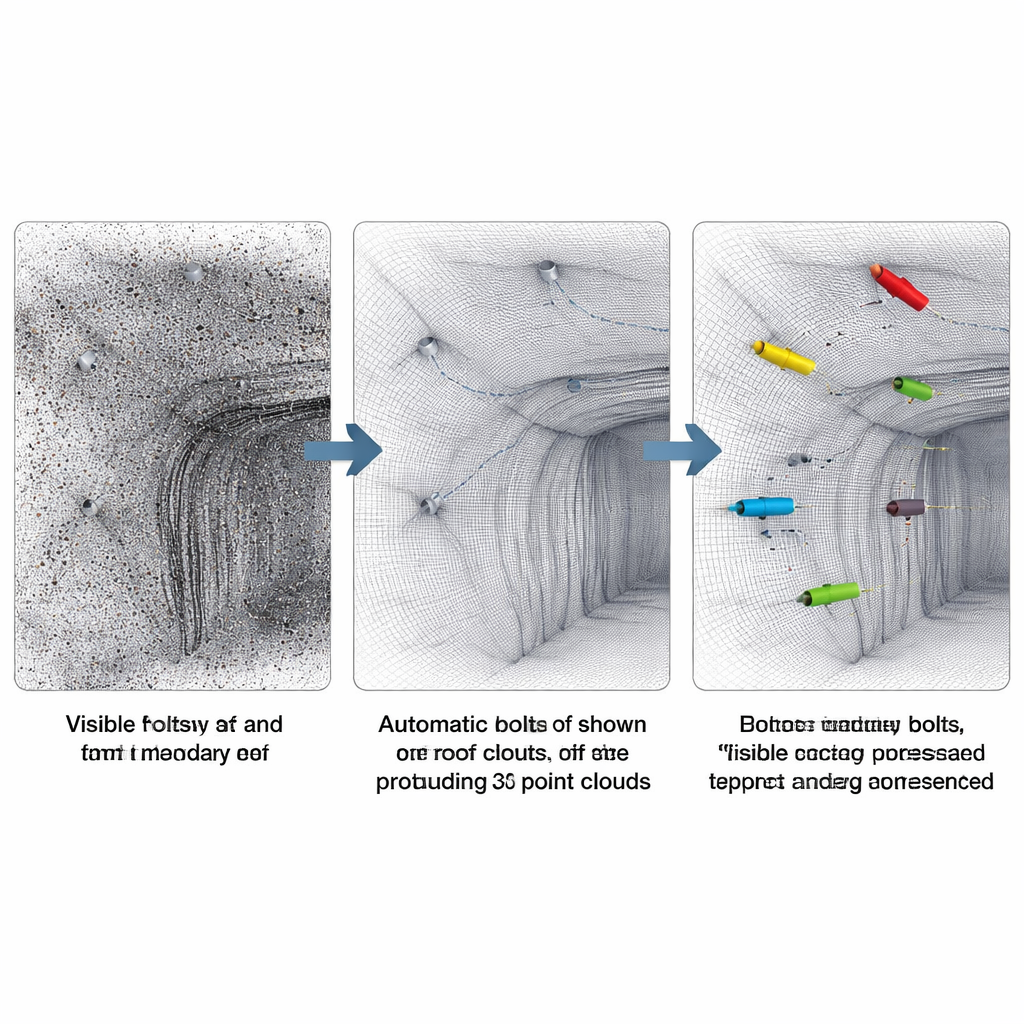
Letting Virtual Cloth Find the Bolts
To separate the roof surface from the hardware attached to it, the researchers use a clever trick known as a Cloth Simulation Filter. They imagine a flexible sheet of cloth slowly settling under gravity onto the upside-down digital roof. Where the real rock is, the cloth hugs the surface. Where a bolt, cable, or plate sticks out, the cloth drapes over it, leaving a gap. By measuring the small height difference between the cloth and the actual points, the algorithm labels which points belong to the smooth rock roof and which are likely protruding objects. Carefully tuned settings ensure the cloth is detailed enough to follow the roof’s natural bumps, but not so fine that it accidentally “swallows” the bolts it is meant to reveal.
Teaching the Computer to Count and Measure Supports
Once potential protrusions are isolated, the method still must decide which clusters of points are real bolts or cables and which are pipes, hanging wires, or noise. Here, a density-based clustering technique groups nearby points that form elongated shapes. The algorithm adjusts its search radius and minimum cluster size so that each bolt typically becomes one clean group, without merging neighbors together. For every group, a simple geometric analysis finds the main axis of the object and projects all points onto it, yielding an estimate of exposed length and tilt angle. Additional rules based on known mine design—such as typical spacing, expected diameter, and allowable installation angle—help filter out impostors and leave only true, correctly installed supports.
From 3D Maps to Practical Safety Insights
The method was tested in a deep coal mine in Inner Mongolia, on five consecutive roof segments containing 127 bolts and cables that had been carefully labeled by hand. The automated system correctly found 118 of them, with only a few misses and false alarms, even under challenging conditions with dust, partial shotcrete cover, and interfering metal parts. Just as importantly, it produced a structured database for each support: its exact location, spacing, length sticking out of the roof, and angle relative to the rock. For mine engineers, this turns a complex 3D cloud of points into a ready-made checklist for quality control and long-term health monitoring. While the approach still depends on getting good scan data and on having at least some part of each bolt visible, it points toward a future where routine tunnel safety checks can be faster, more frequent, and less dependent on subjective human judgment.
Citation: Ren, Z., Zhu, H., Zhao, L. et al. MLS-based recognition and parameter extraction of roadway roof bolts/cables from 3D point clouds. Sci Rep 16, 6538 (2026). https://doi.org/10.1038/s41598-026-37689-3
Keywords: mobile laser scanning, 3D point clouds, rock bolt inspection, underground mining safety, tunnel support monitoring