Clear Sky Science · en
Analysis of urban resilience assessment and spatiotemporal patterns in coastal cities under sea-level rise
Why rising seas matter for city life
For hundreds of millions of people, coastal cities are home, workplace, and cultural center. Yet as global warming drives seas higher, these low-lying hubs face more floods, saltier rivers, and mounting damage to homes, roads, and water supplies. This study looks at how one of the world’s largest coastal cities—Shanghai—can withstand and bounce back from these threats. By building a new way to measure a city’s strength in the face of sea-level rise, the authors reveal which areas are most at risk today and how well the city might cope by the end of this century.
A new way to picture city strength
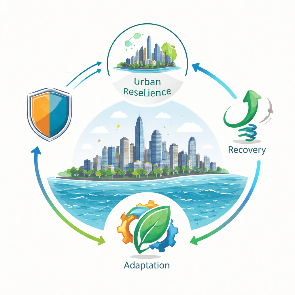
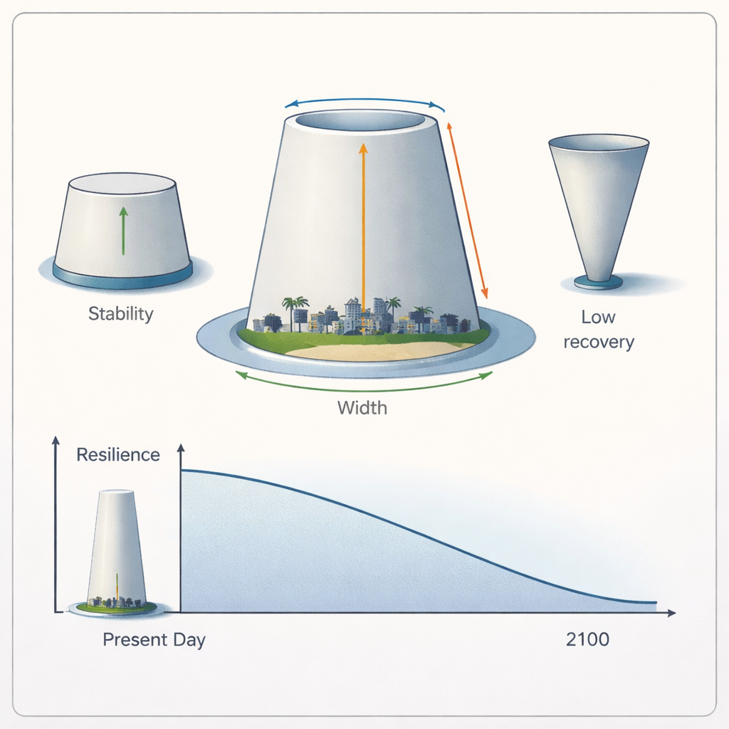
Most past studies boiled a city’s resilience down to a single score or a flat diagram, making it hard to see where that strength really comes from. This paper introduces a three-part picture of urban resilience: how well a city can hold off damage (resistance), how quickly it can get back on its feet (recovery), and how easily it can adjust to new conditions (adaptation). Instead of treating these as separate checkboxes, the researchers represent them as a three-dimensional shape, similar to a truncated cone, where the base width, height, and top width each stand for one of these abilities. The shape makes it easier to see hidden weaknesses—for example, a city that looks strong overall, but has a shaky foundation because its defenses are poor.
Shanghai as a test case on the water’s edge
Shanghai is an ideal test ground for this model. It is a sprawling coastal metropolis built on low, soft ground at the mouth of the Yangtze River. The city depends on river reservoirs for drinking water, yet rising seas push salty water farther inland. Storm surges, heavy rain, and land sinking under the city’s weight all amplify flood danger, especially in districts such as Pudong, Fengxian, and Chongming. To capture these pressures, the team assembled detailed records on sea-level rise, storm losses, drainage pipes, seawalls, wetlands, population, government finances, and more. They then grouped 22 indicators into resistance, recovery, and adaptation, and used a mixed weighting method to avoid over-relying on expert opinion or raw statistics alone.
What the 3D model reveals about city weak spots
The three-dimensional resilience shapes for each district show that Shanghai’s strengths are unevenly distributed. Central districts like Huangpu and Jing’an enjoy strong physical defenses and social services, thanks to dense infrastructure and higher public spending. Pudong, the powerhouse financial zone, appears robust if one only looks at traditional scores, but the new model shows an “inverted truncated cone”: its ability to rebuild and adapt is high, while its front-line defenses against flooding and sea-level rise lag behind. In contrast, Chongming Island has good natural buffers and room to adapt, but limited budgets and weaker infrastructure make it slow to recover after a shock. Overall, economic muscle, land use, and public investment patterns strongly shape who is safer and who is left more exposed.
Trends over time and a glimpse of the future
Looking at records from 2003 to 2022, the study finds that Shanghai’s overall resilience first wobbled, then began a clear slide after 2011. Short bursts of progress—such as upgrades to drainage and ecological restoration—could not keep pace with rapid building, aging pipes and levees, and more frequent extreme weather. By 2022, the city’s resilience had fallen below its level at the start of the century. Using a forecasting method designed for limited data, the authors project that, if current patterns continue, resilience will keep declining through 2100. The drop is steepest in the coming decades and then slows as the system approaches a new, lower plateau. This scenario does not assume dramatic new climate policies or radical redesign of the city; instead, it serves as a warning of what may happen if current practices continue.
What it means for people living in coastal cities
For non-specialists, the message is straightforward: rising seas and stronger storms are already outpacing the upgrades cities like Shanghai are making. The new three-dimensional model shows not just how strong a city is today, but whether that strength is well-balanced or built on a fragile base. Shanghai’s experience suggests that even wealthy megacities can see their resilience erode when growth, aging infrastructure, and climate change collide. The study argues that planners and leaders must tailor strategies to each district—fortifying basic defenses where they are weak, speeding up recovery systems, and investing in long-term adaptation such as wetlands, smarter drainage, and education. Done well, these steps can turn a downward curve into a safer future for millions living at the water’s edge.
Citation: Liang, B., Shi, G., Wu, H. et al. Analysis of urban resilience assessment and spatiotemporal patterns in coastal cities under sea-level rise. Sci Rep 16, 6119 (2026). https://doi.org/10.1038/s41598-026-37425-x
Keywords: urban resilience, sea-level rise, coastal cities, Shanghai, climate adaptation