Clear Sky Science · en
Building new hydrography and virtual watersheds to conserve freshwater fisheries
Why Hidden Streams Matter
Across the globe, freshwater life is in trouble, and Alaska’s wild salmon are no exception. Many decisions about roads, mines, logging, and dams depend on maps that show where streams and rivers flow. Yet those maps often miss the smallest channels where fish feed, grow, and seek refuge from heat. This paper shows how new “virtual watershed” technology, built from high‑resolution elevation data, can reveal thousands of kilometers of previously unmapped streams in Alaska and dramatically change our picture of where salmon and other fish can live. 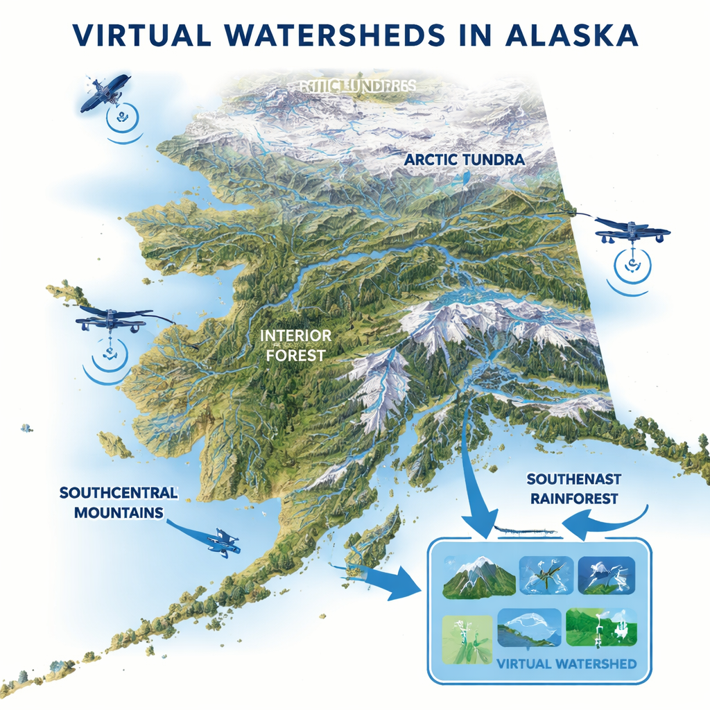
Old Maps, Missing Waters
For most of the twentieth century, river maps were drawn from aerial photos by cartographers working with paper topographic maps. In Alaska, these maps were coarse because of the state’s immense size, bad weather, and limited survey data. As a result, the official National Hydrography Dataset often leaves out headwater channels and small valley‑floor streams, especially under dense rainforest canopies or in flat terrain where streams are hard to see from the air. These cartographic maps also lack many details about slope, flow, and channel shape that scientists need to understand fish habitat and to predict the effects of climate change and development.
From Elevation Data to Virtual Watersheds
The authors use a new approach that turns detailed digital elevation models—fine‑scale measurements of the land’s surface—into complete, data‑rich river networks. Radar‑based IFSAR and laser‑based LiDAR can see subtle grooves carved by water and even peer through forests to the ground. Computer programs trace how water would flow downhill across every grid cell, decide where channels begin, and follow their paths from mountain slopes down to valley bottoms. These modeled channels are then linked to surrounding hillsides, floodplains, wetlands, and lakes, creating a “virtual watershed.” In this virtual version of the landscape, every short piece of stream can be tagged with characteristics such as steepness, confinement in a narrow valley or broad floodplain, and how much land drains into it.
Finding More Rivers and More Salmon Habitat
The team built virtual watersheds in eight regions of Alaska, from Arctic tundra to interior forests and coastal rainforests. They then compared their new algorithm‑based stream networks to the older, hand‑drawn maps, and applied established habitat models for several species, including coho, Chinook, sockeye salmon, and Broad Whitefish. In nearly every study area, the new networks were tens to hundreds of percent longer than the official maps. LiDAR‑based networks in forested southeast Alaska often showed 80–200% more stream length, and when both IFSAR and LiDAR were combined, drainage density increased strongly as well. When the authors used these richer networks to predict fish habitat, the total length of potential salmon and whitefish habitat rose even more dramatically—typically by several hundred percent compared with Alaska’s Anadromous Waters Catalog, which only includes reaches where fish have been directly observed.
Why the Smallest Channels Count
Many of the “new” streams appear high in the headwaters or as extra braids and side channels along valley floors. These places may be tiny on a map, but they are crucial for fish. Salmon often spawn in small, cool headwater creeks, while young fish move into wetlands, side channels, and small tributaries to feed and shelter before heading to sea. Ephemeral channels that only carry water during storms can funnel sediment and wood into larger fish‑bearing streams and help shape gravel beds where salmon lay their eggs. By tuning how sensitive the mapping algorithms are—deciding, for example, whether to include very short or rarely flowing channels—scientists can build stream networks matched to specific questions, such as predicting landslides, locating rearing habitat, or ranking road‑stream crossings for repair. 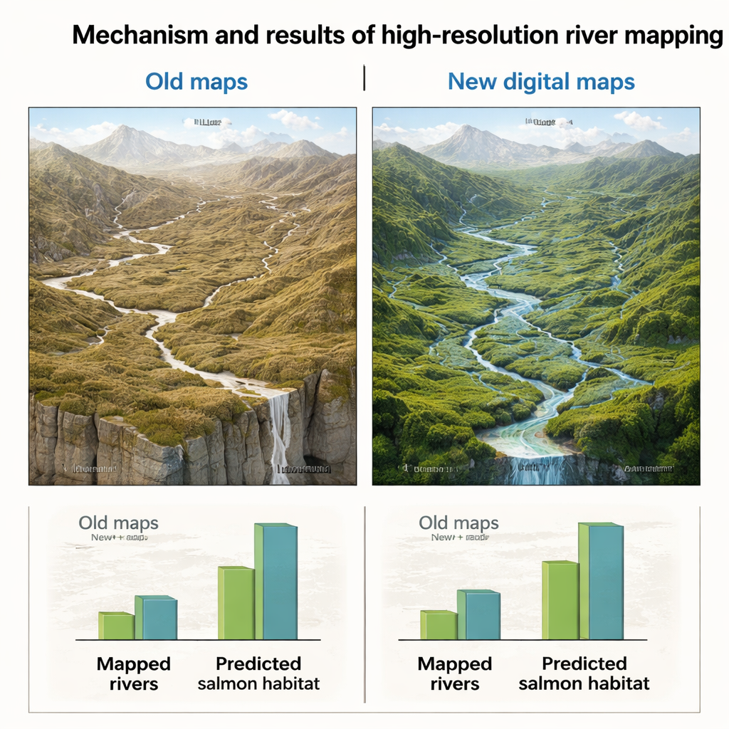
A New Map for Conservation Decisions
The study concludes that Alaska’s traditional river maps—and the fish habitat catalogs built on them—seriously underestimate where salmon and other freshwater species can live. Virtual watersheds built from high‑resolution elevation data reveal thousands of kilometers of additional channels and several‑fold increases in predicted habitat. Because every segment of stream is linked to its surrounding landforms, this framework can also support analyses of flood risk, road impacts, logging, mining, and climate‑driven changes in flow and temperature. The authors argue that Alaska’s experience offers a model for updating national‑scale hydrography worldwide: by upgrading from simple blue lines to virtual watersheds, societies gain a much sharper tool for protecting freshwater biodiversity and guiding development in a warming, rapidly changing world.
Citation: Benda, L., Miller, D., Leppi, J.C. et al. Building new hydrography and virtual watersheds to conserve freshwater fisheries. Sci Rep 16, 6091 (2026). https://doi.org/10.1038/s41598-026-37143-4
Keywords: virtual watersheds, salmon habitat, Alaska rivers, LiDAR mapping, freshwater conservation