Clear Sky Science · en
Assessing drinking and irrigation water quality in a highly altered subtropical river in India using hydro-chemical indices
Why this river matters to everyday life
The Damodar River in eastern India is a lifeline for millions of people, supplying water for drinking, farming, bathing and industry. Yet this same river now carries a heavy load of pollution from factories, mines and growing towns. This study looks closely at how safe the river’s water really is for drinking and irrigation along its most industrialized stretch, helping us understand what that means for human health, food production and the long-term future of the river.
A busy river under pressure
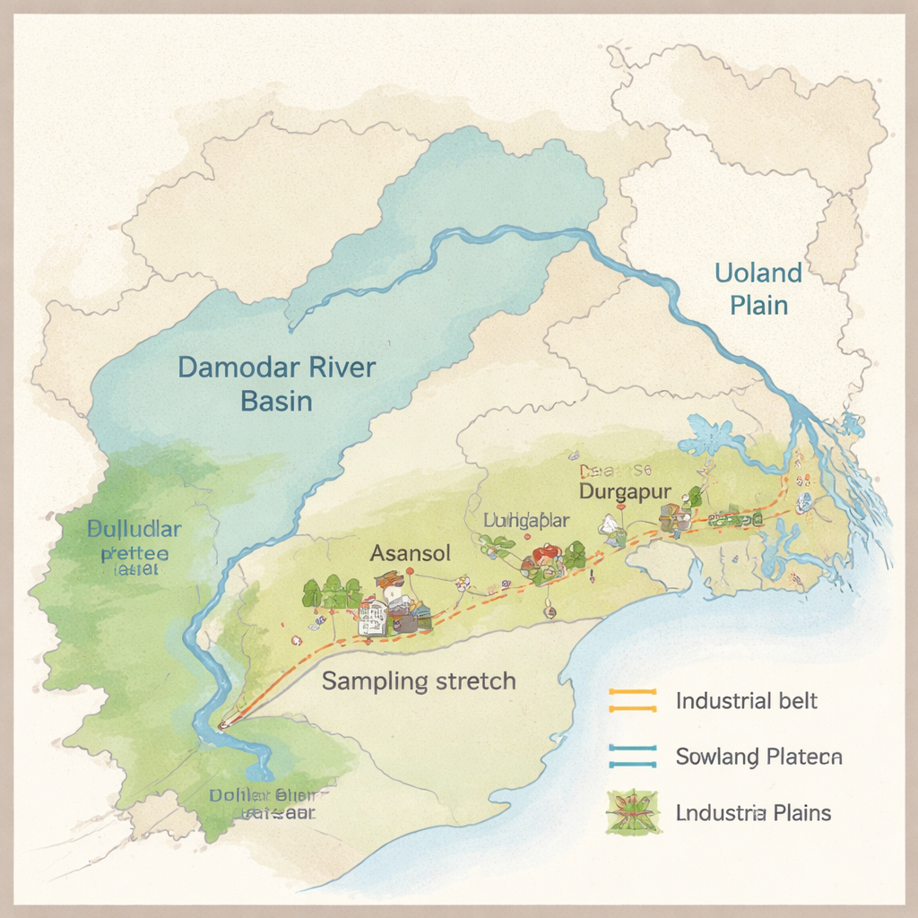
The Damodar River flows almost 600 kilometers from the rocky hills of the Chotanagpur Plateau to the plains of West Bengal. Along the way it passes coal mines, steel plants, power stations and densely populated farming areas. Dams, barrages and canals now regulate much of its flow, slowing the current and giving pollutants more time to build up. Earlier reports had already labeled the Damodar as one of India’s most polluted rivers, but there had been no long-term, detailed picture of whether its water is still safe to drink or use on crops throughout the year.
How the scientists took the river’s pulse
To answer this, the researchers analyzed 12 years of water-quality records from 11 monitoring stations between the towns of Barakar and Burdwan—an 82‑kilometer reach that includes the highly industrial Asansol–Durgapur belt. They grouped the data into three seasons that shape life across the region: pre-monsoon (dry months), monsoon (rainy months) and post-monsoon. At each station and season they measured 22 traits of the water, including acidity, dissolved oxygen, cloudiness, salts and nutrients such as nitrate and phosphate. From these they calculated a standard Water Quality Index (WQI) for drinking and several widely used indices that show whether water is safe to use on fields.
What the tests reveal about drinking water
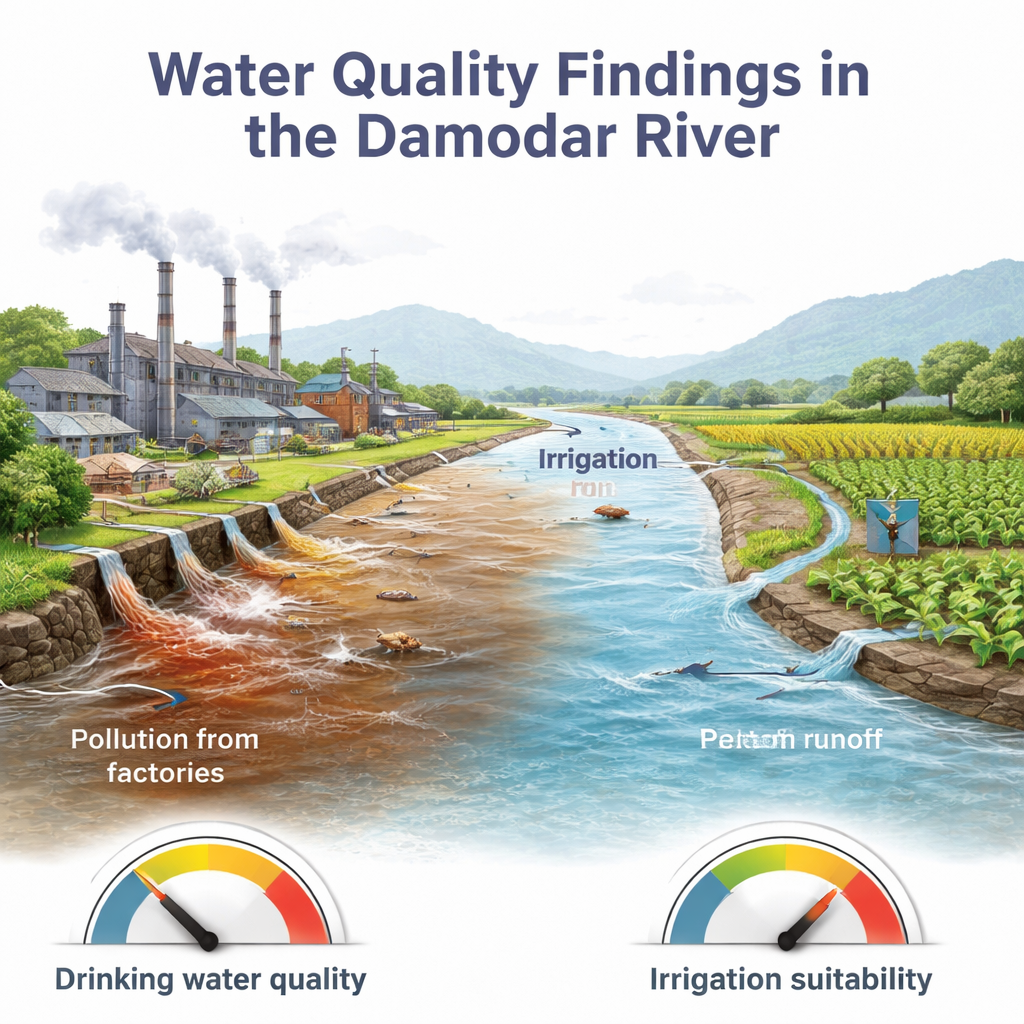
The results are stark. For drinking, more than two-thirds of all samples taken over the study period were rated “unfit,” and the situation was worst during the monsoon: about 87 percent of rainy-season samples failed the safety threshold. The middle of the study reach, near Mujher Mana village downstream of a major industrial drain called Tamla nallah, showed the poorest conditions, with over 95 percent of samples there unsuitable to drink in every season. High cloudiness, high chemical oxygen demand and elevated nutrients pushed the WQI scores well above safe limits, especially when heavy rains washed industrial and farm wastes into the river. In contrast, some basic salts such as calcium, magnesium, sodium and sulphate usually stayed within accepted drinking standards, meaning the main problem is pollution rather than natural mineral content.
Surprisingly, fields can still use the water
When it comes to irrigation, the picture is less bleak. Several indices—such as the sodium adsorption ratio, percentage of sodium, permeability index, potential salinity and magnesium hazard—showed that most water samples fall into categories considered acceptable or even excellent for crop watering. Farmers along the river, surveyed by the team, largely confirmed that they still rely on the Damodar for irrigation and have not seen widespread salt damage to their soils. However, one alkalinity measure, called residual sodium carbonate, often suggested “doubtful” to “unsuitable” conditions, especially near Raniganj. This means that while the water is generally usable for farming today, there is a risk that long-term buildup of certain salts could slowly harm soils if pollution is not controlled.
Where and when the river suffers most
By comparing stations and seasons statistically, the study shows that water quality varies strongly from place to place, and that drinking safety changes over the year. The middle stretch around Mujher Mana stands out as a pollution hotspot, reflecting the combined impact of urban and industrial wastewaters. The monsoon season magnifies these problems: heavy rains wash more contaminants into the river and stir up sediment, making the water especially unsafe to drink just when flows are high and people may assume it is cleaner. The researchers also used advanced statistical tools to group stations with similar pollution patterns, again isolating the industrial middle reach as behaving very differently from less impacted upstream and downstream sites.
What this means for people and policy
For a layperson, the key message is that along this part of the Damodar River, untreated river water should not be consumed, particularly during the rainy season and near industrial outfalls. At the same time, the river still supports farming, though there are warning signs that continued pollution could gradually damage soils. The authors argue that stricter control of industrial and urban discharges, better wastewater treatment, and public education are urgently needed to restore the river. Their long-term, season-by-season assessment offers a blueprint for other polluted rivers worldwide, showing how careful monitoring can guide safer drinking-water supplies and more sustainable irrigation.
Citation: Islam, A., Hoque, M.M., Nasrin, T. et al. Assessing drinking and irrigation water quality in a highly altered subtropical river in India using hydro-chemical indices. Sci Rep 16, 6972 (2026). https://doi.org/10.1038/s41598-026-37030-y
Keywords: river water quality, drinking water safety, irrigation suitability, industrial pollution, Damodar River