Clear Sky Science · en
Incorporating river morphodynamics in the characterization of key ecological system units for conservation in the western Amazon
Why Amazon Rivers Matter for Life Everywhere
The rivers that wind through the western Amazon are far more than water channels on a map. They constantly reshape their banks, spread nutrient-rich sediments across vast forests, and knit together habitats for fish, birds, mammals, reptiles, and amphibians. This study shows that to protect the Amazon’s astonishing freshwater life, we must treat rivers not as fixed blue lines, but as living, shifting systems whose motion and muddiness help sustain one of the planet’s greatest reservoirs of biodiversity and climate stability.
Rivers That Sculpt Forests and Feed Species
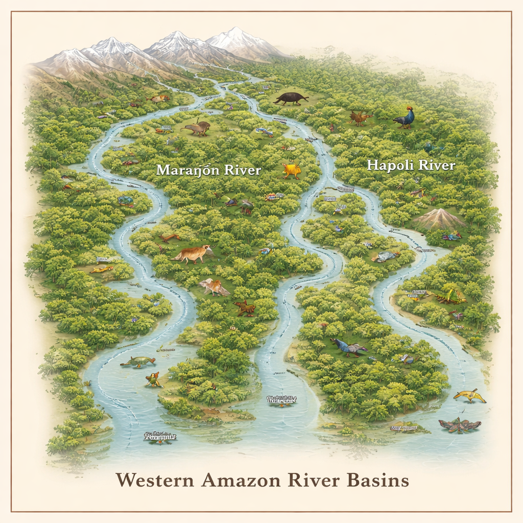
The western Amazon is built around three great river basins: the Marañón, Napo, and Ucayali. Together they form a web of channels and floodplains fed by the Andes, hosting hundreds of freshwater fish species and hundreds more amphibians, birds, reptiles, and mammals. As these rivers rise and fall with the seasons, they flood forests, carve new side channels, and leave behind fertile deposits. This constant reshaping creates a patchwork of habitats where species can spawn, feed, and migrate. The authors argue that this river-driven dynamism is not just background scenery but a powerful engine of evolution and ecological productivity.
Measuring Moving Water and Traveling Sediment
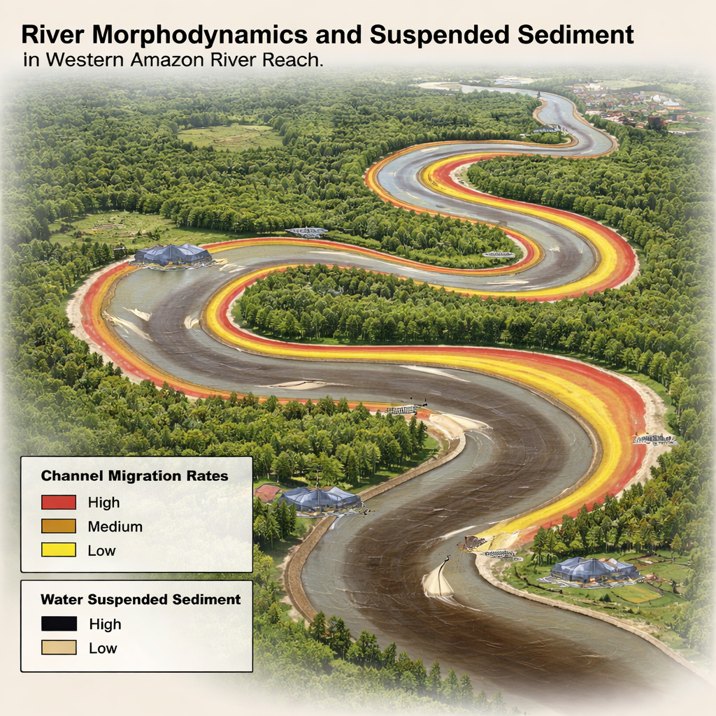
To capture how these rivers behave over time, the team introduced two simple but powerful measures. The first, the Modern Morphodynamics Index (MOR), tracks how much river channels have shifted sideways—eroding some banks and building others—over nearly four decades using satellite images from 1986 to 2022. The second, the Suspended Sediment Index (SSI), estimates how much fine material the rivers are carrying at the surface, using color information from newer satellite sensors. Together, MOR and SSI reveal where rivers are most active and where clouds of sediment deliver nutrients and minerals across the landscape. For instance, the Ucayali basin shows especially lively meandering and high MOR values, while key tributaries bring heavy sediment loads into the Marañón and Napo.
Finding Ecological Hotspots, Not Just Pretty Maps
Rather than treating species as isolated dots, the researchers grouped each basin into thousands of "Ecological System" units, or ES units. Each unit combines information on climate, topography, vegetation, river behavior, and the presence of five major animal groups. They then assessed how intact each unit is—looking at forest cover, floodplain area, river dynamics, and sediment—and contrasted this with human pressures such as dams, roads, mining, fires, agriculture, oil operations, and urban growth. Areas with healthy ecosystems and relatively low impact were flagged as high-value targets for conservation. Mammals consistently showed high levels of risk, amphibians varied sharply from place to place, and fish generally appeared less threatened—although many fish species remain poorly studied.
How Moving Rivers Change Conservation Priorities
The study compared a conventional conservation map, built without the new river indices, to one that explicitly incorporates MOR and SSI. In the older style map, priority areas are scattered more diffusely across the region and often ignore how rivers actually flow and change. Once MOR and SSI are added, high-priority ES units begin to trace active river corridors and their floodplains, better reflecting how species use the landscape. This shift increased the representation of fluvial corridors by up to 10 percent and highlighted clusters of especially valuable areas, such as around the Pacaya Samiria National Reserve and parts of the middle Napo. At the same time, upper basins—where human pressure is intense and data scarce—stood out as underrepresented and in need of focused research and management attention.
Acting Before the Rivers Are Locked in Place
The authors also ranked conservation priorities in time: some areas need urgent action because they face strong human impacts today, especially near cities and proposed dam sites, while others can be secured over the medium or long term. Planned hydropower projects along the upper Marañón, for example, could trap sediment, flatten natural flow swings, and block migrations of large, commercially and culturally important fish. The study concludes that successful Amazon conservation must recognize rivers as restless architects of the forest, whose shifting channels and muddy waters maintain biodiversity and local livelihoods. Protecting these processes—rather than just static patches of land—offers a more realistic path to safeguarding the western Amazon in an era of rapid development and climate stress.
Citation: Dominguez-Ruben, L., Rojas, T.V., Petry, P. et al. Incorporating river morphodynamics in the characterization of key ecological system units for conservation in the western Amazon. Sci Rep 16, 6743 (2026). https://doi.org/10.1038/s41598-026-36942-z
Keywords: Amazon rivers, freshwater conservation, river dynamics, sediment transport, hydropower impacts