Clear Sky Science · en
Multi-target passive positioning with signal classification and MIMO radar
Why finding hidden radios matters
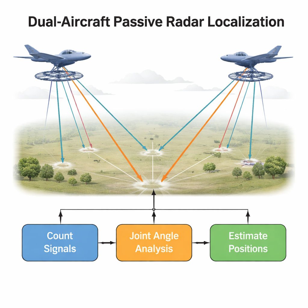
Modern military and security operations rely heavily on knowing who is transmitting radio signals, where they are, and what they are doing—all without revealing one’s own position. Traditional radar sends out pulses and listens for echoes, which can give away the radar’s location. Passive radar does the opposite: it quietly listens for signals that targets already emit. This paper explores a new way for two cooperating aircraft to work together to pinpoint several radio-emitting targets at once, more reliably and with fewer mistakes, even when the signals are weak and crowded.
Listening instead of shouting
Instead of blasting energy into the sky, passive systems simply listen to radio waves that ships, vehicles, or communication devices are already transmitting. Each aircraft carries a ring-shaped antenna that can tell from which direction a signal arrives, much like our two ears help us locate a sound. By comparing angles from two aircraft, the system can triangulate where each source is on the ground. The challenge is that in real battlefields there are often many emitters at once, and their lines of bearing—imaginary lines pointing from each aircraft toward a source—can cross and overlap. Conventional methods estimate angles separately on each aircraft and then try to match which line from aircraft A belongs with which line from aircraft B, a step that can easily go wrong and lead to misplaced targets.
Letting both aircraft think as one
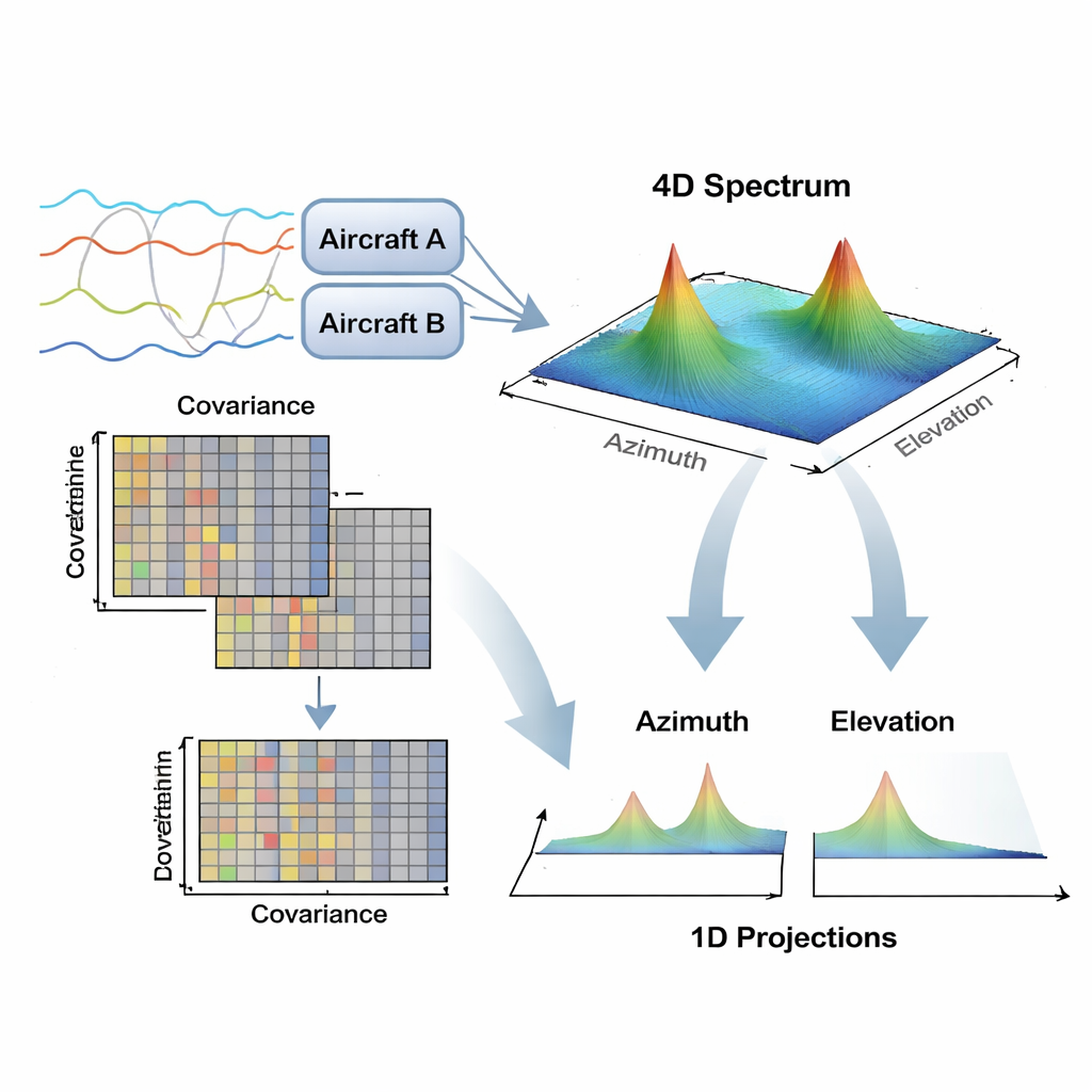
The authors propose treating the two listening aircraft as a single, larger virtual sensor. Instead of processing their measurements independently, they combine the raw data into one mathematical object called a covariance matrix. From this joint view they apply a well-known direction-finding technique, MUSIC, which acts like a highly selective directional microphone that can distinguish several sources at once. In this setup the method directly searches, in one shared "spectral" picture, for angle pairs that correspond to the same target as seen from both aircraft. Because the pairing is built into the search itself, the method largely avoids the fragile after-the-fact matching step that plagues older approaches.
Cutting the math down to size
Working with two aircraft and many targets quickly becomes computationally heavy, because the algorithm must scan through combinations of horizontal and vertical angles for both platforms. Brute-force search across four angle dimensions would be impractically slow. To make the problem manageable, the authors introduce a stepwise "dimensionality reduction" strategy. First, they exploit the fact that faraway ground targets sit at small elevation angles, so they initially fix the vertical angles and scan only the horizontal ones to get rough bearings. Then they refine the vertical angles in a narrower search, and finally polish both sets of angles with a fine grid. At each stage, they project the multi-dimensional energy map down to simple one-dimensional curves, where identifying peaks—and thus directions—is far easier and more robust in the presence of noise.
Testing the method in virtual skies
To assess performance, the researchers simulate two aircraft observing multiple ground targets in a noisy environment. They compare their dual-aircraft joint MUSIC approach against several classical direction-finding methods and modern passive localization schemes, while keeping the final position solver the same for fairness. The new method is particularly strong at estimating the horizontal angles and in correctly separating and matching multiple targets. It maintains good accuracy even when the signal-to-noise ratio is modest and when only a limited number of snapshots—short bursts of data—are available, conditions under which standard criteria for counting and separating sources often break down. Although height estimates remain more error-prone, especially because the antennas lie in a flat plane, horizontal position errors are typically well below a kilometer in the tested scenarios.
What this means in practice
For a non-specialist, the key outcome is that two listening aircraft, if they process their data together in the right way, can locate several independent radio emitters on the ground more reliably than if each aircraft works alone and tries to reconcile results afterward. The proposed technique folds source counting, signal separation, and cross-platform matching into a unified framework, while using mathematical shortcuts to keep computation within realistic limits. In plain terms, the method helps passive radar systems say, with greater confidence and fewer mix-ups, "these signals come from that particular set of vehicles over there"—an ability that is increasingly valuable for surveillance, electronic warfare, and situational awareness without revealing one’s own position.
Citation: Wang, H., Liu, X. & Lei, Z. Multi-target passive positioning with signal classification and MIMO radar. Sci Rep 16, 7777 (2026). https://doi.org/10.1038/s41598-026-36881-9
Keywords: passive radar, multi-target localization, angle of arrival, dual-aircraft sensing, signal processing