Clear Sky Science · en
Research on spatiotemporal risk assessment model of bird strike at airports and precise prevention and control strategies
Why birds and planes can be a dangerous mix
Every time an airplane takes off or lands, it shares the sky with birds. Most of the time nothing happens, but when a bird collides with an aircraft, engines can be damaged, flights diverted, and passengers delayed. In China alone, bird strikes cause hundreds of costly incidents each year. This study looks at how to predict when and where these encounters are most likely, so that airports can keep planes and birds safely apart while reducing unnecessary disruption.
A closer look at birds around a real airport
The researchers focused on Yan’an Nanniwan Airport in central China, a mid-sized facility surrounded by farmland, woodland, and hills that attract many bird species. They carried out detailed bird surveys in four representative months covering spring, summer, autumn, and winter. Teams of observers slowly walked 12 fixed routes in and around the airport during flight hours, counting bird species, numbers, heights, and locations every hour. They then checked these special surveys against the airport’s daily patrol records using a standard ecological similarity test, confirming that their data gave a reliable picture of bird activity across seasons and times of day.
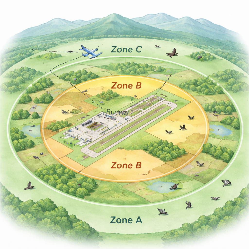
Dividing the sky into practical risk zones
Instead of treating the whole airport as one uniform area, the study divided the space into three zones that match how aircraft actually fly. The innermost zone covers the runway and nearby ground where aircraft move at low altitude and birds can be sucked directly into engines. The second zone includes the airspace just above and around the airport buildings, where planes are climbing or descending. The outer zone reaches several kilometers along the approach and departure paths, where aircraft are higher but still within the range of many flying birds. By matching these zones to bird positions, the team could ask not just “Are birds present?” but “Are birds present where aircraft are most vulnerable?”
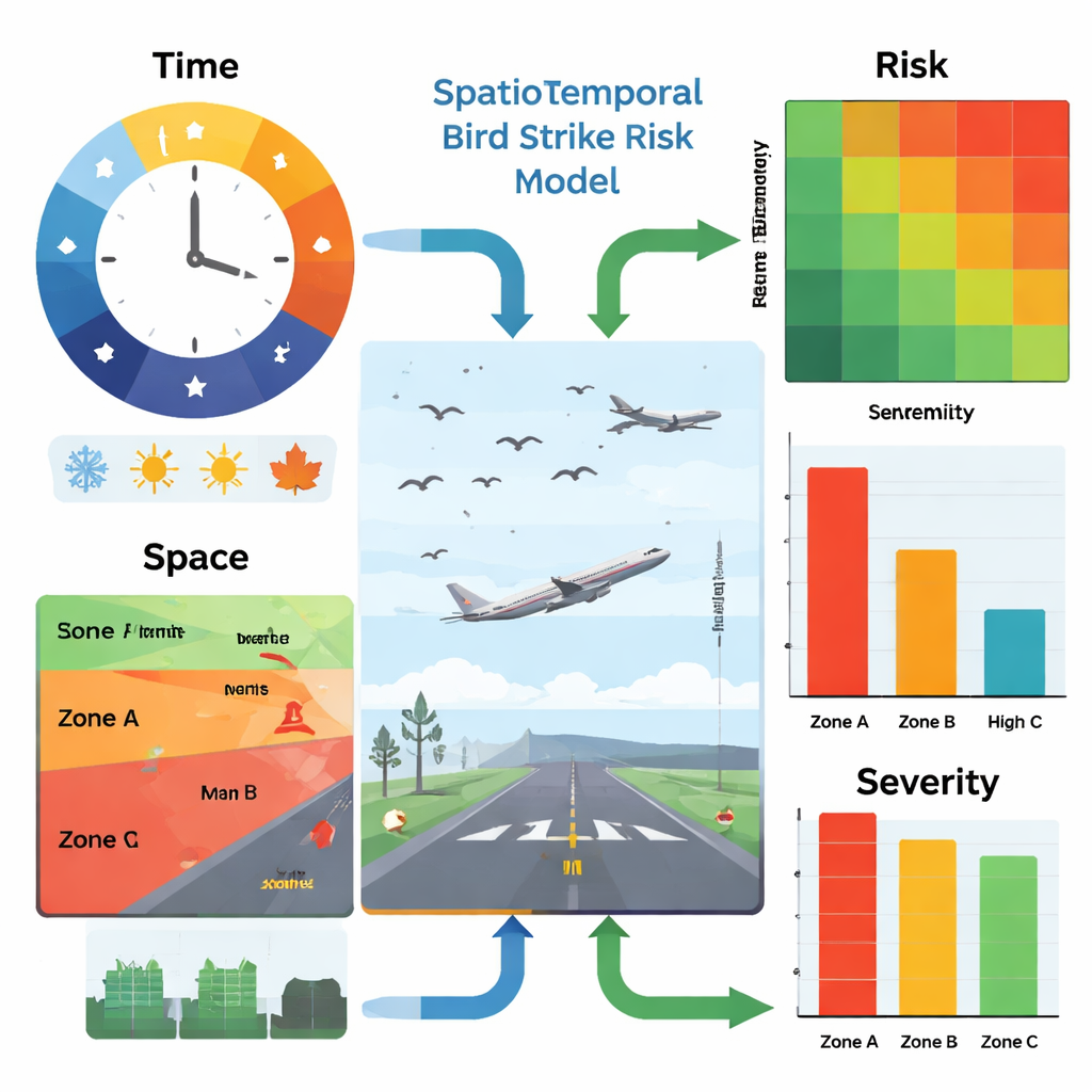
Blending time, space, and damage into one risk score
The heart of the work is a “spatiotemporal” risk model that combines when birds are active, where they are relative to aircraft paths, and how much harm a collision with each species might cause. First, the team calculated a time-based probability for each species by looking at its seasonal abundance, its hourly activity pattern, and how many flights occurred in each hour. They then estimated a space-based probability by measuring how close birds were to the runway and to the takeoff and landing paths, including the chance that birds from outer zones might drift into the most dangerous inner area. Finally, they assessed how serious a strike with each species would be, taking into account bird body weight, how many individuals were present, the type of aircraft, and whether the plane was taking off, landing, or cruising. These ingredients were combined using a risk matrix — a structured table that turns probability and severity into four clear levels: low, medium, high, and extremely high.
How the new model outperforms older methods
Many airports currently use simpler checklists that average bird risk over a whole year and over the entire surroundings. The new model was tested against China’s standard four-factor method using seven years of historical bird strike records from Yan’an Nanniwan Airport. Statistical analysis showed that the new approach matched the real pattern of strikes much more closely, especially in the runway zone and the near-airport airspace. It revealed that summer had the highest overall risk, and that the runway area was consistently the most dangerous. Common species such as sparrows and barn swallows emerged as key threats, not because they are large, but because they are abundant and frequently cross critical flight paths at busy times of day.
Turning numbers into targeted safety actions
By pinpointing high-risk combinations of place, time, and species, the model allows airports to tailor their responses. For example, it can highlight a narrow band beside the runway where grass should be cut and food sources reduced, a cluster of farmland along the approach path where tall trees and shrubs should be thinned, or specific morning or evening hours when extra bird patrols, sound cannons, or lasers are most useful. It also shows when and where risk is low enough that heavy-handed measures are unnecessary. In practical terms, this means safer flights, less wasted effort, and lower costs, offering airports a scientific roadmap to keep both aircraft and birds out of harm’s way.
Citation: Shi, Y., Jia, J., Lin, R. et al. Research on spatiotemporal risk assessment model of bird strike at airports and precise prevention and control strategies. Sci Rep 16, 6449 (2026). https://doi.org/10.1038/s41598-026-36814-6
Keywords: bird strike, aviation safety, airport wildlife, risk assessment, spatiotemporal modeling