Clear Sky Science · en
Evaluating the RUNOFF01 model’s performance and potential for micro-catchment design
Why turning rain into a resource matters
In dry regions, most of the precious rain that falls during short, intense storms rushes away as runoff instead of soaking into the soil where crops can use it. This paper explores whether a relatively simple computer model, called RUNOFF01, can reliably predict how much of that burst of rain will become runoff in small fields and specially built micro-catchments. If the model works well, farmers, engineers, and planners can design low-cost systems that capture more rainwater, reduce soil erosion, and keep crops alive through long dry spells.
How water races across the land
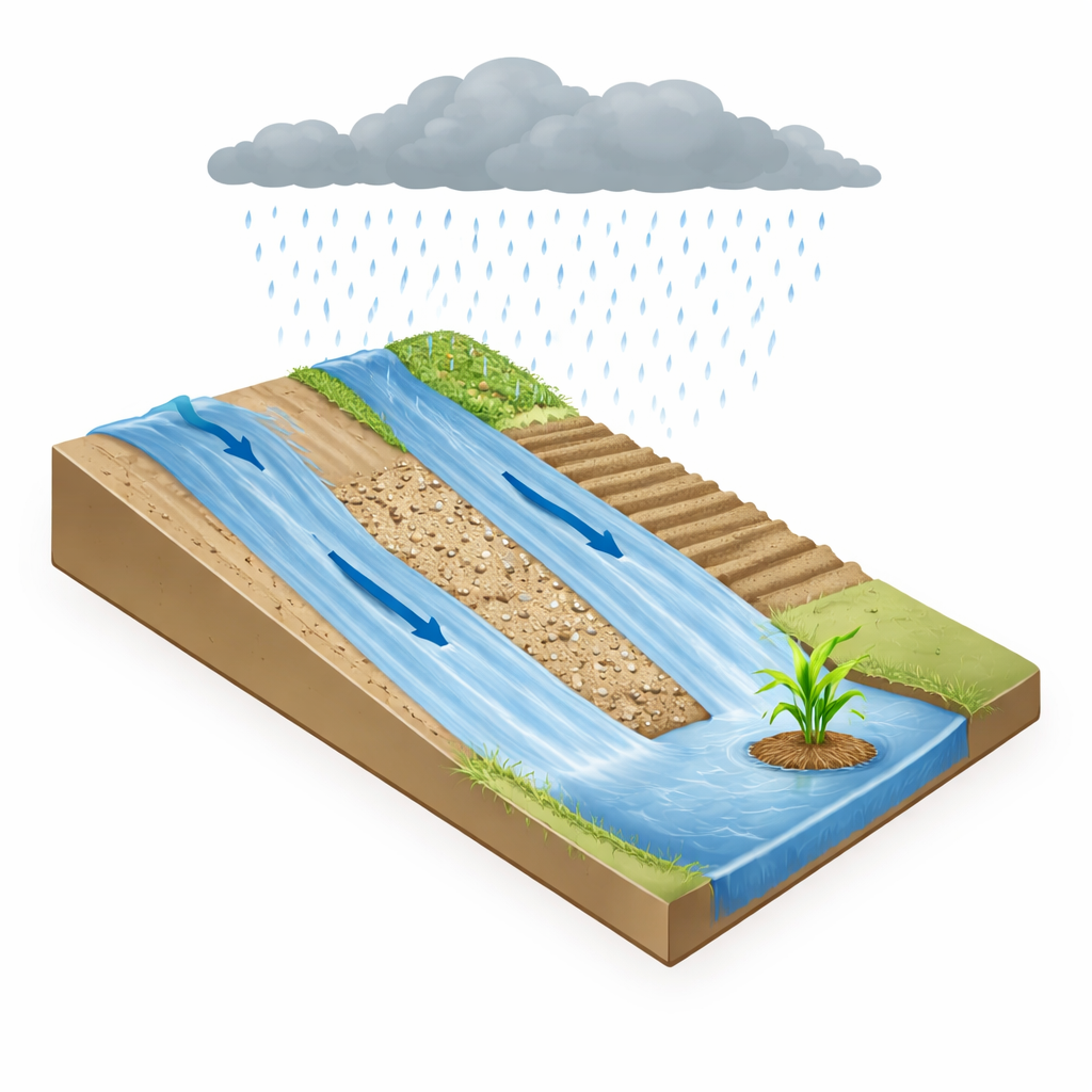
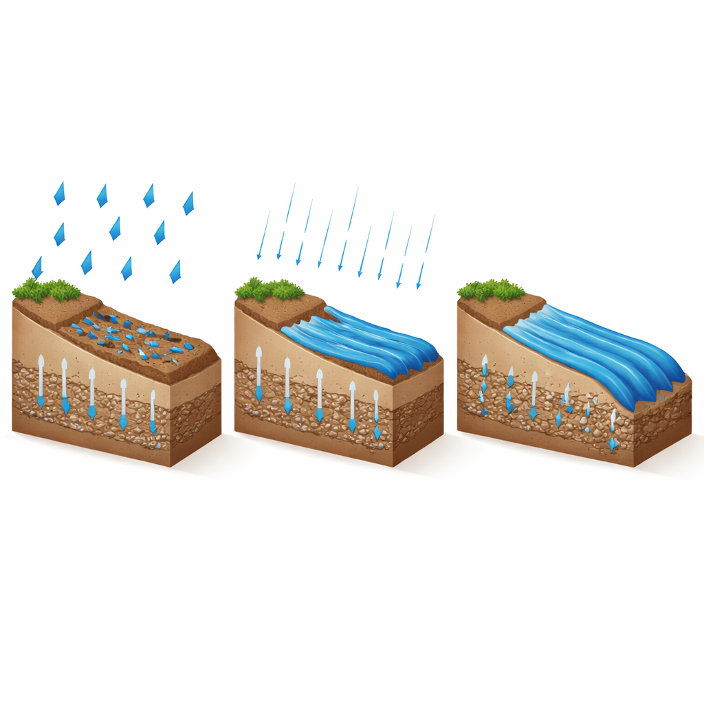
The study focuses on a particular kind of runoff that happens when rain falls faster than the soil can absorb it. In this situation, water starts to pond on the ground surface and then flows downhill as a thin sheet. Scientists describe this process as passing through three stages: first, a build-up phase, when the soil is still taking in water and the flowing area is expanding; second, an equilibrium phase, when the whole slope is contributing and the runoff rate at the bottom becomes steady; and finally, a recession phase, when the rain stops and the flow gradually dies away as surface water drains away. For small, steep catchments in dry climates, storms often last long enough that the slope quickly reaches the equilibrium stage, and almost all of it is actively feeding runoff.
A simple tool for a complex job
RUNOFF01 turns this behavior into equations that estimate how much water soaks into the soil and how much runs off downslope. The model first calculates how quickly the soil can absorb water, using a well-established formula that depends on how easily water moves through the soil and how strongly it is drawn into dry pores. Once rainfall outpaces this absorption, the model assumes runoff begins right away. A second part of the model then sends this shallow flow down the slope, using a streamlined description of how water depth, slope, and surface roughness together control how fast the water moves. Where the surface is rougher, such as with gravel cover, flow slows down; where the surface is smoother or crusted, water moves more quickly.
Putting the model to the test
To see how well RUNOFF01 performs, the authors compared its predictions against three very different sets of measurements. In controlled laboratory plots, they used earlier experiments on loam soil treated in various ways: left bare, covered with gravel, reshaped into small ridges, and sprinkled with a simple chemical that promotes surface crusting. In another set of flume tests, they examined sandy loam and silty clay soils under different slopes and rainfall intensities. Finally, they tested the model against data from a real 4.83-hectare agricultural catchment, where runoff had previously been simulated and measured using a more complex watershed model. Across these situations, the storms were long enough and the slopes short enough that the entire surface quickly became active in producing runoff.
How well the model matched reality
Across the laboratory experiments, RUNOFF01 closely reproduced both the timing and amount of runoff, with error levels rated as good to excellent by standard statistical measures, and a very tight match between predicted and observed values. Differences among surface treatments behaved as expected: gravel increased roughness and slowed flow, ridges sped it up by channeling water, and chemical crusting reduced infiltration and boosted runoff. In the flume tests, predictions for the sandy loam soil were especially accurate; silty clay, whose fine particles rearrange and seal pores during storms, proved more challenging but still showed strong agreement overall. In the real catchment, performance remained acceptable but less perfect, largely because the model does not track how wet or dry the soil was before each storm—a factor that strongly affects how quickly runoff begins.
What this means for dryland farming
The main takeaway is that, under conditions common in arid and semi-arid regions—short slopes and storms that last long enough for the whole slope to start flowing—RUNOFF01 can reliably estimate total runoff without worrying about “scale effects” that complicate larger basins. With only a few key inputs, such as rainfall intensity, soil infiltration rate, slope, and surface roughness, the model can guide the layout of micro-catchments, help size contributor and planting areas, and support erosion-control designs. While it still misses some real-world complexities, especially changing soil wetness between storms, it offers a practical, easy-to-use tool for turning brief, intense rainfalls into a dependable water supply for crops and for protecting vulnerable soils.
Citation: Shabani, A., Roodari, A. & Sepaskhah, A.R. Evaluating the RUNOFF01 model’s performance and potential for micro-catchment design. Sci Rep 16, 7966 (2026). https://doi.org/10.1038/s41598-026-36785-8
Keywords: rainwater harvesting, runoff modeling, micro-catchments, arid agriculture, soil infiltration