Clear Sky Science · en
Attention driven deep convolutional network with optimized learning for accurate landslide detection and monitoring
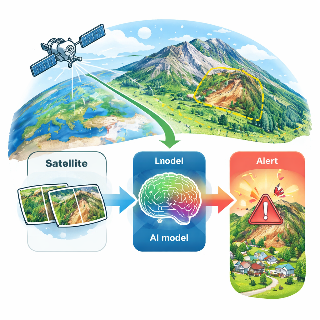
Why watching hills from space can save lives
Landslides can wipe out roads, villages, and vital infrastructure in a matter of seconds, often with little warning. Many mountain communities still rely on people in the field to spot early signs of slope failure, a job that is slow, dangerous, and easy to get wrong. This study shows how a modern form of artificial intelligence, trained on satellite images from around the world, can automatically scan vast areas, pick out unstable slopes, and do so with an accuracy that rivals — and often beats — traditional methods.
From field notebooks to orbiting cameras
Conventional landslide monitoring leans on ground surveys, visual inspections, and seismic instruments. These tools are powerful but limited: they cover only small areas, miss early, subtle changes, and are costly to maintain in remote, rugged terrain. In recent years, satellite missions have begun to offer a different view. Orbiting sensors repeatedly photograph the same hillsides at high resolution, capturing tiny shifts in texture, brightness, and vegetation that can hint at slope instability long before a collapse. The challenge is volume: there are simply too many images for humans to sift through by eye.
Teaching a machine to read the landscape
The authors tackle this challenge with a deep learning system built on VGG16, a well-known image-recognition model originally trained to recognize everyday objects. They retrain and adapt it using thousands of labeled satellite images from two public sources: a Kaggle landslide collection and NASA’s global landslide inventory. Each image is tagged as “landslide” or “non-landslide,” giving the model clear examples of what to look for. The network learns patterns in color, shading, and shape that distinguish a scarred, debris-covered slope from a stable, vegetated hillside, while remaining fast enough to be practical for near–real-time monitoring.
Letting the AI focus on the danger zones
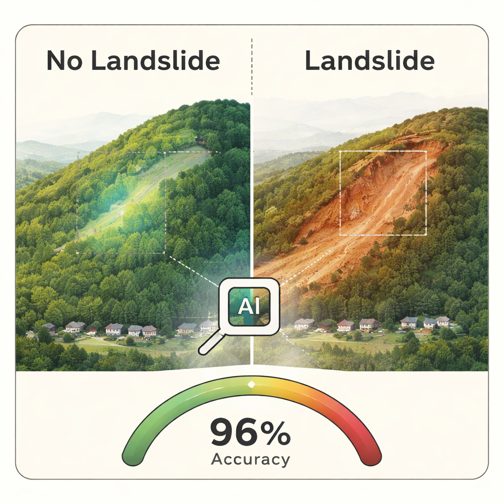
Instead of feeding raw pictures alone, the team builds a richer description of each scene. They compute simple statistics of pixel brightness, which capture overall changes in the ground surface, and texture measures that highlight rough, disrupted terrain typical of slide areas. They also add an index of vegetation health, so the system can notice when lush hillsides suddenly give way to bare soil. A “spatial attention” mechanism then teaches the network to concentrate on the most informative parts of the image — for example, a narrow scar on a steep slope — rather than treating every pixel equally. This attention map makes the model both more accurate and more interpretable, because it becomes clear which regions drove its decision.
Balancing accuracy, speed, and reliability
To keep the system dependable in many settings, the researchers carefully tune how the model learns. They experiment with different learning rates, batch sizes, and layers, and use an optimizer designed to stabilize training while still exploring better solutions. They also test alternative deep networks, such as ResNet and DenseNet, and compare how often each one correctly flags landslide images versus raising false alarms. Across both the Kaggle and NASA datasets, the enhanced VGG16 model consistently comes out on top, reaching around 95–96% accuracy while avoiding the overfitting that often plagues complex neural networks. It even runs on a small single-board computer, hinting at future field deployments in low-resource regions.
What the results mean for people on the ground
In plain terms, this work shows that a carefully engineered AI can reliably tell risky slopes from safe ones in satellite images gathered across different continents and climates. By combining multiple clues — brightness, texture, vegetation, and where in the image to look — the system spots landslides and landslide-prone areas far more effectively than manual surveys alone. Although it still depends on good-quality imagery and solid computing power, the approach points toward automated, large-area early warning systems. Deployed at scale, such tools could give authorities precious extra time to close roads, evacuate homes, and plan safer development in some of the world’s most unstable landscapes.
Citation: S.K.B, S., N, K., M R, P. et al. Attention driven deep convolutional network with optimized learning for accurate landslide detection and monitoring. Sci Rep 16, 6759 (2026). https://doi.org/10.1038/s41598-026-36737-2
Keywords: landslides, satellite imagery, deep learning, disaster monitoring, remote sensing