Clear Sky Science · en
Analysis of human flow during a natural disaster utilizing trajectory-free mobile network data: a case study of earthquake
Why tracking people in disasters matters
When an earthquake or typhoon strikes, people move: they evacuate homes, rush to check on family, or head toward shelters. For emergency managers, knowing where crowds are forming or which areas are emptying out can save lives. But most systems that track movement rely on personal location histories, raising privacy concerns and often arriving too late. This study shows how to read the "pulse" of human movement during a major earthquake using only anonymous, aggregated signals from mobile phones—no individual tracking required.
Seeing crowds through phone signals
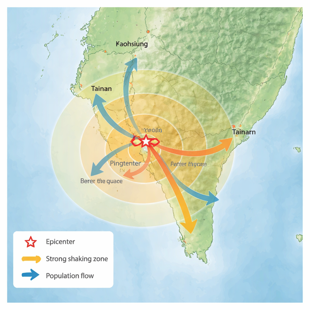
The researchers focused on the 2025 Dapu earthquake in southern Taiwan, a strong nighttime quake that caused heavy shaking and building damage in several districts. Instead of using GPS trails from individual phones, they relied on how many devices were actively connected to cellular towers inside 500-by-500-meter squares every 10 minutes. Each square simply recorded a count of active phones, acting as a rough proxy for how many people were there at that moment. The data covered four hours around the event, from late evening before the quake to several hours afterward, across cities, towns, and rural areas.
From scattered dots to smooth patterns
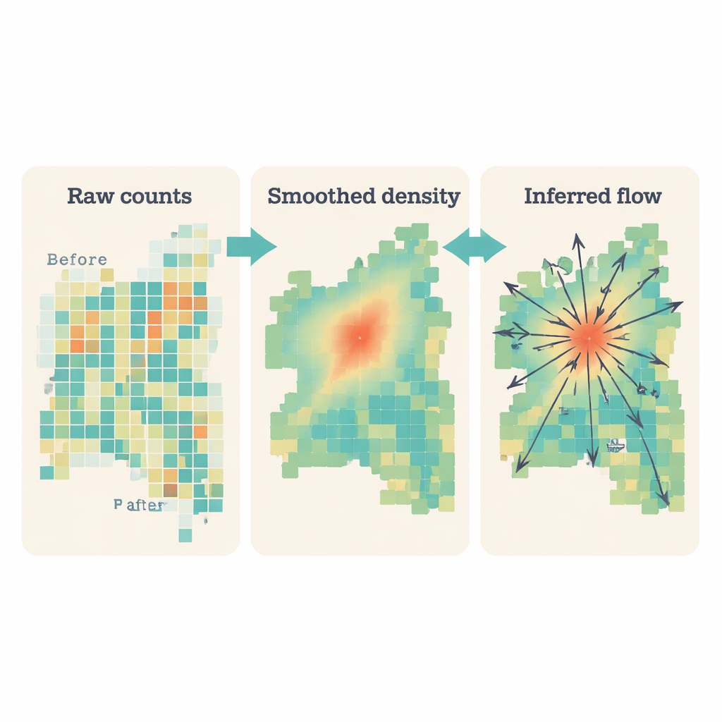
Raw counts in a patchwork of grid squares are noisy and uneven, especially where cell towers are sparse. To make sense of this, the team first converted the scattered counts into a smooth surface, where each place on the map gets a value representing likely crowd density. This is done with a mathematical "smoothing" kernel that spreads each grid’s influence over its neighborhood, somewhat like blurring a pixelated image. The result is a continuous picture of where people are concentrated and how those concentrations change every 10 minutes, while still keeping the underlying phone data anonymous and aggregated.
Turning crowd maps into movement arrows
Knowing where people are is only half the story; emergency planning depends on where they are going. To estimate direction, the researchers adapted a classic tool from geography known as a gravity model—normally used to describe how people or goods move between cities. In their version, areas with more people act like stronger "magnets" for nearby areas, and the strength of attraction falls with distance. By comparing the smoothed crowd surfaces from one time step to the next, and applying this gravity-like rule within a local window, they calculated a field of arrows showing where people were probably moving and how strongly. Repeating this across time produced a movie of invisible flows: arrows radiating out, pulling in, or shifting direction as the situation evolved.
How people reacted to the Dapu earthquake
Applied to the Dapu quake, the method uncovered clear and rapid changes in human movement. Before the shock, flows around urban centers showed a gentle outward spread typical of late-night activity. Right after the quake, many arrows flipped direction, pointing inward toward town centers, dense neighborhoods, and officially designated shelters. This shift was strongest in urban areas with moderate to high shaking, where many buildings were damaged, and weaker in sparsely populated rural zones. By counting how many grid cells showed large changes in direction, the team found a sharp spike in disrupted movement in the first 20–30 minutes, gradually settling back toward normal within about two hours. Different shaking zones showed different timing and intensity of response, with more people moving in moderately shaken, densely populated areas.
What this means for future emergencies
For non-specialists, the key message is that we can learn a lot about how people react to disasters without tracking any single person. By combining anonymous mobile network counts with smart mathematical tools, this framework turns simple phone activity records into maps of where people are converging, where they are leaving, and how quickly patterns stabilize. In an actual emergency, such maps could flag neighborhoods where crowds are unexpectedly forming, where evacuations are underway, or where communication networks may have failed. That information could help authorities direct rescue teams, open or close roads, and plan shelter capacity, all while respecting privacy and working with data that mobile networks already collect.
Citation: Huang, MW., Lin, CY., Ke, MC. et al. Analysis of human flow during a natural disaster utilizing trajectory-free mobile network data: a case study of earthquake. Sci Rep 16, 5275 (2026). https://doi.org/10.1038/s41598-026-36255-1
Keywords: earthquake, human mobility, mobile network data, disaster response, population flow