Clear Sky Science · en
Radiological Hazard Assessment of Soil at North Oil Company Using Spatial Distribution and Monte Carlo Simulation in Kirkuk Governorate, Iraq
Why oil fields and invisible radiation matter
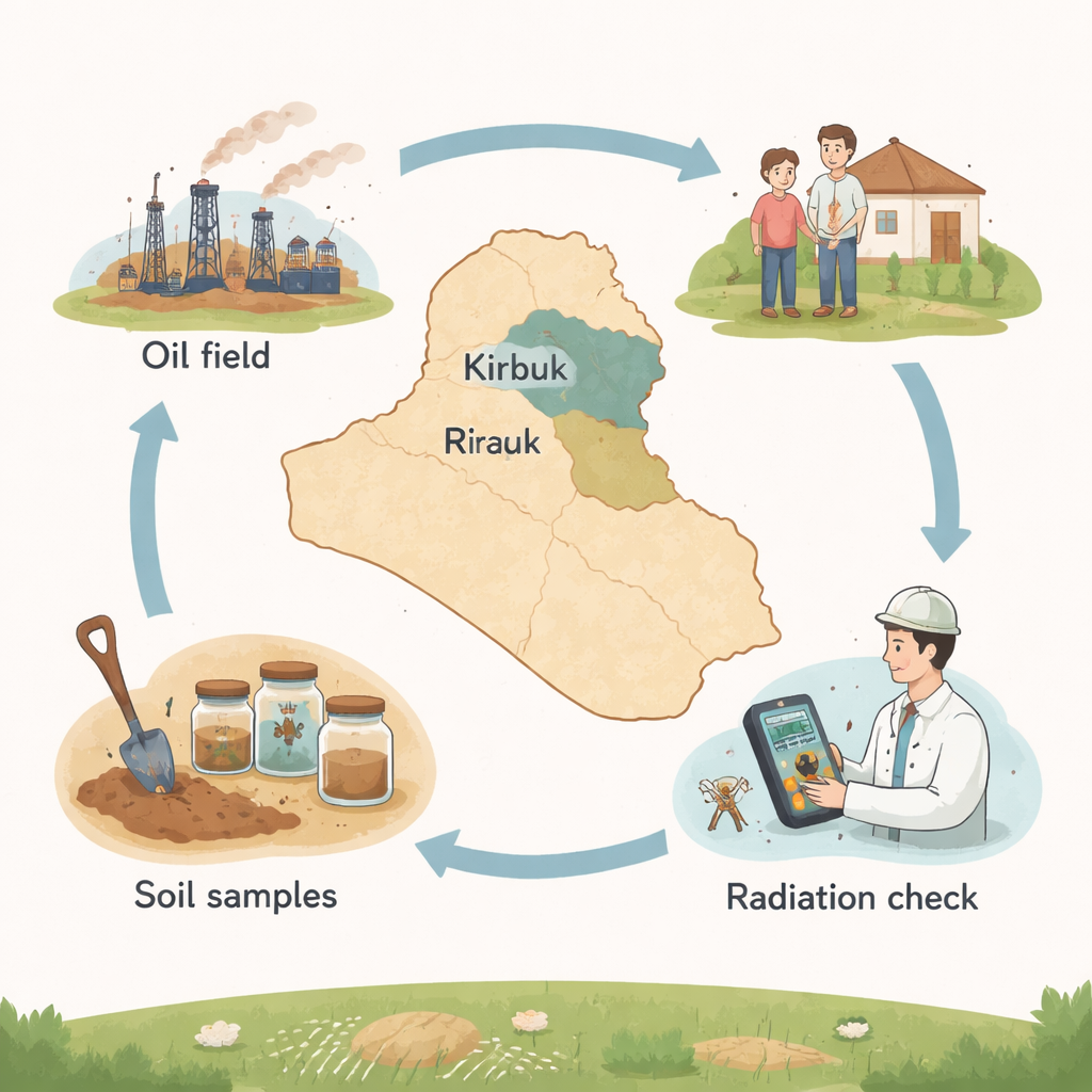
Oil fields are often associated with spills and smoke, but they can also bring naturally radioactive elements from deep underground up to the surface. In northern Iraq’s historic Kirkuk oil region, scientists set out to learn whether decades of oil production have raised radiation levels in the local soil, and what that might mean for workers and nearby communities. Their findings help answer a simple but important question: is it safe to live and work around these fields today, and how can we keep it that way in the future?
Hidden elements in everyday earth
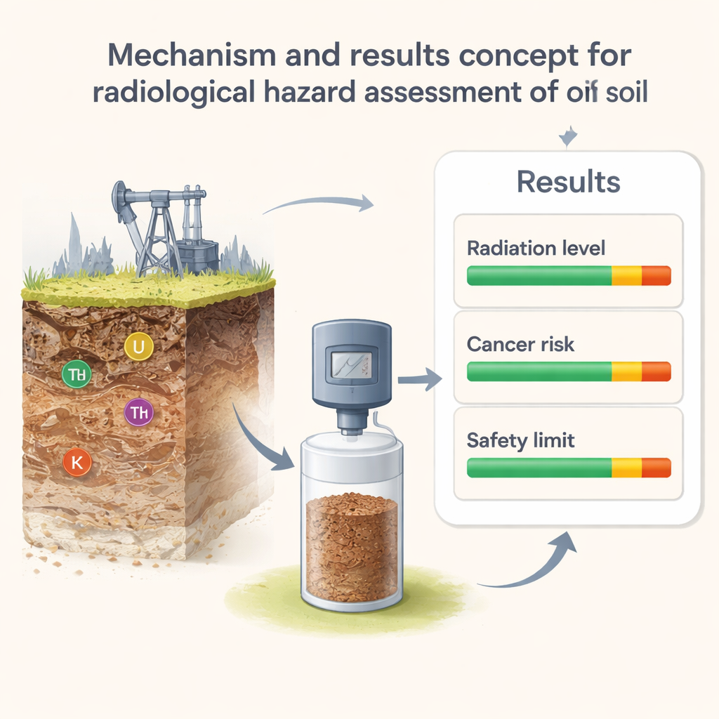
All soil contains tiny amounts of radioactive substances, especially forms of uranium, thorium, and potassium. These are part of the Earth’s natural makeup and have been present since long before humans began drilling for oil. However, industrial activities can concentrate these materials in certain spots. Oil extraction, whether through conventional wells or more intensive methods such as hydraulic fracturing, can pull rock and fluids from deep layers to the surface, where they mix with topsoil and waste. Over time, this can potentially increase the dose of radiation people receive through air, water, and food grown in affected soil.
Taking and testing soil from an oil giant
The researchers focused on the North Oil Company area in Kirkuk, one of Iraq’s oldest and most productive oil regions, in operation since 1929. They collected 50 soil samples from the top few centimeters of ground across the oil fields, a layer most affected by spills, dust, and plant growth. In the laboratory, the soil was cleaned, dried, and ground to a fine powder, then sealed and stored to allow the radioactive families of uranium and thorium to stabilize. Using a gamma detector, which counts the faint flashes of light produced when radiation hits a crystal, they measured how much of each key element was present and converted those counts into standard activity levels.
From measurements to health risk
Raw radiation numbers do not immediately tell us if an area is safe, so the team translated their measurements into several simple risk indicators. These included how much radiation a person standing one meter above the ground would absorb, an estimate of the extra radiation dose people receive in a year, and a lifetime cancer risk related to that exposure. They also calculated indices that compare all three elements together and checked whether the soil appeared contaminated relative to worldwide natural background levels. To see how radiation varied from place to place, the researchers used mapping tools to create color-coded “heat maps” of the oil fields and statistical tests to check whether any high readings formed meaningful clusters.
What the maps and models revealed
On average, the amounts of uranium, thorium, and potassium in Kirkuk’s oil-field soils were actually lower than global background values commonly used by radiation experts. Most of the dose and hazard indicators also fell well below international safety limits, suggesting that the area as a whole does not suffer from serious radiological pollution. Nonetheless, the detailed maps showed localized “hotspots” where certain indices, particularly those related to radiation received by sensitive organs, were higher than the typical reference level, although still not extreme. Statistical tests indicated that, overall, the pattern of radioactivity looked mostly random, shaped by natural differences in rocks and soils as much as by human activity.
A small added risk and a clear warning signal
To better understand uncertainty, the team used a Monte Carlo simulation—a computer method that repeatedly varies the input data within realistic bounds—to explore a wide range of possible lifetime cancer risks. The average value they obtained was slightly above the worldwide figure expected for natural background radiation, but still within what radiation protection bodies view as acceptable for the general public. For non-specialists, this means that living near these oil fields does not currently pose a major radiation threat, even though the risk is marginally higher than in some other places.
Keeping an eye on the future
Overall, the study concludes that soils in the North Oil Company area are only mildly affected by radioactivity and that the present health risk is low. However, because oil extraction can slowly alter the distribution of radioactive materials, the authors stress that regular monitoring is essential, especially around the locations identified as hotspots. Their work provides a much-needed baseline for Iraq: a starting picture of where things stand today. As oil production continues and methods evolve, repeating this kind of survey will help ensure that industrial growth does not quietly erode environmental safety for nearby workers, families, and ecosystems.
Citation: Namq, B.F., Wais, T.Y. Radiological Hazard Assessment of Soil at North Oil Company Using Spatial Distribution and Monte Carlo Simulation in Kirkuk Governorate, Iraq. Sci Rep 16, 5173 (2026). https://doi.org/10.1038/s41598-026-36093-1
Keywords: soil radioactivity, oil fields, environmental monitoring, radiation risk, Iraq Kirkuk