Clear Sky Science · en
A method for planning cycling networks in traditional village contiguous areas using Wi-Fi probe-based attractiveness evaluation
Why village bike routes matter
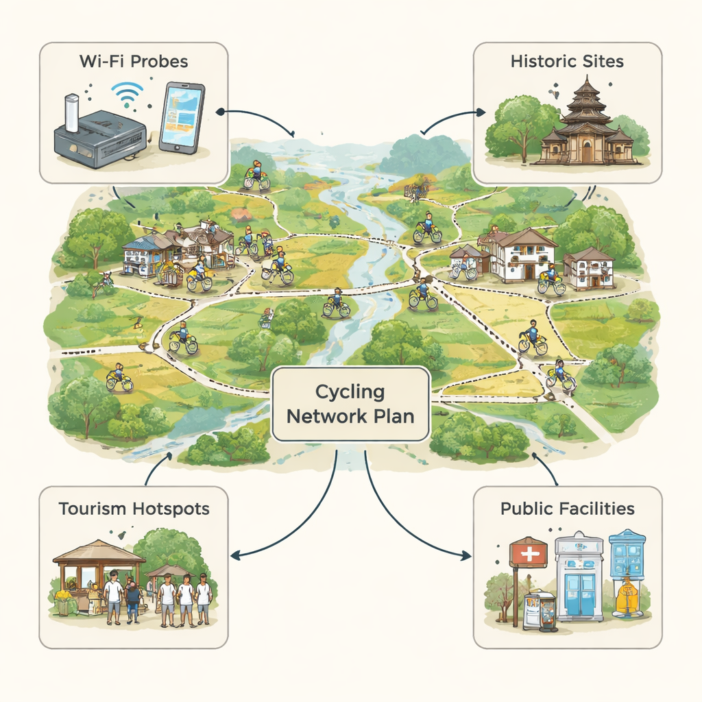
Across the world, historic villages are trying to stay alive as people flock to big cities. One promising strategy is to invite visitors to slow down and explore these places by bicycle. But if cycling routes are drawn only on paper, without understanding where people actually like to walk and ride, many of those paths end up empty. This study from Tonglu County in eastern China shows how simple wireless sensors can reveal real movement patterns in and around traditional villages, and uses that information to design village cycling networks that people will truly use.
Old villages, new pressures
Traditional villages preserve historic buildings, farming landscapes, and long-standing ways of life. In China, many such villages have disappeared during rapid urbanization, and national policies now encourage protecting not just single villages, but whole belts of them. Cycling is seen as a gentle way to connect these places, linking residents, visitors, and local businesses. Famous European examples show that well-designed cycling routes can revive rural areas. Yet in many Chinese villages, existing bike paths are poorly linked to village centers and historic streets, so tourists often ride past instead of stopping, and activity is scattered in time and space.
From paper maps to living movement
Most cycling plans focus on fixed features: road width, slope, and the presence of shops or tourist sites. These are important, but they do not show how people actually move hour by hour. Using ideas from time–geography, the authors argue that a good route should combine two qualities: it should attract many people, and it should keep that attraction steady over the day. To capture these patterns in a rural setting where phone data are too coarse, they turned to Wi‑Fi probes—small devices that listen for anonymous signals from nearby mobile phones. Unlike GPS apps, Wi‑Fi probes do not need users to sign up or keep an app open, and they can track movement with high time and space accuracy.
Listening to the paths people already choose
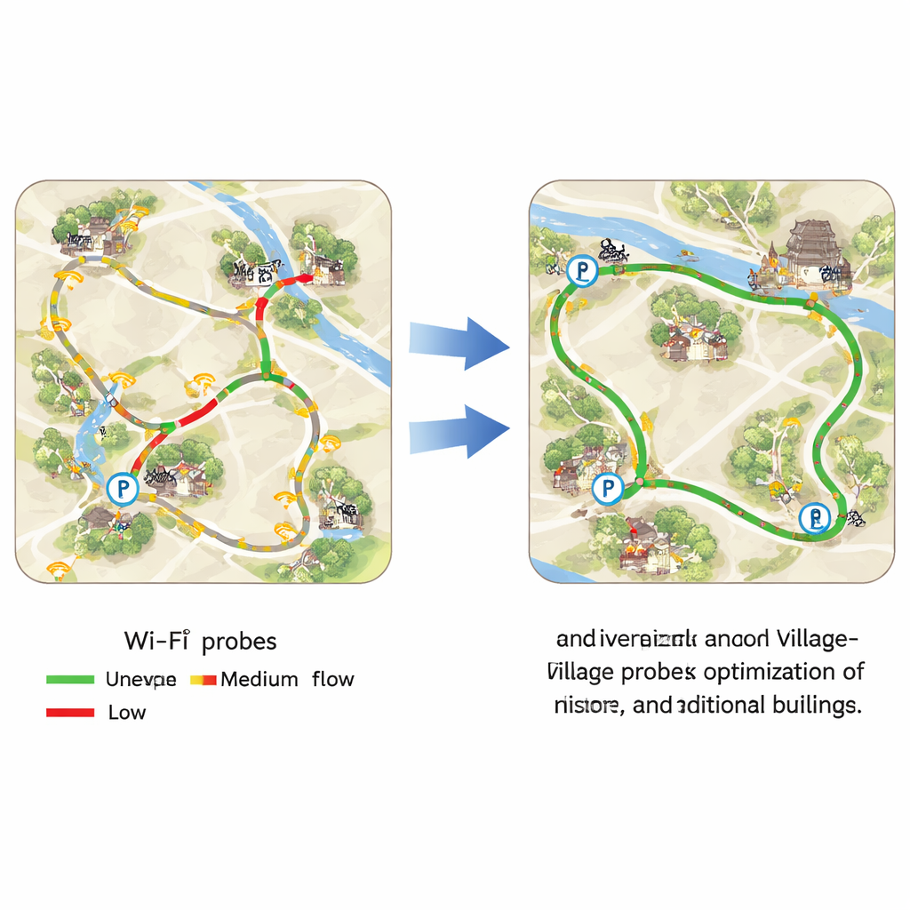
In two neighboring historic villages, Xufan and Huanxi, the team first filtered streets using simple physical rules: only paths wide and gentle enough to ride, and not dead-end lanes or streets with high heritage protection. They then identified “potential routes” that naturally connect village entrances, bus stops, parking lots, historic buildings, and clusters of public services such as food, lodging, and transport. Next, they installed 50 Wi‑Fi probes at key junctions and along longer streets, monitoring movements for four summer days from morning to late afternoon. By counting unique devices moving between probes, they calculated how many people used each street per hour, and how often that use stayed above the village-wide average.
Turning measurements into better bike networks
For every street segment in the preliminary network, the researchers combined two scores: “retention intensity” (how many people passed per meter of street per hour) and “retention stability” (how many hours it stayed busier than average). After normalizing and averaging these, they grouped streets into five levels of attractiveness. They then built a final cycling network by merging the most attractive streets with the previously identified potential routes that serve historic sites and facilities. The result was a 57‑segment loop-like network: sparser in the north, denser in the south, with stronger links between village gateways, riverside spaces, and clusters of old buildings.
Do smarter routes really help?
To test the method, the authors compared their proposed network with the official cycling plan from an earlier heritage protection document. Using standard measures of how easily cyclists can reach all parts of the network, how many historic sites are connected, and how many public facilities are served, the new network performed better on all counts. Overall accessibility rose slightly, while links to historic attractions and public services each improved by about 12 percent. At the same time, the study revealed that only about one quarter of the existing streets had medium or higher attractiveness, and the busiest stretches were near village entrances, rivers, and historic clusters—useful guidance for future upgrades.
What this means for villages and visitors
For non-specialists, the main message is straightforward: the best bike routes start from people’s real behavior, not just from pretty maps. By quietly measuring how visitors and residents already move, and then weaving that knowledge together with historic sites and everyday services, planners can design cycling networks that invite riders to slow down, linger, and spend more time (and money) in traditional villages. While the method still needs longer-term testing and adaptation to different landscapes, it offers a practical, low-cost way to support living heritage—helping old villages stay vibrant in a rapidly changing world.
Citation: Liu, S., Wang, S., Gao, Y. et al. A method for planning cycling networks in traditional village contiguous areas using Wi-Fi probe-based attractiveness evaluation. Sci Rep 16, 5787 (2026). https://doi.org/10.1038/s41598-026-36085-1
Keywords: rural cycling, traditional villages, Wi-Fi sensing, cultural tourism, active travel planning