Clear Sky Science · en
Impact and evolution of hydrological drought in Dagu River Basin under the shared socioeconomic pathways
Why future river droughts matter to everyday life
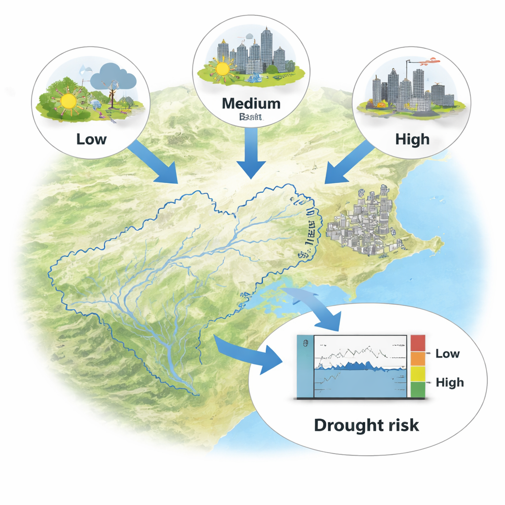
Along China’s northeast coast, the Dagu River is more than a blue line on a map: it supplies drinking water to millions of people in Qingdao and irrigates fields that feed surrounding communities. As the climate warms and the region’s economy grows, this lifeline is increasingly at risk of running low or even running dry. The study summarized here asks a simple but urgent question with far-reaching consequences for households, farmers, and city planners: how will river droughts in the Dagu River Basin change over the coming decades, and what tools can help us see those changes in advance?
Looking ahead with new forecasting tools
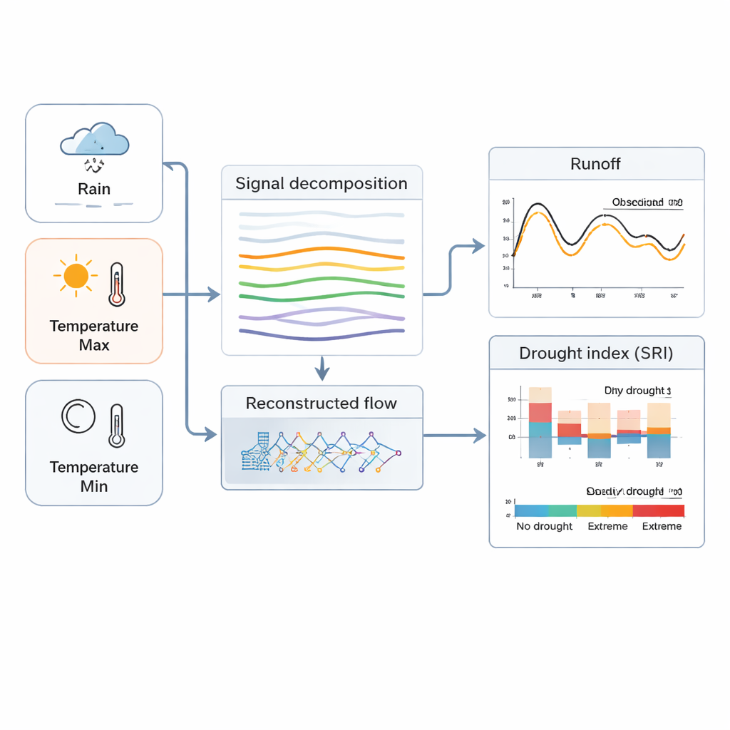
To explore tomorrow’s droughts, the researchers first needed a way to peer into the future of the basin’s streamflow. Traditional hydrological models, which simulate how rain and snow move through soil and rivers, can struggle with today’s rapidly changing climate and land use. At the same time, modern AI methods excel at finding patterns in messy data but often act like “black boxes.” This work combines the strengths of both worlds by using a hybrid deep‑learning model called EMD‑LSTM. It takes long records of rainfall and temperature, carefully separates fast swings from slow trends, then feeds this cleaned signal into a specialized neural network that learns how much water is likely to flow down the Dagu River each month.
Climate storylines for a working river
The team then drove their model with future climate projections from five of the latest global climate models (CMIP6). These models describe not only how greenhouse gases may rise, but also how societies might develop along different “shared socioeconomic pathways” that range from greener, cooperative futures to fossil‑fuel‑heavy growth. For each pathway, the researchers examined two time windows: mid‑century (2041–2060) and late‑century (2081–2100). Across all futures, the Dagu River Basin becomes warmer, with average monthly temperatures climbing by roughly 1.3–2 degrees Celsius by mid‑century and as much as 3.8 degrees by late‑century in the highest‑emissions case. Rainfall does not simply rise or fall; instead, it becomes more erratic, with some months much wetter and others drier than today, especially under the most energy‑intensive scenario.
Turning river flow into drought signals
More heat and jumpy rainfall do not automatically translate into clear‑cut droughts, so the authors used a standardized runoff index—essentially a score that compares each month’s flow to typical past conditions—to flag when the river is unusually low. They calculated this index at three time scales: 1 month, 3 months, and 12 months. Short scales reveal quick swings between dry and wet conditions, while the year‑long scale highlights persistent deficits that matter for reservoirs and long‑term planning. The results show a pronounced see‑saw pattern between dry and wet spells in all scenarios. Droughts are projected to be more frequent and generally more intense around mid‑century than toward the end of the century, even though temperatures keep rising. As the time window considered grows longer, individual droughts tend to last more months but their average intensity weakens, reflecting how prolonged but moderate shortages can accumulate into serious stress.
Measuring how rare and risky droughts will be
For water managers, knowing that droughts will happen is not enough; they also need to know how severe a “once in decades” event might look. To answer this, the study goes beyond single‑number drought scores and analyzes duration, depth, and intensity together. Using a statistical tool called a copula, the researchers estimated how often a drought that is both long‑lasting and very severe might recur under each future storyline. These joint probabilities show that when low flows persist for many months and fall far below normal, the waiting time between such events lengthens sharply—but the influence of different socioeconomic pathways on these joint risks is relatively modest for this basin. In other words, for Dagu River, the core threat is the combination of warming and shifting rainfall itself, regardless of the precise development path.
What it all means for people and planning
In everyday terms, this study finds that the Dagu River’s future is likely to be more volatile: hotter conditions and uneven rains will cause the river to swing between high and low flows, with mid‑century bringing a particularly challenging cluster of droughts. Yet the work also offers a hopeful message. By showing that the EMD‑LSTM hybrid can track river behavior more accurately than several established models, the authors provide a sharper early‑warning tool for local authorities. With better forecasts and a clearer picture of how often serious droughts might strike, city planners and water managers can design reservoirs, backup supplies, and conservation measures that keep taps flowing and fields productive, even as the climate shifts.
Citation: Yang, H., Kang, F., Yang, F. et al. Impact and evolution of hydrological drought in Dagu River Basin under the shared socioeconomic pathways. Sci Rep 16, 5219 (2026). https://doi.org/10.1038/s41598-026-36042-y
Keywords: hydrological drought, climate change, deep learning, water resources, China coastal rivers