Clear Sky Science · en
Spatiotemporal evolution and drivers of production-living-ecological land in the northern Tianshan Mountains using complex network analysis
Why this fragile region matters
The northern slope of China’s Tianshan Mountains squeezes farms, towns and wild landscapes into a narrow strip of land. It grows grain, cotton and livestock for the country, but also holds deserts, grasslands and snow‑fed rivers that keep this oasis alive. As cities and fields spread, they compete with the natural areas that protect soil, water and climate. This study asks a simple but urgent question: how is the balance between land for production, land for living, and land for nature changing here, and what is pushing those changes?
A landscape under pressure
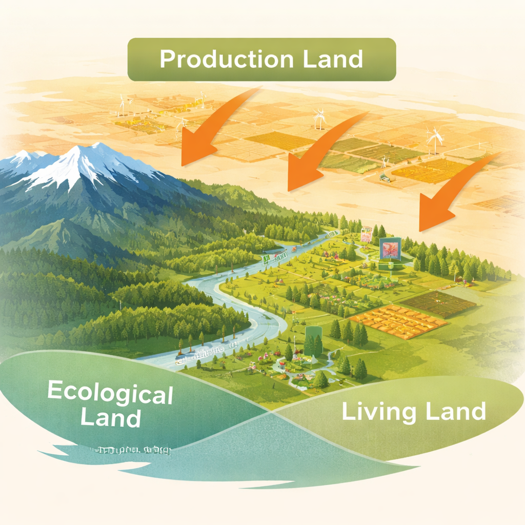
The researchers divide all land into three everyday functions: land that produces food and raw materials, land where people live and work, and land that mainly supports nature. On the northern Tianshan slope, natural land still dominates, covering more than 60 percent of the area. Much of this is desert, bare rock and fragile grassland, with smaller pockets of forests, wetlands, rivers and lakes. Productive farmland and grazing land fill the greener oases, while towns, villages and industrial sites cluster along roads and near government centers. This mix forms a classic mountain–oasis–desert belt, where human activity depends entirely on water and soil coming from the high mountains.
From grass and sand to fields and cities
Using satellite‑based land‑use maps from 2000 to 2023, the team tracks how each land type expands or shrinks. Over two decades, natural ecological land shrank by more than 5,000 square kilometers, even though it still covers most of the region. In contrast, cropland and grazing land grew by nearly 3,700 square kilometers, and land for towns and industry expanded by more than 1,600 square kilometers. The biggest winner was agricultural land, which increased by about 4,500 square kilometers. Urban and industrial areas grew even faster in percentage terms—industrial land more than tripled—though they still occupy a small share of the total area. Most of this new development replaced grassland and other ecologically important areas.
Seeing land as a connected network
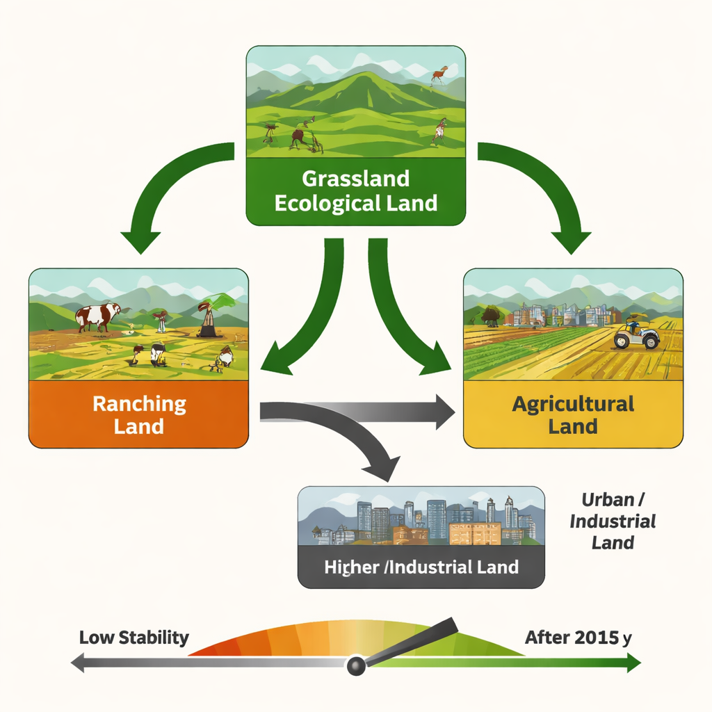
Instead of treating each land change as an isolated swap, the authors borrow tools from network science—the same ideas used to study social media or power grids. They treat each land type as a “node” and every conversion from one type to another as a “link.” This allows them to see which types sit at the center of change, how easily land can flip from one use to another, and how stable the overall system is. Three land types emerge as key hubs: grassland used mainly for nature, ranching land, and farmland. Grassland and ranching land are heavily converted into cropland, while cropland and natural land, in turn, feed the growth of towns and factories. On average, any land type can be reached from another in just a little more than one step in this network, which means the system is highly connected—and, worryingly, easy to disturb.
What drives the shift
To uncover what pushes these conversions, the study combines climate, terrain, population and economic data at the county level. Warmth, rather than rainfall, turns out to be the main natural factor guiding expansion of farmland in this irrigated region: places with enough heat for crops and sufficient labor see the most growth in production land. Population growth and rising incomes strongly drive the spread of cities and industrial zones, especially near major roads and administrative centers. Steep slopes and harsh high‑mountain conditions act as partial safeguards, making it harder for farms and towns to climb upslope and helping pockets of ecological land to persist or recover. National “Western Development” policies and farm subsidies have further encouraged agricultural expansion and rapid urbanization, even though they are not directly measured in the models.
What it means for the future
For a non‑specialist, the takeaway is stark: the northern Tianshan region is running its land system in a high‑risk, low‑stability mode. Natural areas still dominate on paper, but they are being steadily carved up by farms and expanding towns, with grasslands and degraded desert edges taking the biggest hit. Because the land‑use network is so tightly connected, changes in one part—such as a new irrigation project or industrial park—can quickly ripple through the whole system. The authors argue that key land types like grassland, ranching areas and cropland must be managed as strategic hubs, with stricter protection for fragile ecosystems and smarter limits on urban sprawl. Otherwise, the current pattern of growth will be difficult to sustain without eroding the very ecological base that keeps this oasis region alive.
Citation: Zhang, Z., Liu, Z., Yin, X. et al. Spatiotemporal evolution and drivers of production-living-ecological land in the northern Tianshan Mountains using complex network analysis. Sci Rep 16, 6283 (2026). https://doi.org/10.1038/s41598-026-35910-x
Keywords: land use change, Tianshan Mountains, grassland conversion, urban expansion, ecosystem stability