Clear Sky Science · en
Vorticity budget analysis of a mesoscale convective vortex during the July 2022 flash flood in Northern Tehran
Why this sudden flood matters
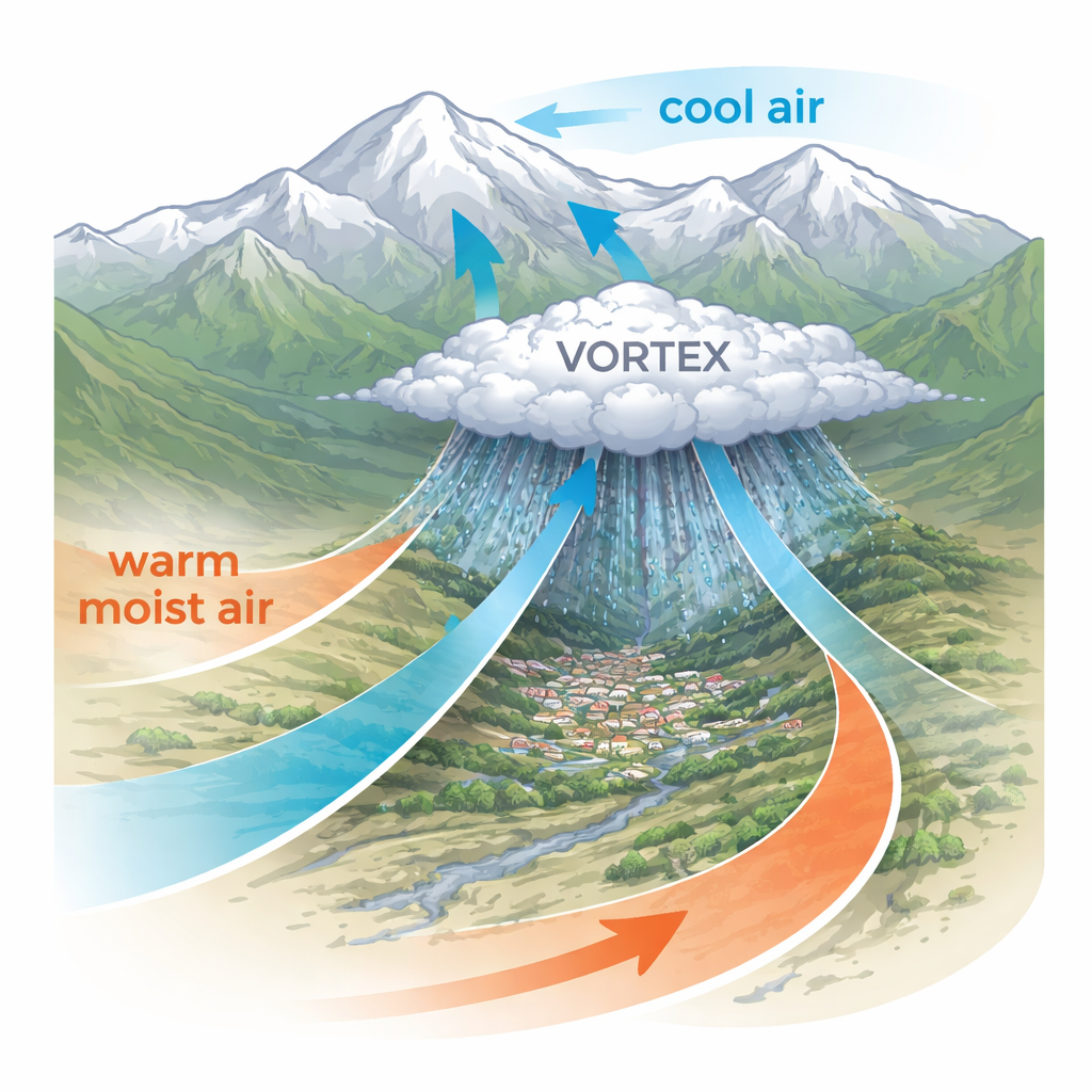
On a July evening in 2022, a torrent of mud and water rushed down a mountain valley in northern Tehran, killing dozens of people in the village of Imamzadeh Davood. At first glance, it looked like a sudden cloudburst over steep terrain. But behind this disaster was a subtle spinning weather system, too small for many forecasts to capture clearly. This study dissects that event in detail, showing how a compact atmospheric vortex helped turn moist summer air into a deadly flash flood — and what that means for predicting similar events in other mountainous, semi‑arid regions.
A hidden whirlpool in the sky
The focus of the paper is a mesoscale convective vortex, or MCV — a spinning pocket of air a few hundred kilometers wide that can live for hours to days inside large thunderstorm systems. Using a combination of ERA5 reanalysis data, satellite rainfall estimates, infrared cloud images, and Doppler radar, the authors reconstruct how such a vortex formed south of Tehran on 27 July 2022 and moved north as storms intensified. The vortex did not resemble a classic cyclone spanning half a continent; instead, it was a compact, mid‑tropospheric swirl embedded within a convective storm cluster. Yet its timing and position lined up closely with the convective organization and the most intense rainfall over the flood‑stricken valley.
Two colliding air masses over sharp terrain
The atmosphere that day was primed for trouble. High above Iran, the polar jet stream dipped unusually far south and intersected the subtropical jet, creating regions of rising motion. Near the ground, a low‑pressure center over central Iran helped draw in very warm, humid air from the south, linked to monsoon flows from the Indian Ocean. At the same time, cooler air from higher latitudes slid in from the northwest and west. Over northern Tehran, these contrasting air masses met along the foothills of the Alborz Mountains. Satellite data showed cloud tops as cold as −65 °C, signaling tall, powerful thunderstorm towers, while radar captured a line of strong echoes that later weakened as the system decayed. The complex terrain funnelled and focused low‑level winds and moisture, magnifying the impact of the colliding air streams.
The spin that supercharged the storm
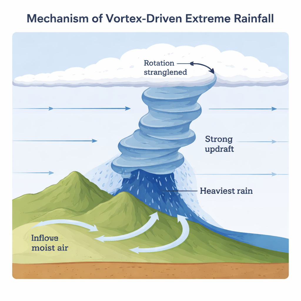
To understand why the vortex intensified, the researchers computed a full “vorticity budget” throughout the atmosphere — essentially tracking how different physical processes added or removed spin from the air column. Four mechanisms mattered: horizontal advection (spin carried in by the wind), vertical advection (spin moved up or down), stretching (air columns speeding up as they are squeezed), and tilting (turning horizontal spin into vertical spin in wind shear). Several hours before the heaviest rain, horizontal advection dominated in the 700–600 hPa layer, building a core of cyclonic rotation. Closer to the ground, stretching and tilting took over, as strong vertical wind shear converted horizontal spin into vertical spin and low‑level convergence squeezed the rotating column. Vertical advection, in contrast, often acted as a brake, shuttling vorticity vertically in a way that partially cancelled the growth of spin near the surface. The net result was a vertically coherent vortex column that strengthened just as radar showed the storms organizing over the flood area.
From budget terms to real‑world floods
The time‑height evolution of key quantities — potential vorticity, humidity, divergence, and vertical motion — paints a consistent picture. Early on 27 July, negative vorticity south of the flood site and a background of rising air created a favorable cradle for convection. As moist monsoon air surged in at low levels and cooler, drier air arrived aloft, distinct pockets of positive and negative potential vorticity stacked over the region. By evening, a positive vorticity center near the surface had intensified and extended upward to about 800 hPa, while mid‑level negative anomalies shrank. This pattern signals a strengthening low‑level cyclonic circulation, closely tied in space and time to the zone of maximum rainfall. In other words, the MCV did not merely accompany the storms; it actively helped focus and sustain them over a vulnerable mountain catchment.
What this means for future warnings
For non‑specialists, the key message is that small to medium‑scale spinning systems like this MCV can make the difference between a heavy shower and a catastrophic flash flood. The study shows that, in northern Tehran, all the main processes that create atmospheric spin worked together — the imported spin from surrounding winds, the squeezing of rising air, and the bending of wind shear into vertical rotation. Relying only on broad synoptic patterns, such as jet streams or large pressure systems, is not enough to anticipate such events. Improving forecasts in mountainous regions will require weather models and warning systems that capture these subtle vortices and their interaction with terrain and monsoon moisture. Better representation of these mechanisms could offer crucial extra lead time before the next sudden and deadly flood.
Citation: Pegahfar, N., Gharaylou, M. & Alizadeh, O. Vorticity budget analysis of a mesoscale convective vortex during the July 2022 flash flood in Northern Tehran. Sci Rep 16, 1951 (2026). https://doi.org/10.1038/s41598-026-35778-x
Keywords: flash floods, mountain thunderstorms, mesoscale convective vortex, extreme rainfall, Iran climate