Clear Sky Science · en
Study on the driving mechanism of cultivated land change in the urban–rural fringe with Bayesian network modeling
Why the disappearing fields at the city edge matter
On the outskirts of fast-growing cities, apartment blocks and highways often rise where rice paddies and vegetable plots once stood. This shift is not just a local inconvenience for farmers; it affects food security, flood control, and even the character of whole regions. This study looks closely at Nanchang, a booming city in central China, to understand how and why farmland in the urban–rural fringe is shrinking—and what can be done to protect it while cities continue to grow.
Where city and countryside collide
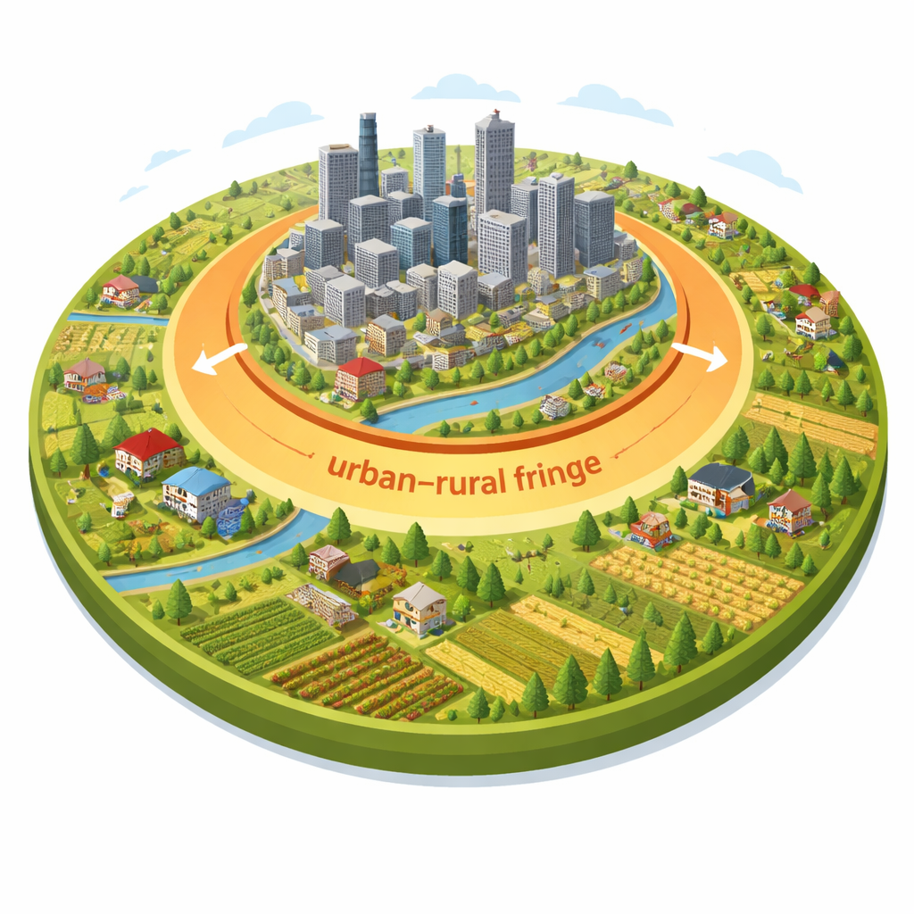
The urban–rural fringe is the fuzzy, constantly changing belt between dense city centers and open countryside. In these zones, factories, new housing estates and traditional villages sit side by side. Because this area is so mixed and fast-changing, it has long been difficult to map or manage. The authors built a new way to track this fringe over more than two decades, using satellite images, land-use maps, nighttime light data and statistics on population, roads and the economy. Their model divides Nanchang’s territory into three types—urban, fringe and rural—based on how fragmented the landscape is, how much construction land there is, and how quickly land use is changing.
Following the spread of the city
Applying this method to data from 2000 to 2024, the team found that Nanchang’s urban–rural fringe expanded dramatically. It grew from about 12,000 hectares to more than 54,000 hectares, and from a narrow ring around the urban core to a broad U-shaped belt wrapping the main built-up area. Within this zone, the pattern of farmland use told a clear story: more land was leaving farming than entering it in every period studied. Large, continuous fields close to the city center were especially likely to be converted, while new farmland tended to appear farther out, in scattered, smaller patches. Over time this led to more fragmented plots, which are harder and less efficient to farm.
What happens to the lost farmland
The study examined exactly how farmland changed. Each parcel of land was tracked through time as either staying in cultivation, transferring out to other uses, or being converted from other uses back into fields. Most of the farmland that disappeared became building land for housing, industry, roads or other urban uses; a smaller share turned into water bodies or ecological areas such as forests and grassland. Although the city government did bring some land back into cultivation—often by converting construction land, water areas or forest land—this "transfer in" was too small to offset the steady transfer out. The result is a net loss of cultivated land in the fringe, even as efforts are made to balance what is taken with what is added elsewhere.
Uncovering the hidden drivers
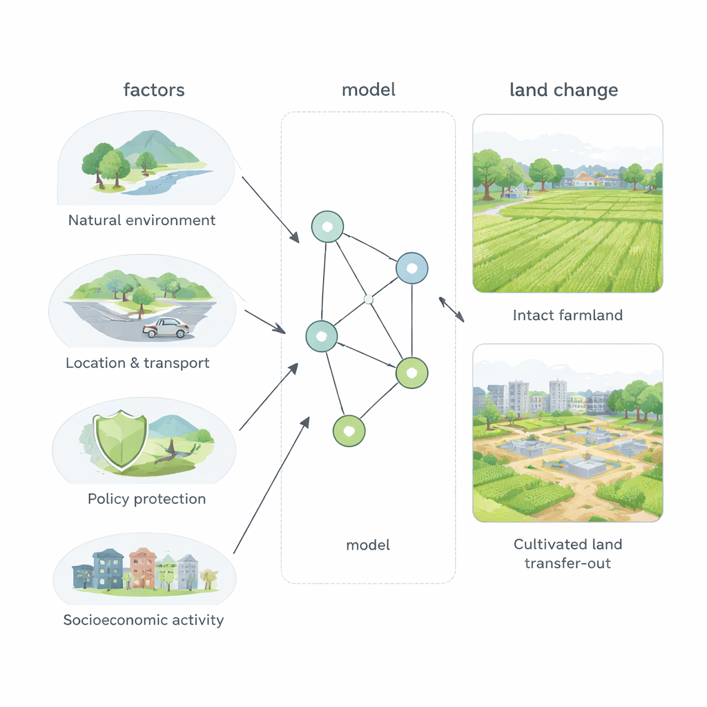
To move beyond simple maps and totals, the researchers used a Bayesian network model, a kind of probabilistic diagram that links causes and effects. They fed the model information on terrain, distance to rivers, distance to major roads and the city center, the presence of protected farmland, the official urban growth boundary, and levels of population and economic activity. The model showed that the single strongest driver of farmland loss is construction occupation—urban building projects that take over fields—especially where roads and city services are close by. Ecological projects, such as creating parks or restoring wetlands, also contribute but much less. Policy tools like permanent basic farmland zones do help slow down conversion, but in this fringe zone they remain weaker than the pull of new transport links and real estate development.
Balancing growth with the ground beneath our feet
For non-specialists, the takeaway is straightforward: at the city’s edge, roads and buildings almost always win out over crops unless strong, well-targeted protections are in place. In Nanchang’s fringe, farmland has been pushed outward, broken into smaller pieces, and steadily reduced as the city grows. The authors argue that future development should focus less on spreading into new fields and more on improving existing urban areas, carefully aligning transport projects with farmland protection, and using permanent farmland zones as a firm baseline. Their methods—and their warning—apply to many growing cities worldwide that are struggling to feed people, house them and safeguard the land that makes both possible.
Citation: Wang, J., Zhu, Z., Chen, M. et al. Study on the driving mechanism of cultivated land change in the urban–rural fringe with Bayesian network modeling. Sci Rep 16, 5599 (2026). https://doi.org/10.1038/s41598-026-35760-7
Keywords: urban–rural fringe, cultivated land, urbanization, land-use change, Bayesian network