Clear Sky Science · en
Simulating different scenarios of vegetation dynamics under the influence of human and climatic factors based on the residual trend analysis and machine learning
Why the fate of a distant watershed matters
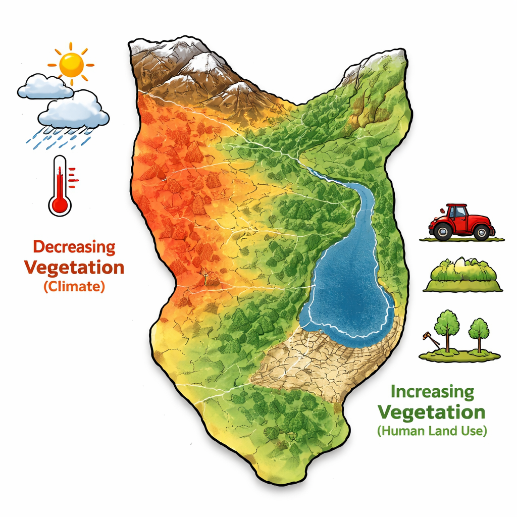
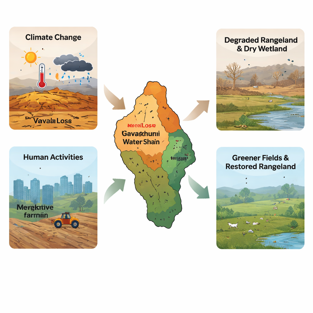
In the heart of Iran lies the Gavkhuni watershed, a dryland region where farms, rangelands and a once-vibrant wetland all depend on a delicate balance between climate and human use. This study asks a question that matters far beyond Iran: when plants disappear or turn greener, how much is due to a warming, drying climate, and how much comes from our own choices—cities, farms, and land restoration projects? By teasing apart these influences, the research offers a window into how people can either accelerate land degradation or help nature recover in water‑scarce regions worldwide.
Watching plants from space
The researchers tracked how vegetation changed across the Gavkhuni watershed from 2001 to 2023 using satellite data. They relied on the Enhanced Vegetation Index (EVI), which gives a clearer picture of plant health than more familiar indices by better handling bright soils and hazy skies common in arid zones. For each year, they focused on May, the month when plants are typically at their greenest. Over the same period, they calculated a drought indicator called the Standardized Precipitation Evapotranspiration Index (SPEI), which blends rainfall and temperature to show how much water is really available for plants.
Separating climate’s footprint from our own
Simply seeing vegetation change is not enough; the challenge is to decide whether climate or people are mainly responsible. To do this, the team used a technique called residual trend analysis. First, they used the drought index to predict what the vegetation should look like if climate were the only driver. Then they compared this “climate‑only” prediction with what the satellites actually saw. Where the land was greener than climate alone would suggest, they inferred a positive human influence, such as irrigation or restoration. Where it was browner than expected, they attributed extra damage to human pressure, such as urban expansion or overgrazing.
Where the land is greening and where it is fading
The picture that emerged was not simple decline, but a patchwork of loss and recovery. Climate was the main cause of vegetation decrease in about one‑fifth of the watershed, especially in drier northern, eastern and southern zones with low rainfall and high temperatures. In contrast, human activities were the dominant reason for vegetation increase in nearly 38 percent of the area. Much of this greening occurred in western and central parts of the basin, where agriculture, orchards, rangeland rehabilitation and tree planting have expanded. Human and climate influences sometimes reinforced one another, with both contributing to greener conditions in about 12 percent of the region.
Hidden warning in a drying wetland
Not all increases in the vegetation signal were good news. At the downstream end of the watershed sits the Gavkhuni wetland, which has shrunk and dried in recent decades. In satellite data, open water appears with very low or negative vegetation values. As the wetland dried and exposed bare soil, the index rose toward zero—even though plants were not recovering. By combining maps and local knowledge, the researchers showed that both climate change and upstream water use had intensified this drying, turning a once‑important wetland into a source of hotter local conditions and potential dust.
How machine learning refines the picture
To dig deeper, the team used a machine‑learning method called random forests to see which factors best explained where vegetation rose or fell. They fed the model not only climate and human‑related variables such as land use, but also terrain and soil‑related information, including elevation, slope and groundwater salinity. The results confirmed that climate extremes were key to vegetation decline in many poor rangelands, while human actions—especially farming, gardening and rangeland rehabilitation—were central to vegetation gains. Elevation emerged as a particularly important influence, because it shapes local temperature and rainfall patterns, helping to explain why high‑altitude western zones can support greener landscapes.
What this means for people and policy
For non‑specialists, the take‑home message is straightforward: climate change is pushing large parts of this dryland watershed toward browner, more fragile landscapes, but human decisions can either worsen or counteract that trend. In Gavkhuni, drought and heat drove much of the vegetation loss, while better land management and targeted agriculture produced much of the greening. By combining satellite records with smart analysis and machine learning, the study offers a practical toolset for other regions: identify where climate is the main culprit, where human pressure is doing the damage, and where careful intervention—such as reduced grazing, efficient irrigation or replanting—can give vegetation a chance to recover.
Citation: Abolhasani, A., Tavili, A. & Khosravi, H. Simulating different scenarios of vegetation dynamics under the influence of human and climatic factors based on the residual trend analysis and machine learning. Sci Rep 16, 6485 (2026). https://doi.org/10.1038/s41598-026-35649-5
Keywords: vegetation dynamics, climate change, human activities, dryland ecosystems, remote sensing