Clear Sky Science · en
Multi-scenario simulation of land use change and landscape ecological vulnerability analysis in Fuzhou City based on GA-PLUS coupled modeling
Why the Future of Fuzhou’s Land Matters
As cities grow, they reshape forests, farms, rivers, and coasts—often in ways that quietly raise the risk of floods, erosion, and habitat loss. This study looks at Fuzhou, a fast‑developing coastal city in southeastern China, and asks a simple but urgent question: how will today’s choices about where to build and what to protect affect the city’s ecological health by 2030? Using an advanced computer model, the authors explore different futures for Fuzhou’s land and show how policy decisions can either worsen or ease environmental vulnerability.
A City Between Mountains and the Sea
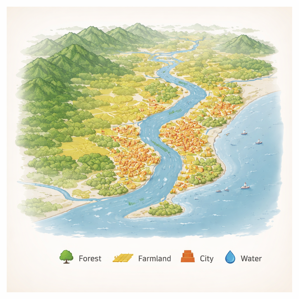
Fuzhou sits between steep mountains in the northwest and low coastal plains in the southeast, with the Min River running through it to the sea. This geography creates a natural gradient from cool forests to fertile farmland to fragile coastal wetlands. Over the past 20 years, Fuzhou has seen rapid urbanization: roughly 475 square kilometers of new construction land have appeared, while about 506 square kilometers of forest have been lost. The current landscape can be summed up as “farmland dominant, forest scattered, and construction land clustered,” with dense development along the river and major roads and more intact ecosystems in the mountains.
Three Possible Paths to 2030
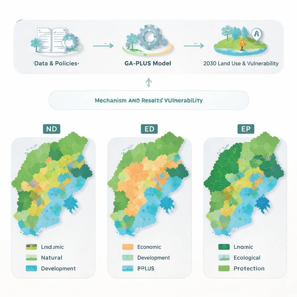
To explore Fuzhou’s future, the researchers built a coupled GA‑PLUS model, which combines a Markov chain (to project how land changes over time), a genetic algorithm (to search for the best mix of land transitions), and a spatial land‑use simulator. Instead of only asking “how much” land should be in each category, the model focuses on “how likely” one type of land is to turn into another—for example, farmland becoming city land or forest being restored from unused areas. They then designed three scenarios for 2030: natural development (ND), where trends continue with little policy intervention; economic development (ED), which prioritizes growth; and ecological protection (EP), which follows Fuzhou’s recent eco‑planning and seeks to maximize ecological benefits.
How Land Use Shifts Under Different Choices
Across all scenarios, construction land keeps expanding, but to very different degrees. Under ED, city areas grow the fastest, with an 8.14% increase, fueled by strong economic priorities and expansion along the river and coast. Under ND, construction still spreads outward from the urban core, but at a more moderate pace. The EP scenario takes a different approach: it sharply reduces cultivated land, especially in vulnerable or low‑yield locations, in order to increase forest and water areas. Water bodies grow most under EP, reflecting planned investments in wetlands, river restoration, and coastal protection. Forest areas also expand here, especially in mountain slopes and key ecological zones, demonstrating how “lucid waters and lush mountains” can be treated as long‑term assets rather than obstacles to development.
Measuring Landscape Health and Weak Spots
Beyond simple land totals, the authors examined how chopped up or connected the landscape becomes, and how diverse its patchwork of land types is. In all futures, the land pattern becomes more fragmented, with more edges and smaller pieces of farmland and city land. Yet the overall cohesion of major land patches stays very high, suggesting that large continuous areas of forest and other key habitats still hold together. The ecological protection scenario stands out by having the highest landscape diversity, meaning a richer mix of land types that can support more functions and species. When the team translated these patterns into a landscape vulnerability index—combining how sensitive areas are to disturbance with how well they can adapt and recover—a clear picture emerged: Fuzhou’s southeast coastal plain remains the most vulnerable, while the northwest mountains remain the most stable.
What the Study Reveals About Risk
The three scenarios lead to very different vulnerability outcomes. Under economic development, the overall level of ecological vulnerability is highest, and highly vulnerable zones expand inland as construction land spreads over farmland and near sensitive coasts. Natural development keeps the broad pattern of “high in the southeast, low in the northwest” but does little to improve weak spots. In contrast, the ecological protection path substantially shrinks the area of severely vulnerable land to about 5.7% of the city and increases the share of ecologically sound areas to more than 40%. Many places shift from high to moderate or low vulnerability, especially where restored forests and wetlands buffer the impacts of urban growth. For non‑specialists, the main message is straightforward: by carefully steering where cities grow and where nature is restored, it is possible to support economic development while reducing environmental risk and building a safer, more resilient Fuzhou.
Citation: Zhou, F., Wang, J., Li, Z. et al. Multi-scenario simulation of land use change and landscape ecological vulnerability analysis in Fuzhou City based on GA-PLUS coupled modeling. Sci Rep 16, 6331 (2026). https://doi.org/10.1038/s41598-026-35642-y
Keywords: urbanization, land use change, ecological vulnerability, scenario modeling, coastal cities