Clear Sky Science · en
Unveiling scale effects in human settlement environment suitability through a novel multi-factor weighting approach
Why some countryside feels more livable
Why do some rural areas feel comfortable, productive, and safe to live in, while others struggle with floods, droughts, and steep, unusable land? This article looks at central Hunan in China, a major farming region of hills and mountains, and asks a simple but crucial question: how naturally suitable is the landscape for people to live and farm on—and how can we measure that fairly and accurately?
Measuring how friendly nature is to people
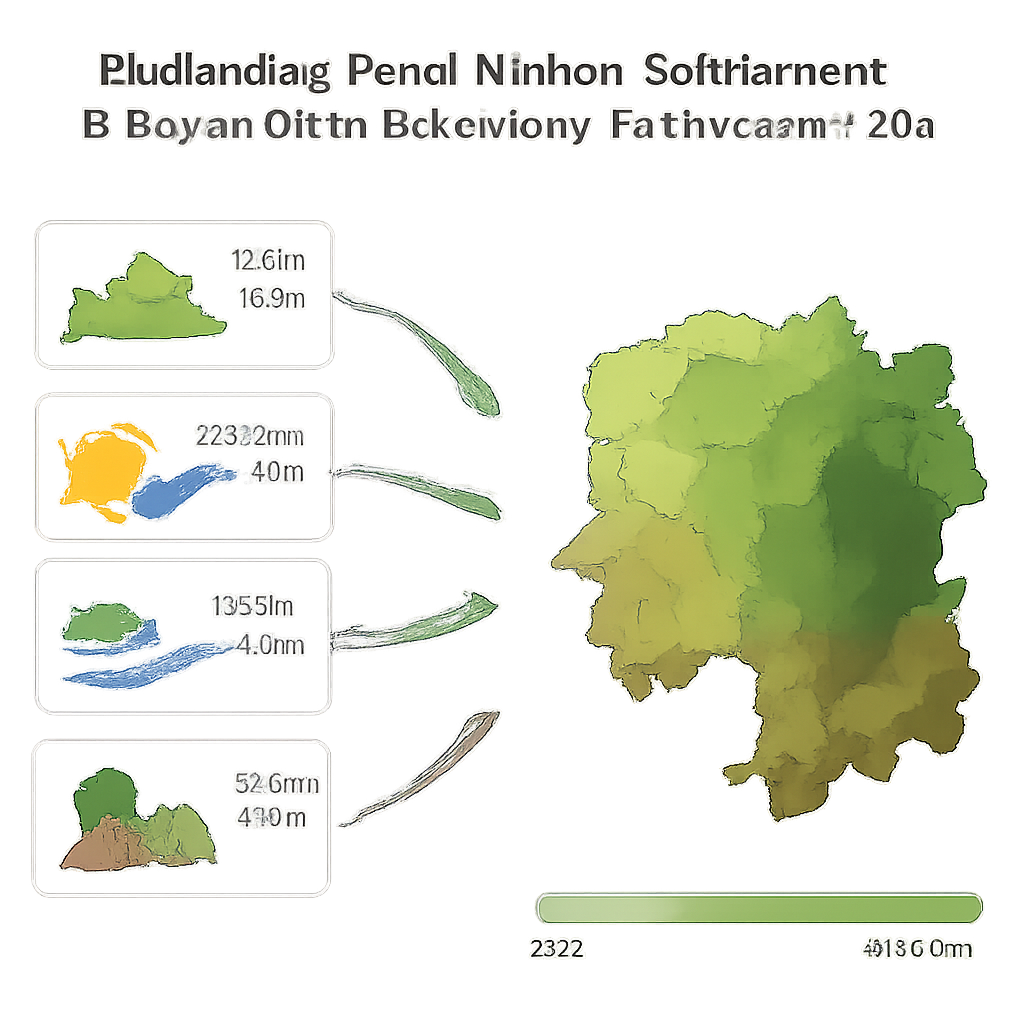
The researchers treat the rural environment almost like a report card for nature’s "friendliness" to human life. They focus on four basic ingredients: how rough or gentle the terrain is, how hot and humid the climate feels, how much usable water is available, and how the land is covered—by forests, fields, water, or bare ground. Using detailed digital maps and satellite data, they turn each of these ingredients into a score for every small patch of land across central Hunan. Together, these scores feed into a single index that describes how naturally suitable each place is for people to live and farm.
Finding fair weights for the ingredients
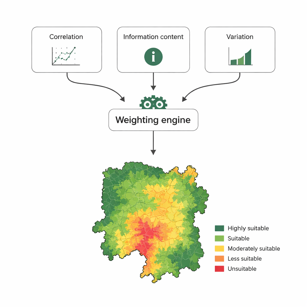
One tricky part is deciding how much each ingredient should count. Should terrain matter more than water? In many past studies, experts simply guessed the weights, or they used a single mathematical link to population, which can be biased. This team instead combines three independent clues: how strongly each factor lines up with where people actually live, how much useful information it carries, and how much it varies from place to place. By blending these three measures, they build a more balanced "weighting engine" that gives more importance to factors that truly shape where people settle, without overreacting to quirks in the data. Tests show that this combined method matches real population patterns better than older approaches.
What the maps reveal about central Hunan
When the improved method is applied to central Hunan, a clear picture emerges. The eastern and central basins, with flatter land, richer soils, and better access to water, stand out as highly suitable for rural life. These areas already hold the vast majority of the region’s people and form its key grain and cash-crop bases. In contrast, the western mountains, carved by deep valleys and steep slopes, rank as only marginally suitable or outright unsuitable for large-scale settlement and farming. There, land is fragmented, water runs off too quickly, and floods, landslides, or droughts are more common.
One region, five types of countryside
To make the findings practical, the authors divide the landscape into five zones, from "unsuitable" to "highly suitable." In the most fragile mountain areas, they recommend prioritizing forest protection, soil conservation, and low-impact uses such as ecological tourism or carbon sink forestry, rather than pushing more farmland or housing. In mid-level zones with mixed hills and valleys, they suggest carefully expanding specialty crops, building terraces, and improving small-scale water systems. In the flattest and most productive basins, the focus shifts to better farming technology, smarter land use, and tighter environmental safeguards, so that growth does not come at the cost of long-term damage.
Why scale and method matter for planning
Another key lesson is that the "right" importance of each factor changes with the scale of the map. At broad national or provincial scales, several natural elements may look equally important. But at the finer scale of central Hunan’s counties and villages, terrain relief clearly dominates: small changes in slope and elevation make a big difference to where safe, productive settlements can exist. This means that planning tools built for very large regions may miss what really matters on the ground. By using a more objective weighting method and paying attention to scale, the study offers not only a sharper picture of central Hunan’s countryside, but also a reusable framework for other hilly rural regions trying to balance ecological protection, food security, and better living conditions.
Citation: Xiao, L., Xiang, J., Liu, X. et al. Unveiling scale effects in human settlement environment suitability through a novel multi-factor weighting approach. Sci Rep 16, 6952 (2026). https://doi.org/10.1038/s41598-026-35554-x
Keywords: rural livability, human settlement suitability, central Hunan, land use planning, terrain and climate